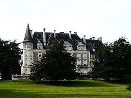
Saint-Médard-de-Mussidan
| Saint-Médard-de-Mussidan | |
|---|---|
| Commune | |
 | |
 Saint-Médard-de-Mussidan Location within Nouvelle-Aquitaine region  Saint-Médard-de-Mussidan | |
| Coordinates: 45°02′42″N 0°20′52″E / 45.045°N 0.3478°ECoordinates: 45°02′42″N 0°20′52″E / 45.045°N 0.3478°E | |
| Country | France |
| Region | Nouvelle-Aquitaine |
| Department | Dordogne |
| Arrondissement | Périgueux |
| Canton | Vallée de l'Isle |
| Intercommunality | Mussidanais en Périgord |
| Government | |
| • Mayor (2008–2014) | Michel Florenty |
| Area1 | 24.45 km2 (9.44 sq mi) |
| Population (2008)2 | 1,662 |
| • Density | 68/km2 (180/sq mi) |
| Time zone | UTC+1 (CET) |
| • Summer (DST) | UTC+2 (CEST) |
| INSEE/Postal code | 24462 /24400 |
| Elevation |
37–150 m (121–492 ft) (avg. 56 m or 184 ft) |
|
1 French Land Register data, which excludes lakes, ponds, glaciers > 1 km2 (0.386 sq mi or 247 acres) and river estuaries. 2 Population without double counting: residents of multiple communes (e.g., students and military personnel) only counted once. | |
Saint-Médard-de-Mussidan is a commune in the Dordogne department in Nouvelle-Aquitaine in southwestern France.
Population
| Historical population | ||
|---|---|---|
| Year | Pop. | ±% |
| 1962 | 1,153 | — |
| 1968 | 1,327 | +15.1% |
| 1975 | 1,540 | +16.1% |
| 1982 | 1,644 | +6.8% |
| 1990 | 1,600 | −2.7% |
| 1999 | 1,514 | −5.4% |
| 2008 | 1,662 | +9.8% |
See also
References
| Wikimedia Commons has media related to Saint-Médard-de-Mussidan. |
This article is issued from
Wikipedia.
The text is licensed under Creative Commons - Attribution - Sharealike.
Additional terms may apply for the media files.