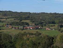
Salagnac
| Salagnac | ||
|---|---|---|
| Commune | ||
 | ||
| ||
 Salagnac Location within Nouvelle-Aquitaine region  Salagnac | ||
| Coordinates: 45°18′43″N 1°11′56″E / 45.3119°N 1.1989°ECoordinates: 45°18′43″N 1°11′56″E / 45.3119°N 1.1989°E | ||
| Country | France | |
| Region | Nouvelle-Aquitaine | |
| Department | Dordogne | |
| Arrondissement | Nontron | |
| Canton | Isle-Loue-Auvézère | |
| Government | ||
| • Mayor (2008–2014) | Alain Maigret | |
| Area1 | 9.08 km2 (3.51 sq mi) | |
| Population (2008)2 | 891 | |
| • Density | 98/km2 (250/sq mi) | |
| Time zone | UTC+1 (CET) | |
| • Summer (DST) | UTC+2 (CEST) | |
| INSEE/Postal code | 24515 /24160 | |
| Elevation |
176–354 m (577–1,161 ft) (avg. 190 m or 620 ft) | |
|
1 French Land Register data, which excludes lakes, ponds, glaciers > 1 km2 (0.386 sq mi or 247 acres) and river estuaries. 2 Population without double counting: residents of multiple communes (e.g., students and military personnel) only counted once. | ||

Salagnac (Occitan: Salanhac) is a commune in the Dordogne department in Nouvelle-Aquitaine in southwestern France.
History
During the creation of the French departments in 1790, it first joined the Corrèze department. In 1793 it became part of the Dordogne department.
Population
| Historical population | ||
|---|---|---|
| Year | Pop. | ±% |
| 1962 | 734 | — |
| 1968 | 826 | +12.5% |
| 1975 | 1,122 | +35.8% |
| 1982 | 967 | −13.8% |
| 1990 | 990 | +2.4% |
| 1999 | 1,028 | +3.8% |
| 2008 | 891 | −13.3% |
See also
References
External links
| Wikimedia Commons has media related to Salagnac. |
This article is issued from
Wikipedia.
The text is licensed under Creative Commons - Attribution - Sharealike.
Additional terms may apply for the media files.