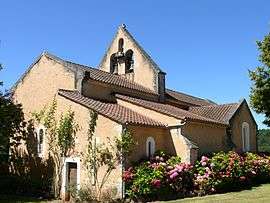
Lavaur, Dordogne
| Lavaur | |
|---|---|
| Commune | |
 | |
 Lavaur Location within Nouvelle-Aquitaine region  Lavaur | |
| Coordinates: 44°36′51″N 1°01′27″E / 44.6142°N 1.0242°ECoordinates: 44°36′51″N 1°01′27″E / 44.6142°N 1.0242°E | |
| Country | France |
| Region | Nouvelle-Aquitaine |
| Department | Dordogne |
| Arrondissement | Sarlat-la-Canéda |
| Canton | Vallée Dordogne |
| Intercommunality | Pays du Châtaignier |
| Government | |
| • Mayor (2008–2014) | Michel Lapouge |
| Area1 | 9.00 km2 (3.47 sq mi) |
| Population (2008)2 | 84 |
| • Density | 9.3/km2 (24/sq mi) |
| Time zone | UTC+1 (CET) |
| • Summer (DST) | UTC+2 (CEST) |
| INSEE/Postal code | 24232 /24550 |
| Elevation |
135–282 m (443–925 ft) (avg. 250 m or 820 ft) |
|
1 French Land Register data, which excludes lakes, ponds, glaciers > 1 km2 (0.386 sq mi or 247 acres) and river estuaries. 2 Population without double counting: residents of multiple communes (e.g., students and military personnel) only counted once. | |
Lavaur is a commune in the Dordogne department in Nouvelle-Aquitaine in southwestern France.
Population
| Historical population | ||
|---|---|---|
| Year | Pop. | ±% |
| 1962 | 151 | — |
| 1968 | 153 | +1.3% |
| 1975 | 113 | −26.1% |
| 1982 | 107 | −5.3% |
| 1990 | 102 | −4.7% |
| 1999 | 88 | −13.7% |
| 2008 | 84 | −4.5% |
See also
References
| Wikimedia Commons has media related to Lavaur (Dordogne). |
This article is issued from
Wikipedia.
The text is licensed under Creative Commons - Attribution - Sharealike.
Additional terms may apply for the media files.