Soulaures
| Soulaures | |
|---|---|
| Commune | |
 | |
 Soulaures Location within Nouvelle-Aquitaine region  Soulaures | |
| Coordinates: 44°39′04″N 0°55′27″E / 44.6511°N 0.9242°ECoordinates: 44°39′04″N 0°55′27″E / 44.6511°N 0.9242°E | |
| Country | France |
| Region | Nouvelle-Aquitaine |
| Department | Dordogne |
| Arrondissement | Bergerac |
| Canton | Lalinde |
| Intercommunality | Monpaziérois |
| Government | |
| • Mayor (2008–2014) | Laurence Pistore |
| Area1 | 10.28 km2 (3.97 sq mi) |
| Population (2008)2 | 86 |
| • Density | 8.4/km2 (22/sq mi) |
| Time zone | UTC+1 (CET) |
| • Summer (DST) | UTC+2 (CEST) |
| INSEE/Postal code | 24542 /24540 |
| Elevation |
168–274 m (551–899 ft) (avg. 241 m or 791 ft) |
|
1 French Land Register data, which excludes lakes, ponds, glaciers > 1 km2 (0.386 sq mi or 247 acres) and river estuaries. 2 Population without double counting: residents of multiple communes (e.g., students and military personnel) only counted once. | |
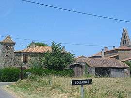
Soulaures is a commune in the Dordogne department in Nouvelle-Aquitaine in southwestern France.
Church of Saint-Martial built in the twelfth century. The small single nave church has a bell placed at the right wall of the triumphal arch
Population
The inhabitants of Soulaures are called Soulaurais. The evolution of the number of inhabitants is known through the censuses carried out in the commune since 1793.
| Historical population | ||
|---|---|---|
| Year | Pop. | ±% |
| 1962 | 88 | — |
| 1968 | 85 | −3.4% |
| 1975 | 80 | −5.9% |
| 1982 | 76 | −5.0% |
| 1990 | 72 | −5.3% |
| 1999 | 77 | +6.9% |
| 2008 | 86 | +11.7% |
Economy
As of December 31, 2013, the municipality had eleven establishments, eight of them in agriculture, forestry or fishing, one in construction, one in industry, and one in the administrative sector.
See also
References
| Wikimedia Commons has media related to Soulaures. |
This article is issued from
Wikipedia.
The text is licensed under Creative Commons - Attribution - Sharealike.
Additional terms may apply for the media files.