Marsalès
| Marsalès | |
|---|---|
| Commune | |
 | |
 Marsalès Location within Nouvelle-Aquitaine region  Marsalès | |
| Coordinates: 44°42′11″N 0°53′10″E / 44.7031°N 0.8861°ECoordinates: 44°42′11″N 0°53′10″E / 44.7031°N 0.8861°E | |
| Country | France |
| Region | Nouvelle-Aquitaine |
| Department | Dordogne |
| Arrondissement | Bergerac |
| Canton | Lalinde |
| Intercommunality | Monpaziérois |
| Government | |
| • Mayor (2008–2014) | Jeannine Leygues |
| Area1 | 9.43 km2 (3.64 sq mi) |
| Population (2008)2 | 223 |
| • Density | 24/km2 (61/sq mi) |
| Time zone | UTC+1 (CET) |
| • Summer (DST) | UTC+2 (CEST) |
| INSEE/Postal code | 24257 /24540 |
| Elevation |
135–232 m (443–761 ft) (avg. 170 m or 560 ft) |
|
1 French Land Register data, which excludes lakes, ponds, glaciers > 1 km2 (0.386 sq mi or 247 acres) and river estuaries. 2 Population without double counting: residents of multiple communes (e.g., students and military personnel) only counted once. | |
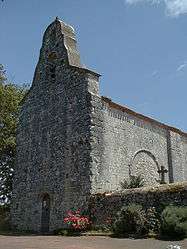
Marsalès is a commune in the Dordogne department in Nouvelle-Aquitaine in southwestern France.
Population
| Historical population | ||
|---|---|---|
| Year | Pop. | ±% |
| 1962 | 146 | — |
| 1968 | 144 | −1.4% |
| 1975 | 169 | +17.4% |
| 1982 | 204 | +20.7% |
| 1990 | 204 | +0.0% |
| 1999 | 204 | +0.0% |
| 2008 | 223 | +9.3% |
See also
References
| Wikimedia Commons has media related to Marsalès. |
This article is issued from
Wikipedia.
The text is licensed under Creative Commons - Attribution - Sharealike.
Additional terms may apply for the media files.