Soudat
| Soudat | |
|---|---|
| Commune | |
 | |
 Soudat Location within Nouvelle-Aquitaine region  Soudat | |
| Coordinates: 45°37′31″N 0°33′56″E / 45.6253°N 0.5656°ECoordinates: 45°37′31″N 0°33′56″E / 45.6253°N 0.5656°E | |
| Country | France |
| Region | Nouvelle-Aquitaine |
| Department | Dordogne |
| Arrondissement | Nontron |
| Canton | Périgord Vert Nontronnais |
| Intercommunality | Villages du Haut Périgord |
| Government | |
| • Mayor (2008–2014) | Jean-Claude Rathier |
| Area1 | 8.82 km2 (3.41 sq mi) |
| Population (2008)2 | 83 |
| • Density | 9.4/km2 (24/sq mi) |
| Time zone | UTC+1 (CET) |
| • Summer (DST) | UTC+2 (CEST) |
| INSEE/Postal code | 24541 /24360 |
| Elevation |
134–266 m (440–873 ft) (avg. 250 m or 820 ft) |
|
1 French Land Register data, which excludes lakes, ponds, glaciers > 1 km2 (0.386 sq mi or 247 acres) and river estuaries. 2 Population without double counting: residents of multiple communes (e.g., students and military personnel) only counted once. | |
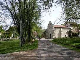
Soudat is a commune in the Dordogne department in Nouvelle-Aquitaine in southwestern France.
Population
| Historical population | ||
|---|---|---|
| Year | Pop. | ±% |
| 1962 | 150 | — |
| 1968 | 121 | −19.3% |
| 1975 | 98 | −19.0% |
| 1982 | 99 | +1.0% |
| 1990 | 78 | −21.2% |
| 1999 | 72 | −7.7% |
| 2008 | 83 | +15.3% |
See also
References
| Wikimedia Commons has media related to Soudat. |
This article is issued from
Wikipedia.
The text is licensed under Creative Commons - Attribution - Sharealike.
Additional terms may apply for the media files.