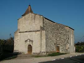
Bonneville-et-Saint-Avit-de-Fumadières
| Bonneville-et-Saint-Avit-de-Fumadières | |
|---|---|
| Commune | |
 | |
 Bonneville-et-Saint-Avit-de-Fumadières Location within Nouvelle-Aquitaine region  Bonneville-et-Saint-Avit-de-Fumadières | |
| Coordinates: 44°53′23″N 0°05′02″E / 44.8897°N 0.0839°ECoordinates: 44°53′23″N 0°05′02″E / 44.8897°N 0.0839°E | |
| Country | France |
| Region | Nouvelle-Aquitaine |
| Department | Dordogne |
| Arrondissement | Bergerac |
| Canton | Pays de Montaigne et Gurson |
| Intercommunality | Montaigne en Montravel |
| Government | |
| • Mayor (2008–2014) | Serge Fourcaud |
| Area1 | 7.04 km2 (2.72 sq mi) |
| Population (2008)2 | 317 |
| • Density | 45/km2 (120/sq mi) |
| Time zone | UTC+1 (CET) |
| • Summer (DST) | UTC+2 (CEST) |
| INSEE/Postal code | 24048 /24230 |
| Elevation |
18–108 m (59–354 ft) (avg. 90 m or 300 ft) |
|
1 French Land Register data, which excludes lakes, ponds, glaciers > 1 km2 (0.386 sq mi or 247 acres) and river estuaries. 2 Population without double counting: residents of multiple communes (e.g., students and military personnel) only counted once. | |
Bonneville-et-Saint-Avit-de-Fumadières is a commune in the Dordogne department in southwestern France.
Population
| Historical population | ||
|---|---|---|
| Year | Pop. | ±% |
| 1864 | 318 | — |
| 1962 | 247 | −22.3% |
| 1968 | 220 | −10.9% |
| 1975 | 195 | −11.4% |
| 1982 | 214 | +9.7% |
| 1990 | 216 | +0.9% |
| 1999 | 216 | +0.0% |
| 2008 | 317 | +46.8% |
See also
References
| Wikimedia Commons has media related to Bonneville-et-Saint-Avit-de-Fumadières. |
| Authority control |
|---|
This article is issued from
Wikipedia.
The text is licensed under Creative Commons - Attribution - Sharealike.
Additional terms may apply for the media files.