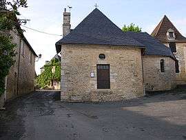
Les Farges
| Les Farges | |
|---|---|
| Commune | |
 | |
 Les Farges Location within Nouvelle-Aquitaine region  Les Farges | |
| Coordinates: 45°06′58″N 1°11′15″E / 45.1161°N 1.1875°ECoordinates: 45°06′58″N 1°11′15″E / 45.1161°N 1.1875°E | |
| Country | France |
| Region | Nouvelle-Aquitaine |
| Department | Dordogne |
| Arrondissement | Sarlat-la-Canéda |
| Canton | Vallée de l'Homme |
| Intercommunality | Vallée de la Vézère |
| Government | |
| • Mayor (2008–2014) | Annie Drouilhet |
| Area1 | 8.14 km2 (3.14 sq mi) |
| Population (2008)2 | 324 |
| • Density | 40/km2 (100/sq mi) |
| Time zone | UTC+1 (CET) |
| • Summer (DST) | UTC+2 (CEST) |
| INSEE/Postal code | 24175 /24290 |
| Elevation |
71–267 m (233–876 ft) (avg. 250 m or 820 ft) |
|
1 French Land Register data, which excludes lakes, ponds, glaciers > 1 km2 (0.386 sq mi or 247 acres) and river estuaries. 2 Population without double counting: residents of multiple communes (e.g., students and military personnel) only counted once. | |
Les Farges is a commune in the Dordogne department in Nouvelle-Aquitaine in southwestern France.
Population
| Historical population | ||
|---|---|---|
| Year | Pop. | ±% |
| 1962 | 151 | — |
| 1968 | 151 | +0.0% |
| 1975 | 159 | +5.3% |
| 1982 | 180 | +13.2% |
| 1990 | 228 | +26.7% |
| 1999 | 262 | +14.9% |
| 2008 | 324 | +23.7% |
See also
References
| Wikimedia Commons has media related to Les Farges. |
This article is issued from
Wikipedia.
The text is licensed under Creative Commons - Attribution - Sharealike.
Additional terms may apply for the media files.