Limeyrat
| Limeyrat | |
|---|---|
| Commune | |
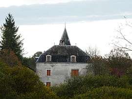 Chateau | |
 Limeyrat Location within Nouvelle-Aquitaine region  Limeyrat | |
| Coordinates: 45°09′41″N 0°58′54″E / 45.1614°N 0.9817°ECoordinates: 45°09′41″N 0°58′54″E / 45.1614°N 0.9817°E | |
| Country | France |
| Region | Nouvelle-Aquitaine |
| Department | Dordogne |
| Arrondissement | Sarlat-la-Canéda |
| Canton | Haut-Périgord Noir |
| Government | |
| • Mayor (2008–2014) | Claude Sautier |
| Area1 | 19.72 km2 (7.61 sq mi) |
| Population (2008)2 | 450 |
| • Density | 23/km2 (59/sq mi) |
| Time zone | UTC+1 (CET) |
| • Summer (DST) | UTC+2 (CEST) |
| INSEE/Postal code | 24241 /24210 |
| Elevation | 143–266 m (469–873 ft) |
|
1 French Land Register data, which excludes lakes, ponds, glaciers > 1 km2 (0.386 sq mi or 247 acres) and river estuaries. 2 Population without double counting: residents of multiple communes (e.g., students and military personnel) only counted once. | |
Limeyrat is a commune in the Dordogne department in Nouvelle-Aquitaine in southwestern France.
Population
| Historical population | ||
|---|---|---|
| Year | Pop. | ±% |
| 1962 | 315 | — |
| 1968 | 343 | +8.9% |
| 1975 | 394 | +14.9% |
| 1982 | 408 | +3.6% |
| 1990 | 427 | +4.7% |
| 1999 | 436 | +2.1% |
| 2008 | 450 | +3.2% |
See also
References
External links
| Wikimedia Commons has media related to Limeyrat. |
This article is issued from
Wikipedia.
The text is licensed under Creative Commons - Attribution - Sharealike.
Additional terms may apply for the media files.