Escoire
| Escoire | |
|---|---|
| Commune | |
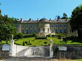 Château d'Escoire | |
 Escoire Location within Nouvelle-Aquitaine region  Escoire | |
| Coordinates: 45°12′41″N 0°51′01″E / 45.2114°N 0.8503°ECoordinates: 45°12′41″N 0°51′01″E / 45.2114°N 0.8503°E | |
| Country | France |
| Region | Nouvelle-Aquitaine |
| Department | Dordogne |
| Arrondissement | Périgueux |
| Canton | Trélissac |
| Intercommunality | agglomération Périgourdine |
| Government | |
| • Mayor (2008–2014) | Bernard Geoffroy |
| Area1 | 3.94 km2 (1.52 sq mi) |
| Population (2008)2 | 465 |
| • Density | 120/km2 (310/sq mi) |
| Time zone | UTC+1 (CET) |
| • Summer (DST) | UTC+2 (CEST) |
| INSEE/Postal code | 24162 /24420 |
| Elevation |
92–213 m (302–699 ft) (avg. 100 m or 330 ft) |
|
1 French Land Register data, which excludes lakes, ponds, glaciers > 1 km2 (0.386 sq mi or 247 acres) and river estuaries. 2 Population without double counting: residents of multiple communes (e.g., students and military personnel) only counted once. | |
Escoire is a commune in the Dordogne department in Nouvelle-Aquitaine in southwestern France.
Population
| Historical population | ||
|---|---|---|
| Year | Pop. | ±% |
| 1793 | 207 | — |
| 1800 | 220 | +6.3% |
| 1806 | 233 | +5.9% |
| 1821 | 199 | −14.6% |
| 1831 | 201 | +1.0% |
| 1836 | 204 | +1.5% |
| 1841 | 178 | −12.7% |
| 1846 | 186 | +4.5% |
| 1851 | 170 | −8.6% |
| 1856 | 189 | +11.2% |
| 1861 | 181 | −4.2% |
| 1866 | 208 | +14.9% |
| 1872 | 173 | −16.8% |
| 1876 | 174 | +0.6% |
| 1881 | 203 | +16.7% |
| 1886 | 183 | −9.9% |
| 1891 | 187 | +2.2% |
| 1896 | 191 | +2.1% |
| 1901 | 161 | −15.7% |
| 1906 | 134 | −16.8% |
| 1911 | 160 | +19.4% |
| 1921 | 121 | −24.4% |
| 1926 | 125 | +3.3% |
| 1931 | 126 | +0.8% |
| 1936 | 129 | +2.4% |
| 1946 | 97 | −24.8% |
| 1954 | 126 | +29.9% |
| 1962 | 148 | +17.5% |
| 1968 | 168 | +13.5% |
| 1975 | 177 | +5.4% |
| 1982 | 234 | +32.2% |
| 1990 | 367 | +56.8% |
| 1999 | 429 | +16.9% |
| 2008 | 465 | +8.4% |
See also
References
| Wikimedia Commons has media related to Escoire. |
This article is issued from
Wikipedia.
The text is licensed under Creative Commons - Attribution - Sharealike.
Additional terms may apply for the media files.