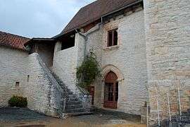
Gabillou
| Gabillou | |
|---|---|
| Commune | |
 | |
 Gabillou Location within Nouvelle-Aquitaine region  Gabillou | |
| Coordinates: 45°12′24″N 1°02′08″E / 45.2067°N 1.0356°ECoordinates: 45°12′24″N 1°02′08″E / 45.2067°N 1.0356°E | |
| Country | France |
| Region | Nouvelle-Aquitaine |
| Department | Dordogne |
| Arrondissement | Sarlat-la-Canéda |
| Canton | Haut-Périgord Noir |
| Government | |
| • Mayor (2008–2014) | Gaston Grand |
| Area1 | 7.92 km2 (3.06 sq mi) |
| Population (2008)2 | 98 |
| • Density | 12/km2 (32/sq mi) |
| Time zone | UTC+1 (CET) |
| • Summer (DST) | UTC+2 (CEST) |
| INSEE/Postal code | 24192 /24210 |
| Elevation |
145–238 m (476–781 ft) (avg. 221 m or 725 ft) |
|
1 French Land Register data, which excludes lakes, ponds, glaciers > 1 km2 (0.386 sq mi or 247 acres) and river estuaries. 2 Population without double counting: residents of multiple communes (e.g., students and military personnel) only counted once. | |
Gabillou is a commune in the Dordogne department in Nouvelle-Aquitaine in southwestern France.
Population
| Historical population | ||
|---|---|---|
| Year | Pop. | ±% |
| 1962 | 112 | — |
| 1968 | 130 | +16.1% |
| 1975 | 97 | −25.4% |
| 1982 | 94 | −3.1% |
| 1990 | 104 | +10.6% |
| 1999 | 89 | −14.4% |
| 2008 | 98 | +10.1% |
See also
References
External links
| Wikimedia Commons has media related to Gabillou. |
This article is issued from
Wikipedia.
The text is licensed under Creative Commons - Attribution - Sharealike.
Additional terms may apply for the media files.