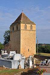
Montferrand-du-Périgord
| Montferrand-du-Périgord | ||
|---|---|---|
| Commune | ||
 | ||
| ||
 Montferrand-du-Périgord Location within Nouvelle-Aquitaine region  Montferrand-du-Périgord | ||
| Coordinates: 44°45′06″N 0°52′01″E / 44.7517°N 0.8669°ECoordinates: 44°45′06″N 0°52′01″E / 44.7517°N 0.8669°E | ||
| Country | France | |
| Region | Nouvelle-Aquitaine | |
| Department | Dordogne | |
| Arrondissement | Bergerac | |
| Canton | Lalinde | |
| Intercommunality | Pays Beaumontois | |
| Government | ||
| • Mayor (2008–2014) | Georges Meyrignac | |
| Area1 | 13.1 km2 (5.1 sq mi) | |
| Population (2008)2 | 170 | |
| • Density | 13/km2 (34/sq mi) | |
| Time zone | UTC+1 (CET) | |
| • Summer (DST) | UTC+2 (CEST) | |
| INSEE/Postal code | 24290 /24440 | |
| Elevation |
85–234 m (279–768 ft) (avg. 105 m or 344 ft) | |
|
1 French Land Register data, which excludes lakes, ponds, glaciers > 1 km2 (0.386 sq mi or 247 acres) and river estuaries. 2 Population without double counting: residents of multiple communes (e.g., students and military personnel) only counted once. | ||

Montferrand-du-Périgord is a commune in the Dordogne department in Nouvelle-Aquitaine in southwestern France.
Population
| Historical population | ||
|---|---|---|
| Year | Pop. | ±% |
| 1962 | 232 | — |
| 1968 | 236 | +1.7% |
| 1975 | 211 | −10.6% |
| 1982 | 185 | −12.3% |
| 1990 | 197 | +6.5% |
| 1999 | 180 | −8.6% |
| 2008 | 170 | −5.6% |
See also
More information and pictures on Montferrand-du-Perigord in French on Wikipedia. Official news on Facebook: Mairie de Montferrand-du-Perigord
References
| Wikimedia Commons has media related to Montferrand-du-Périgord. |
This article is issued from
Wikipedia.
The text is licensed under Creative Commons - Attribution - Sharealike.
Additional terms may apply for the media files.