Saint-Antoine-de-Breuilh
| Saint-Antoine-de-Breuilh | |
|---|---|
| Commune | |
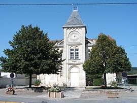 Town hall | |
 Saint-Antoine-de-Breuilh Location within Nouvelle-Aquitaine region  Saint-Antoine-de-Breuilh | |
| Coordinates: 44°50′42″N 0°09′20″E / 44.845°N 0.1556°ECoordinates: 44°50′42″N 0°09′20″E / 44.845°N 0.1556°E | |
| Country | France |
| Region | Nouvelle-Aquitaine |
| Department | Dordogne |
| Arrondissement | Bergerac |
| Canton | Pays de Montaigne et Gurson |
| Intercommunality | Montaigne en Montravel |
| Government | |
| • Mayor (2008–2014) | Christian Gallot |
| Area1 | 17.82 km2 (6.88 sq mi) |
| Population (2014)2 | 1,945 |
| • Density | 110/km2 (280/sq mi) |
| Time zone | UTC+1 (CET) |
| • Summer (DST) | UTC+2 (CEST) |
| INSEE/Postal code | 24370 /24230 |
| Elevation |
7–113 m (23–371 ft) (avg. 18 m or 59 ft) |
|
1 French Land Register data, which excludes lakes, ponds, glaciers > 1 km2 (0.386 sq mi or 247 acres) and river estuaries. 2 Population without double counting: residents of multiple communes (e.g., students and military personnel) only counted once. | |
Saint-Antoine-de-Breuilh is a commune in the Dordogne department in Nouvelle-Aquitaine in southwestern France, in the urban unit of Bergerac. It was created in 1824 with the fusion of Saint-Aulaye and Le Breuilh.[1]
Population
| Historical population | ||
|---|---|---|
| Year | Pop. | ±% |
| 1962 | 1,287 | — |
| 1968 | 1,415 | +9.9% |
| 1975 | 1,534 | +8.4% |
| 1982 | 1,523 | −0.7% |
| 1990 | 1,756 | +15.3% |
| 1999 | 1,843 | +5.0% |
| 2008 | 2,049 | +11.2% |
| 2013 | 1,967 | −4.0% |
| 2014 | 1,945 | −1.1% |
See also
References
- ↑ "Notice communale de Saint-Aulaye". School for Advanced Studies in the Social Sciences/Cassini (in French). Retrieved 17 February 2017. .
| Wikimedia Commons has media related to Saint-Antoine-de-Breuilh. |
This article is issued from
Wikipedia.
The text is licensed under Creative Commons - Attribution - Sharealike.
Additional terms may apply for the media files.