Prigonrieux
| Prigonrieux | ||
|---|---|---|
| Commune | ||
 | ||
| ||
 Prigonrieux Location within Nouvelle-Aquitaine region  Prigonrieux | ||
| Coordinates: 44°51′18″N 0°24′15″E / 44.855°N 0.4042°ECoordinates: 44°51′18″N 0°24′15″E / 44.855°N 0.4042°E | ||
| Country | France | |
| Region | Nouvelle-Aquitaine | |
| Department | Dordogne | |
| Arrondissement | Bergerac | |
| Canton | Pays de la Force | |
| Intercommunality | Dordogne-Eyraud-Lidoire | |
| Government | ||
| • Mayor (2008–2014) | Jean-Paul Rochoir | |
| Area1 | 26.12 km2 (10.08 sq mi) | |
| Population (2008)2 | 3,942 | |
| • Density | 150/km2 (390/sq mi) | |
| Time zone | UTC+1 (CET) | |
| • Summer (DST) | UTC+2 (CEST) | |
| INSEE/Postal code | 24340 /24130 | |
| Elevation |
12–118 m (39–387 ft) (avg. 28 m or 92 ft) | |
|
1 French Land Register data, which excludes lakes, ponds, glaciers > 1 km2 (0.386 sq mi or 247 acres) and river estuaries. 2 Population without double counting: residents of multiple communes (e.g., students and military personnel) only counted once. | ||
.svg.png)
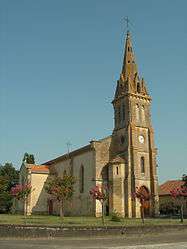
Prigonrieux (Prigond Riu in Occitan) is a commune in the Dordogne department in Nouvelle-Aquitaine in southwestern France.
Population
| Historical population | ||
|---|---|---|
| Year | Pop. | ±% |
| 1962 | 1,498 | — |
| 1968 | 1,728 | +15.4% |
| 1975 | 2,461 | +42.4% |
| 1982 | 3,093 | +25.7% |
| 1990 | 3,721 | +20.3% |
| 1999 | 3,957 | +6.3% |
| 2008 | 3,942 | −0.4% |
See also
References
| Wikimedia Commons has media related to Prigonrieux. |
This article is issued from
Wikipedia.
The text is licensed under Creative Commons - Attribution - Sharealike.
Additional terms may apply for the media files.