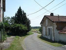
Saint-Géry, Dordogne
| Saint-Géry | |
|---|---|
| Commune | |
 | |
 Saint-Géry Location within Nouvelle-Aquitaine region  Saint-Géry | |
| Coordinates: 44°59′06″N 0°19′28″E / 44.985°N 0.3244°ECoordinates: 44°59′06″N 0°19′28″E / 44.985°N 0.3244°E | |
| Country | France |
| Region | Nouvelle-Aquitaine |
| Department | Dordogne |
| Arrondissement | Bergerac |
| Canton | Pays de la Force |
| Government | |
| • Mayor (2008–2014) | Patrick Lalyman |
| Area1 | 18.71 km2 (7.22 sq mi) |
| Population (2008)2 | 211 |
| • Density | 11/km2 (29/sq mi) |
| Time zone | UTC+1 (CET) |
| • Summer (DST) | UTC+2 (CEST) |
| INSEE/Postal code | 24420 /24400 |
| Elevation | 60–148 m (197–486 ft) |
|
1 French Land Register data, which excludes lakes, ponds, glaciers > 1 km2 (0.386 sq mi or 247 acres) and river estuaries. 2 Population without double counting: residents of multiple communes (e.g., students and military personnel) only counted once. | |
Saint-Géry is a commune in the Dordogne department in Nouvelle-Aquitaine in southwestern France.
Population
| Historical population | ||
|---|---|---|
| Year | Pop. | ±% |
| 1962 | 274 | — |
| 1968 | 258 | −5.8% |
| 1975 | 233 | −9.7% |
| 1982 | 203 | −12.9% |
| 1990 | 207 | +2.0% |
| 1999 | 193 | −6.8% |
| 2008 | 211 | +9.3% |
See also
References
| Wikimedia Commons has media related to Saint-Géry (Dordogne). |
This article is issued from
Wikipedia.
The text is licensed under Creative Commons - Attribution - Sharealike.
Additional terms may apply for the media files.