Capdrot
| Capdrot | |
|---|---|
| Commune | |
 | |
 Capdrot Location within Nouvelle-Aquitaine region  Capdrot | |
| Coordinates: 44°40′56″N 0°55′25″E / 44.6822°N 0.9236°ECoordinates: 44°40′56″N 0°55′25″E / 44.6822°N 0.9236°E | |
| Country | France |
| Region | Nouvelle-Aquitaine |
| Department | Dordogne |
| Arrondissement | Bergerac |
| Canton | Lalinde |
| Intercommunality | Monpaziérois |
| Government | |
| • Mayor (2008–2014) | Jacques Magimel-Pelonnier |
| Area1 | 43.72 km2 (16.88 sq mi) |
| Population (2008)2 | 491 |
| • Density | 11/km2 (29/sq mi) |
| Time zone | UTC+1 (CET) |
| • Summer (DST) | UTC+2 (CEST) |
| INSEE/Postal code | 24080 /24540 |
| Elevation |
143–288 m (469–945 ft) (avg. 150 m or 490 ft) |
|
1 French Land Register data, which excludes lakes, ponds, glaciers > 1 km2 (0.386 sq mi or 247 acres) and river estuaries. 2 Population without double counting: residents of multiple communes (e.g., students and military personnel) only counted once. | |
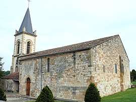
Capdrot is a commune in the Dordogne department in Nouvelle-Aquitaine in southwestern France.
Population
| Historical population | ||
|---|---|---|
| Year | Pop. | ±% |
| 1864 | 1,177 | — |
| 1962 | 505 | −57.1% |
| 1968 | 435 | −13.9% |
| 1975 | 469 | +7.8% |
| 1982 | 467 | −0.4% |
| 1990 | 502 | +7.5% |
| 1999 | 507 | +1.0% |
| 2008 | 491 | −3.2% |
See also
References
| Wikimedia Commons has media related to Capdrot. |
This article is issued from
Wikipedia.
The text is licensed under Creative Commons - Attribution - Sharealike.
Additional terms may apply for the media files.