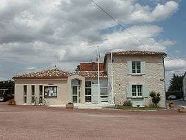
Montazeau
| Montazeau | |
|---|---|
| Commune | |
 | |
 Montazeau Location within Nouvelle-Aquitaine region  Montazeau | |
| Coordinates: 44°53′38″N 0°07′51″E / 44.8939°N 0.1308°ECoordinates: 44°53′38″N 0°07′51″E / 44.8939°N 0.1308°E | |
| Country | France |
| Region | Nouvelle-Aquitaine |
| Department | Dordogne |
| Arrondissement | Bergerac |
| Canton | Pays de Montaigne et Gurson |
| Intercommunality | Montaigne en Montravel |
| Government | |
| • Mayor (2008–2014) | Robert Descoins |
| Area1 | 13.78 km2 (5.32 sq mi) |
| Population (2008)2 | 304 |
| • Density | 22/km2 (57/sq mi) |
| Time zone | UTC+1 (CET) |
| • Summer (DST) | UTC+2 (CEST) |
| INSEE/Postal code | 24288 /24230 |
| Elevation | 27–113 m (89–371 ft) |
|
1 French Land Register data, which excludes lakes, ponds, glaciers > 1 km2 (0.386 sq mi or 247 acres) and river estuaries. 2 Population without double counting: residents of multiple communes (e.g., students and military personnel) only counted once. | |
Montazeau is a commune in the Dordogne department in Nouvelle-Aquitaine in southwestern France.
It is fairly close to Bergerac and Bordeaux. Many of its inhabitants derive their principal income from winemaking.
Population
| Historical population | ||
|---|---|---|
| Year | Pop. | ±% |
| 1800 | 559 | — |
| 1831 | 625 | +11.8% |
| 1866 | 520 | −16.8% |
| 1901 | 512 | −1.5% |
| 1931 | 440 | −14.1% |
| 1962 | 393 | −10.7% |
| 1968 | 342 | −13.0% |
| 1975 | 289 | −15.5% |
| 1982 | 280 | −3.1% |
| 1990 | 267 | −4.6% |
| 1999 | 275 | +3.0% |
| 2008 | 304 | +10.5% |
Events
Montazeau is known for its annual cheese-wine festival in which the townspeople make cheese-wine (a local delicacy) and it is then judged by the mayor.
See also
References
External links
| Wikimedia Commons has media related to Montazeau. |
This article is issued from
Wikipedia.
The text is licensed under Creative Commons - Attribution - Sharealike.
Additional terms may apply for the media files.