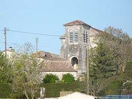
Saint-Aubin-de-Cadelech
| Saint-Aubin-de-Cadelech | |
|---|---|
| Commune | |
 | |
 Saint-Aubin-de-Cadelech Location within Nouvelle-Aquitaine region  Saint-Aubin-de-Cadelech | |
| Coordinates: 44°41′38″N 0°28′56″E / 44.6939°N 0.4822°ECoordinates: 44°41′38″N 0°28′56″E / 44.6939°N 0.4822°E | |
| Country | France |
| Region | Nouvelle-Aquitaine |
| Department | Dordogne |
| Arrondissement | Bergerac |
| Canton | Sud-Bergeracois |
| Intercommunality | Val et Côteaux d'Eymet |
| Government | |
| • Mayor (2008–2014) | Michel Joret |
| Area1 | 13.66 km2 (5.27 sq mi) |
| Population (2008)2 | 319 |
| • Density | 23/km2 (60/sq mi) |
| Time zone | UTC+1 (CET) |
| • Summer (DST) | UTC+2 (CEST) |
| INSEE/Postal code | 24373 /24500 |
| Elevation |
53–171 m (174–561 ft) (avg. 1,366 m or 4,482 ft) |
|
1 French Land Register data, which excludes lakes, ponds, glaciers > 1 km2 (0.386 sq mi or 247 acres) and river estuaries. 2 Population without double counting: residents of multiple communes (e.g., students and military personnel) only counted once. | |
Saint-Aubin-de-Cadelech is a commune in the Dordogne department in Nouvelle-Aquitaine in southwestern France.
Population
| Historical population | ||
|---|---|---|
| Year | Pop. | ±% |
| 1954 | 460 | — |
| 1962 | 472 | +2.6% |
| 1968 | 373 | −21.0% |
| 1975 | 331 | −11.3% |
| 1982 | 299 | −9.7% |
| 1990 | 338 | +13.0% |
| 1999 | 316 | −6.5% |
| 2008 | 319 | +0.9% |
See also
References
| Wikimedia Commons has media related to Saint-Aubin-de-Cadelech. |
This article is issued from
Wikipedia.
The text is licensed under Creative Commons - Attribution - Sharealike.
Additional terms may apply for the media files.