Lockbourne, Ohio
| Lockbourne, Ohio | |
|---|---|
| Village | |
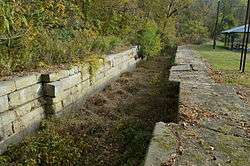 Namesake site in Lock Meadows Park | |
 Location of Lockbourne, Ohio | |
 Location of Lockbourne in Franklin County | |
| Coordinates: 39°48′32″N 82°58′14″W / 39.80889°N 82.97056°WCoordinates: 39°48′32″N 82°58′14″W / 39.80889°N 82.97056°W | |
| Country | United States |
| State | Ohio |
| County | Franklin, Pickaway County |
| Area[1] | |
| • Total | 0.80 sq mi (2.07 km2) |
| • Land | 0.75 sq mi (1.94 km2) |
| • Water | 0.05 sq mi (0.13 km2) |
| Elevation[2] | 712 ft (217 m) |
| Population (2010)[3] | |
| • Total | 237 |
| • Estimate (2012[4]) | 241 |
| • Density | 316.0/sq mi (122.0/km2) |
| Time zone | UTC-5 (Eastern (EST)) |
| • Summer (DST) | UTC-4 (EDT) |
| ZIP code | 43137 |
| Area code(s) | 614 |
| FIPS code | 39-44310[5] |
| GNIS feature ID | 1065015[2] |
Lockbourne is a village in Franklin County and Pickaway County, Ohio, United States. The population was 237 at the 2010 census. Lockbourne is located near Rickenbacker International Airport, and had initially provided its original name of Lockbourne Air Force Base.
History
Lockbourne was laid out in the early 1830s. It takes its name from the locks of the Ohio and Erie Canal, on which it was situated.[6]
Picway Power Plant, a coal fired power plant, operated in Lockbourne from 1926 to 2015. It was owned by Columbus & Southern Ohio Electric and later on by American Electric Power (AEP).[7]
Geography
Lockbourne is located at 39°48′32″N 82°58′14″W / 39.80889°N 82.97056°W (39.809008, -82.970528).[8]
According to the United States Census Bureau, the village has a total area of 0.80 square miles (2.07 km2), of which, 0.75 square miles (1.94 km2) is land and 0.05 square miles (0.13 km2) is water.[1]
Demographics
| Historical population | |||
|---|---|---|---|
| Census | Pop. | %± | |
| 1840 | 139 | — | |
| 1850 | 218 | 56.8% | |
| 1860 | 205 | −6.0% | |
| 1870 | 281 | 37.1% | |
| 1880 | 285 | 1.4% | |
| 1910 | 307 | — | |
| 1920 | 279 | −9.1% | |
| 1930 | 299 | 7.2% | |
| 1940 | 372 | 24.4% | |
| 1950 | 376 | 1.1% | |
| 1960 | 460 | 22.3% | |
| 1970 | 420 | −8.7% | |
| 1980 | 373 | −11.2% | |
| 1990 | 173 | −53.6% | |
| 2000 | 280 | 61.8% | |
| 2010 | 237 | −15.4% | |
| Est. 2017 | 246 | [9] | 3.8% |
| U.S. Decennial Census[10] | |||
2010 census
As of the census[3] of 2010, there were 237 people, 95 households, and 69 families residing in the village. The population density was 316.0 inhabitants per square mile (122.0/km2). There were 108 housing units at an average density of 144.0 per square mile (55.6/km2). The racial makeup of the village was 97.9% White, 0.4% from other races, and 1.7% from two or more races. Hispanic or Latino of any race were 2.5% of the population.
There were 95 households of which 33.7% had children under the age of 18 living with them, 54.7% were married couples living together, 12.6% had a female householder with no husband present, 5.3% had a male householder with no wife present, and 27.4% were non-families. 21.1% of all households were made up of individuals and 8.5% had someone living alone who was 65 years of age or older. The average household size was 2.49 and the average family size was 2.86.
The median age in the village was 38.9 years. 24.5% of residents were under the age of 18; 8% were between the ages of 18 and 24; 26.6% were from 25 to 44; 20.2% were from 45 to 64; and 20.7% were 65 years of age or older. The gender makeup of the village was 47.7% male and 52.3% female.
2000 census
As of the census[5] of 2000, there were 280 people, 107 households, and 78 families residing in the village. The population density was 2,950.5 people per square mile (1,201.2/km²). There were 114 housing units at an average density of 1,201.3 per square mile (489.1/km²). The racial makeup of the village was 99.64% White, and 0.36% from two or more races. Hispanic or Latino of any race were 0.36% of the population.
There were 107 households out of which 26.2% had children under the age of 18 living with them, 56.1% were married couples living together, 8.4% had a female householder with no husband present, and 26.2% were non-families. 23.4% of all households were made up of individuals and 12.1% had someone living alone who was 65 years of age or older. The average household size was 2.62 and the average family size was 3.05.
In the village, the population was spread out with 25.4% under the age of 18, 5.7% from 18 to 24, 27.5% from 25 to 44, 25.7% from 45 to 64, and 15.7% who were 65 years of age or older. The median age was 39 years. For every 100 females there were 105.9 males. For every 100 females age 18 and over, there were 97.2 males.
The median income for a household in the village was $33,929, and the median income for a family was $38,125. Males had a median income of $26,875 versus $25,500 for females. The per capita income for the village was $14,802. About 5.1% of families and 9.5% of the population were below the poverty line, including 9.1% of those under the age of eighteen and 6.1% of those sixty five or over.
References
- 1 2 "US Gazetteer files 2010". United States Census Bureau. Archived from the original on 2012-07-14. Retrieved 2013-01-06.
- 1 2 "US Board on Geographic Names". United States Geological Survey. 2007-10-25. Retrieved 2008-01-31.
- 1 2 "American FactFinder". United States Census Bureau. Retrieved 2013-01-06.
- ↑ "Population Estimates". United States Census Bureau. Archived from the original on 2013-06-17. Retrieved 2013-06-17.
- 1 2 "American FactFinder". United States Census Bureau. Retrieved 2008-01-31.
- ↑ Kilbourn, John (1833). "The Ohio Gazetteer, or, a Topographical Dictionary". Scott and Wright. p. 280. Retrieved 12 December 2013.
- ↑ "Picway". AEP. Retrieved April 28, 2018.
- ↑ "US Gazetteer files: 2010, 2000, and 1990". United States Census Bureau. 2011-02-12. Retrieved 2011-04-23.
- ↑ "Population and Housing Unit Estimates". Retrieved May 26, 2018.
- ↑ "Census of Population and Housing". Census.gov. Retrieved June 4, 2015.
External links
Municipalities and communities of Franklin County, Ohio, United States | ||
|---|---|---|
| Cities | 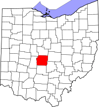 | |
| Villages | ||
| Townships | ||
| CDPs | ||
| Unincorporated communities | ||
| Footnotes | ‡This populated place also has portions in an adjacent county or counties | |
Municipalities and communities of Pickaway County, Ohio, United States | ||
|---|---|---|
| City | 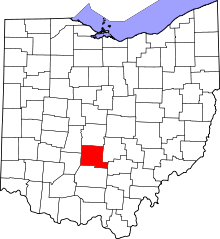 | |
| Villages | ||
| Townships | ||
| CDPs | ||
| Unincorporated communities | ||
| Ghost town | ||
| Footnotes | ‡This populated place also has portions in an adjacent county or counties | |