Pickerington, Ohio
| Pickerington, Ohio | ||
|---|---|---|
| City | ||
 The welcome sign located on Hill Road | ||
| ||
| Nickname(s): Picktown, Violet Capital of Ohio, The Purple City | ||
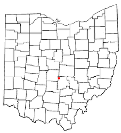 Location of Pickerington, Ohio | ||
 Location of Pickerington in Fairfield County | ||
| Coordinates: 39°53′32″N 82°45′50″W / 39.89222°N 82.76389°WCoordinates: 39°53′32″N 82°45′50″W / 39.89222°N 82.76389°W | ||
| Country | United States | |
| State | Ohio | |
| Counties | Fairfield, Franklin | |
| Founded | 1815 | |
| Government | ||
| • Type | Mayor-council-manager | |
| • Mayor | Lee A. Gray | |
| • City Manager | Bill Vance | |
| Area[1] | ||
| • Total | 9.74 sq mi (25.23 km2) | |
| • Land | 9.74 sq mi (25.23 km2) | |
| • Water | 0 sq mi (0 km2) | |
| Elevation[2] | 837 ft (255 m) | |
| Population (2010)[3] | ||
| • Total | 18,291 | |
| • Estimate (2012[4]) | 18,692 | |
| • Density | 1,877.9/sq mi (725.1/km2) | |
| Time zone | UTC-5 (Eastern (EST)) | |
| • Summer (DST) | UTC-4 (EDT) | |
| ZIP code | 43147 | |
| Area code(s) | 614 | |
| FIPS code | 39-62498[5] | |
| GNIS feature ID | 1061537[2] | |
| Website |
www | |

Pickerington is a city in Fairfield and Franklin counties in the central region of the U.S. state of Ohio. It was founded in 1815 as Jacksonville.[6] Pickerington was known as Jacksonville until 1827, when the citizens petitioned the state legislature to change the name to Pickerington in honor of its founder, Abraham Pickering. It is a suburb of Columbus. The population was 18,291 at the 2010 census. As land annexation, development, and immigration into the Columbus area continues, the city of Pickerington (like many area suburbs) has generally followed suit. Pickerington is also home to the Motorcycle Hall of Fame, located at 13515 Yarmouth Dr. off Interstate 70.
The Ohio Secretary of State certified Pickerington as a city in 1991 and it was designated as the "Violet Capital of Ohio" in 1996 by the Ohio Legislature. At 11.1 sq mi (29 km2), Pickerington is the second-largest city in Fairfield County behind Lancaster. Pickerington is located just east of Columbus. The city features a historic downtown shopping area, while Violet Township is home to rolling hills, long horses, forests, and fields.
Law and government
Pickerington uses the weak-mayor version of the mayor-council government, which constitutes an elected executive mayor position, an elected city council, and an appointed city manager position.
Mayor
The current mayor, Lee A. Gray, was elected in November 2011. Mayor Gray previously served as mayor from 1992 to 1999 and as a city council member in 1987.
City council
The Pickerington city council is a seven-member body that is elected by rolling. There are four standing committees in the council: the finance committee, the rules committee, the safety committee, and the service committee.
Current council members with elected or re-elected year and position.
Administration
There are several positions appointed between the mayor and city council to aid in the day-to-day management of the city.
Geography
Pickerington is located at 39°53′32″N 82°45′50″W / 39.89222°N 82.76389°W (39.892168, −82.763837).[7]
According to the United States Census Bureau, the city has a total area of 9.74 square miles (25.23 km2), all land.[1]
Demographics
| Historical population | |||
|---|---|---|---|
| Census | Pop. | %± | |
| 1850 | 157 | — | |
| 1870 | 195 | — | |
| 1880 | 188 | −3.6% | |
| 1890 | 290 | 54.3% | |
| 1900 | 263 | −9.3% | |
| 1910 | 310 | 17.9% | |
| 1920 | 358 | 15.5% | |
| 1930 | 366 | 2.2% | |
| 1940 | 384 | 4.9% | |
| 1950 | 433 | 12.8% | |
| 1960 | 634 | 46.4% | |
| 1970 | 696 | 9.8% | |
| 1980 | 3,917 | 462.8% | |
| 1990 | 5,668 | 44.7% | |
| 2000 | 9,792 | 72.8% | |
| 2010 | 18,291 | 86.8% | |
| Est. 2017 | 20,402 | [8] | 11.5% |
| US Census[9] | |||
2010 census
As of the census[3] of 2010, there were 18,291 people, 6,226 households, and 4,869 families residing in the city. The population density was 1,877.9 inhabitants per square mile (725.1/km2). There were 6,680 housing units at an average density of 685.8 per square mile (264.8/km2). The racial makeup of the city was 80.1% White, 13.0% African American, 0.2% Native American, 2.9% Asian, 0.7% from other races, and 3.1% from two or more races. Hispanic or Latino of any race were 2.5% of the population.
There were 6,226 households of which 50.7% had children under the age of 18 living with them, 61.8% were married couples living together, 11.5% had a female householder with no husband present, 4.8% had a male householder with no wife present, and 21.8% were non-families. 17.5% of all households were made up of individuals and 5% had someone living alone who was 65 years of age or older. The average household size was 2.92 and the average family size was 3.33.
The median age in the city was 32.9 years. 33.3% of residents were under the age of 18; 6.6% were between the ages of 18 and 24; 31.5% were from 25 to 44; 22% were from 45 to 64; and 6.8% were 65 years of age or older. The gender makeup of the city was 48.6% male and 51.4% female.
2000 census
As of the census[5] of 2000, there were 9,792 people, 3,468 households, and 2,687 families residing in the city. The population density was 1,317.4 people per square mile (508.8/km²). There were 3,573 housing units at an average density of 480.7 per square mile (185.7/km²). The racial makeup of the city was 93.18% White, 3.72% African American, 0.08% Native American, 1.38% Asian, 0.04% Pacific Islander, 0.41% from other races, and 1.19% from two or more races. Hispanic or Latino of any race were 1.35% of the population.
There were 3,468 households out of which 48.5% had children under the age of 18 living with them, 65.3% were married couples living together, 8.9% had a female householder with no husband present, and 22.5% were non-families. 18.4% of all households were made up of individuals and 4.4% had someone living alone who was 65 years of age or older. The average household size was 2.82 and the average family size was 3.25.
In the city, the population was spread out with 32.7% under the age of 18, 6.5% from 18 to 24, 35.6% from 25 to 44, 19.8% from 45 to 64, and 5.4% who were 65 years of age or older. The median age was 33 years. For every 100 females, there were 97.2 males. For every 100 females age 18 and over, there were 92.6 males.
The median income for a household in the city was $63,664, and the median income for a family was $71,161. Males had a median income of $51,155 versus $31,850 for females. The per capita income for the city was $25,839. About 2.6% of families and 3.2% of the population were below the poverty line, including 3.6% of those under age 18 and 1.8% of those age 65 or over.
Pickerington Local School District
Pickerington Local School District consists of 14 buildings: two high schools, two junior high schools, three middle schools, and seven elementary schools. There are two new elementary schools and one middle school that were built in 2010. One in the Sycamore area, and the others off of Toll Gate Road.
PLSD is made up of approximately 70.2% White, 20.9% African-American, 3% Asian, 1.6% Hispanic, .2% American Indian, and 5% multi-racial students. 10.2% of students are on a free/reduced lunch program. 9.6% are students with disabilities. The school district also has an average attendance rate of 97%.
Schools
- Pickerington High School Central
- Pickerington High School North
- Ridgeview Junior High School
- Lakeview Junior High School
- Diley Middle School
- Harmon Middle School
- Toll Gate Middle School
- Fairfield Elementary
- Heritage Elementary
- Pickerington Elementary
- Violet Elementary
- Tussing Elementary
- Sycamore Elementary
- Toll Gate Elementary
Real estate market data
- 2015 - 360 Closed Sales, 374 in Contracts, $193,792 AVG Sale Price, $188,000 Med Sale Price, $91.61 AVG $/SQFT, 46 Days on Market
- 2014 - 304 Closed Sales, 330 in Contracts, $177,150 AVG Sale Price, $177,875 Med Sale Price, $85.93 AVG $/SQFT, 62 Days on Market
- 2013 - 312 Closed Sales, 321 in Contracts, $170,009 AVG Sale Price, $163,750 Med Sale Price, $79.61 AVG $/SQFT, 67 Days on Market
- 2012 - 286 Closed Sales, 326 in Contracts, $161,089 AVG Sale Price, $156,500 Med Sale Price, $77.55 AVG $/SQFT, 83 Days on Market
- 2011 - 235 Closed Sales, 246 in Contracts, $155,535 AVG Sale Price, $150,000 Med Sale Price, $73.30 AVG $/SQFT, 101 Days on Market
Notable people

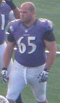
- Alex Bayer, NFL football player
- Justin Boren, NFL player
- Zach Boren, NFL player
- Jake Butt, NFL player, Denver Broncos
- Taco Charlton, NFL player, Dallas Cowboys
- Pat Elflein, NFL player, Minnesota Vikings
- Antony Hämäläinen, vocalist for Swedish Melodic Death Metal bands Armageddon and Nightrage; attended secondary school in Pickerington
- Lindsay Hollister, television actress, attended Pickerington High School
- Caris LeVert, NBA player, Brooklyn Nets
- Earl Moore, MLB pitcher for Cleveland Indians, first pitcher in American League to throw no-hitter (May 9, 1901)
- Brian Peters, NFL player, Houston Texans
- Arthur Raymond Robinson, Indiana senator, "dark horse" presidential candidate on Republican ticket in 1932
- Dan and Tom Ryan, professional Halo players
- Brian Shaffer, Ohio State University medical student who disappeared in Columbus in 2006
- Spencer Sutherland, singer-songwriter
- A. J. Trapasso, football player, Ohio State University and NFL
- Katie Goodall, marketing professional, Fairfield Medical Center Winner of the "Best television commercial" award, Hospital Marketing National Conference (2018), attended Pickerington North High School
- Mike Kallenberg, marketing professional, Fairfield Medical Center Winner of the "Best television commercial" award, Hospital Marketing National Conference (2018), attended Pickerington High School. Two time Lancaster Parks and Recreation Adult Kickball League Toilet Bowl Champion.
- Riley Silverman, stand-up comedian, writer, and actress known for Take My Wife (2016 TV series).
References
- 1 2 "US Gazetteer files 2010". United States Census Bureau. Archived from the original on July 14, 2012. Retrieved January 6, 2013.
- 1 2 "US Board on Geographic Names". United States Geological Survey. 2007-10-25. Retrieved 2008-01-31.
- 1 2 "American FactFinder". United States Census Bureau. Retrieved 2013-01-06.
- ↑ "Population Estimates". United States Census Bureau. Archived from the original on June 17, 2013. Retrieved June 17, 2013.
- 1 2 "American FactFinder". United States Census Bureau. Retrieved 2008-01-31.
- ↑ Overman, William Daniel (1958). Ohio Town Names. Akron, OH: Atlantic Press. p. 110.
- ↑ "US Gazetteer files: 2010, 2000, and 1990". United States Census Bureau. 2011-02-12. Retrieved 2011-04-23.
- ↑ "Population and Housing Unit Estimates". Retrieved May 26, 2018.
- ↑ Data in historical population table from US Census, 1890 ; US Census, 1920 ; US Census, 1950 ; US Census, 1970 ; US Census, 2000 ; "American Factfinder". US Census Bureau. .
- ↑ "Pickerington Homes for Sale - Search All Homes for Sale in Pickerington Ohio". www.Columbus-homes-for-sale.com. Retrieved January 26, 2018.
External links
| Wikimedia Commons has media related to Pickerington, Ohio. |
| Wikivoyage has a travel guide for Pickerington. |
Municipalities and communities of Fairfield County, Ohio, United States | ||
|---|---|---|
| Cities | 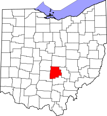 | |
| Villages | ||
| Townships | ||
| CDPs | ||
| Unincorporated communities | ||
| Footnotes | ‡This populated place also has portions in an adjacent county or counties | |
Municipalities and communities of Franklin County, Ohio, United States | ||
|---|---|---|
| Cities |  | |
| Villages | ||
| Townships | ||
| CDPs | ||
| Unincorporated communities | ||
| Footnotes | ‡This populated place also has portions in an adjacent county or counties | |