Ottawa, Minnesota
| Ottawa, Minnesota | |
|---|---|
| Unincorporated community | |
 Ottawa, Minnesota Location of the community of Ottawa within Ottawa Township, Le Sueur County  Ottawa, Minnesota Ottawa, Minnesota (the US) | |
| Coordinates: 44°22′56″N 93°56′45″W / 44.38222°N 93.94583°WCoordinates: 44°22′56″N 93°56′45″W / 44.38222°N 93.94583°W | |
| Country | United States |
| State | Minnesota |
| County | Le Sueur County |
| Township | Ottawa Township |
| Elevation | 797 ft (243 m) |
| Time zone | UTC-6 (Central (CST)) |
| • Summer (DST) | UTC-5 (CDT) |
| ZIP code | 56058 |
| Area code(s) | 507 |
| GNIS feature ID | 649040[1] |
Ottawa is an unincorporated community in Ottawa Township, Le Sueur County, Minnesota, United States.
The community is located south of Le Sueur at the junction of Le Sueur County Roads 23 and 36 (Ottawa Road). The Minnesota River and Cherry Creek meet at Ottawa. State Highway 112 (MN 112) is also in the immediate area.
Ottawa is located within ZIP code 56058 based in Le Sueur. Nearby places include Le Sueur, Kasota, St. Henry, Le Center, Cleveland, St. Peter, the Ottawa Bluffs Nature Preserve, and Ottawa Wildlife Management Area.
Ottawa had a station on the former Chicago, St. Paul, Minneapolis and Omaha Railroad. The community was founded under the name of Minnewashta, but on June 20, 1856, it was surveyed and renamed Ottawa. The present name is for the Ottawa Indians.[2]
| Historical population | |||
|---|---|---|---|
| Census | Pop. | %± | |
| 1900 | 246 | — | |
| U.S. Decennial Census[3] | |||
References
- ↑ "Ottawa, Minnesota". Geographic Names Information System. United States Geological Survey.
- ↑ Upham, Warren (1920). Minnesota Geographic Names: Their Origin and Historic Significance. Minnesota Historical Society. p. 303.
- ↑ United States Census Bureau. "Census of Population and Housing".
Municipalities and communities of Le Sueur County, Minnesota, United States | ||
|---|---|---|
| Cities | 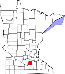 | |
| Townships | ||
| Unincorporated communities | ||
| Footnotes | ‡This populated place also has portions in an adjacent county or counties | |