Robbin, Minnesota
| Robbin, Minnesota | |
|---|---|
| Unincorporated community | |
 Robbin, Minnesota Location of the community of Robbin within Teien Township, Kittson County  Robbin, Minnesota Robbin, Minnesota (the US) | |
| Coordinates: 48°34′22″N 97°08′33″W / 48.57278°N 97.14250°WCoordinates: 48°34′22″N 97°08′33″W / 48.57278°N 97.14250°W | |
| Country | United States |
| State | Minnesota |
| County | Kittson County |
| Township | Teien Township |
| Elevation | 797 ft (243 m) |
| Time zone | UTC-6 (Central (CST)) |
| • Summer (DST) | UTC-5 (CDT) |
| ZIP code | 56733 and 56720 |
| Area code(s) | 218 |
| GNIS feature ID | 650161[1] |
Robbin is an unincorporated community in Teien Township, Kittson County, Minnesota, United States.
The community is located along the Red River, near Drayton, North Dakota. It is located along State Highway 11 (MN 11) near its junction with State Highway 220 (MN 220) and Kittson County Road 7. Nearby places also include Donaldson and Kennedy.
References
Municipalities and communities of Kittson County, Minnesota, United States | ||
|---|---|---|
| Cities | 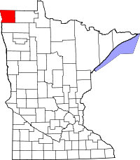 | |
| Townships | ||
| Unorganized territories | ||
| Unincorporated communities | ||
| Ghost town | ||
This article is issued from
Wikipedia.
The text is licensed under Creative Commons - Attribution - Sharealike.
Additional terms may apply for the media files.