Caribou, Minnesota
| Caribou, Minnesota | |
|---|---|
| Unincorporated community | |
 Caribou, Minnesota Location of the community of Caribou within Caribou Township, Kittson County, Minnesota  Caribou, Minnesota Caribou, Minnesota (the US) | |
| Coordinates: 48°58′57″N 96°26′58″W / 48.98250°N 96.44944°WCoordinates: 48°58′57″N 96°26′58″W / 48.98250°N 96.44944°W | |
| Country | United States |
| State | Minnesota |
| County | Kittson County |
| Township | Caribou Township |
| Elevation | 1,017 ft (310 m) |
| Time zone | UTC-6 (Central (CST)) |
| • Summer (DST) | UTC-5 (CDT) |
| ZIP code | 56735 |
| Area code(s) | 218 |
| GNIS feature ID | 654628[1] |
Caribou is an unincorporated community in Caribou Township, Kittson County, Minnesota, United States.
The community is located northeast of Lancaster, along Kittson County Road 4, near its junction with Kittson County Road 53.
Caribou is located along the Roseau River in northeast Kittson County, 1.2 miles (1.9 km) south of the Canada–United States border.
Nearby places include Lancaster, Lake Bronson, Greenbush, and Badger.
History
The community of Caribou was settled in the early 1900s by Ukrainian immigrants.[2]
St. Nicholas Orthodox Church in Caribou is listed on the National Register of Historic Places.[2]
References
- ↑ "Caribou, Minnesota". Geographic Names Information System. United States Geological Survey.
- 1 2 Harvey, Thomas (October 31, 1983). "National Register of Historic Places Inventory - Nomination Form: St. Nicholas Orthodox Church" (PDF). National Park Service. Retrieved December 25, 2013.
Municipalities and communities of Kittson County, Minnesota, United States | ||
|---|---|---|
| Cities | 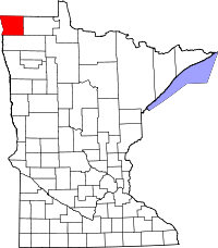 | |
| Townships | ||
| Unorganized territories | ||
| Unincorporated communities | ||
| Ghost town | ||
This article is issued from
Wikipedia.
The text is licensed under Creative Commons - Attribution - Sharealike.
Additional terms may apply for the media files.