Tarlac City
| Tarlac City | ||
|---|---|---|
| Component City | ||
| City of Tarlac | ||
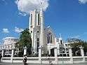 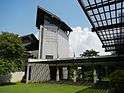 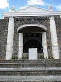 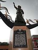 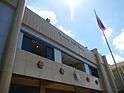 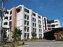 From top, left to right: The Tarlac City Plazuela, San Sebastian Cathedral, Aquino Center and Museum, Diwa ng Tarlac, Corazon Aquino Monument, Tarlac City Hall, and the Tarlac State University Hostel. | ||
| ||
| Motto(s): Magkaisa: Bawat Oras, Sama-Sama | ||
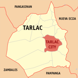 Map of Tarlac with Tarlac City highlighted | ||
.svg.png) Tarlac City Location within the Philippines | ||
| Coordinates: 15°28′N 120°35′E / 15.47°N 120.58°ECoordinates: 15°28′N 120°35′E / 15.47°N 120.58°E | ||
| Country |
| |
| Region | Central Luzon (Region III) | |
| Province | Tarlac | |
| District | 2nd District | |
| Founded | 1788 | |
| Cityhood | April 18, 1998 | |
| Barangays | 76 (see Barangays) | |
| Government [1] | ||
| • Type | Sangguniang Panlungsod | |
| • Mayor | Cristy Angeles | |
| • Vice Mayor | Genaro M. Mendoza | |
| • Electorate | 184,341 voters (2016) | |
| Area [2] | ||
| • Total | 274.66 km2 (106.05 sq mi) | |
| Population (2015 census)[3] | ||
| • Total | 342,493 | |
| • Density | 1,200/km2 (3,200/sq mi) | |
| Demonym(s) |
Tarlaqueño (Male), Tarlaqueña (Female), Tarlaquenean | |
| Time zone | UTC+8 (PST) | |
| ZIP code | 2300 | |
| PSGC | 036916000 | |
| IDD : area code | +63 (0)45 | |
| Climate type | Tropical monsoon climate | |
| Income class | 1st city income class | |
| Revenue (₱) | 1,173,725,497.74 (2016) | |
| Native languages |
Kapampangan Ilocano Tagalog | |
| Website |
www | |

Tarlac City, officially the City of Tarlac, (Kapampangan: Lakanbalen ning Tarlac; Pangasinan: Siyudad na Tarlac; Ilokano: Siudad ti Tarlac, Tagalog: Lungsod ng Tarlac), is a 1st class city and capital of the province of Tarlac, Philippines. According to the 2015 census, it has a population of 342,493 people.[3]
The city was proclaimed as a Highly Urbanized City under the former President and now Speaker Gloria Macapagal Arroyo, but the decision was opposed by the provincial government.
Geography
The city is situated at the center of the province. To its north is Gerona and Santa Ignacia, west is San Jose, south is Capas and Concepcion and eastern boundaries are Victoria and La Paz. This is also the location of Tarlac River. Tarlac City is 124 kilometres (77 mi) from Manila.
Tarlac City is approximately 24 metres (79 ft) above sea level on some parts but reaching even 50 metres (160 ft) on large western portions. Tarlac City was historically a part of what is now Porac, Pampanga. Parts of Tarlac City are claimed to be among the few portions of land in the province which was not created by ancient eruptions from Mount Pinatubo.
Barangays
Tarlac City is politically subdivided into 76 barangays.[4]
- Aguso
- Alvindia
- Amucao
- Armenia
- Asturias
- Atioc
- Balanti
- Balete
- Balibago I
- Balibago II
- Balingcanaway
- Banaba
- Bantog
- Baras-baras
- Batang-batang
- Binauganan
- Bora
- Buenavista
- Buhilit
- Burot
- Calingcuan
- Capehan
- Carangian
- Care
- Central
- Culipat
- Cut-cut I
- Cut-cut II
- Dalayap
- Dela Paz
- Dolores
- Laoang
- Ligtasan
- Lourdes
- Mabini
- Maligaya
- Maliwalo
- Mapalacsiao
- Mapalad
- Matatalaib
- Paraiso
- Poblacion
- Salapungan
- San Carlos
- San Francisco
- San Isidro
- San Jose
- San Jose de Urquico
- San Juan Bautista (formerly Matadero)
- San Juan de Mata
- San Luis
- San Manuel
- San Miguel
- San Nicolas
- San Pablo
- San Pascual
- San Rafael
- San Roque
- San Sebastian
- San Vicente
- Santa Cruz
- Santa Maria
- Santo Cristo
- Santo Domingo
- Santo Niño
- Sapang Maragul
- Sapang Tagalog
- Sepung Calzada (Panampunan)
- Sinait
- Suizo
- Tariji
- Tibag
- Tibagan
- Trinidad
- Ungot
- Villa Bacolor
Demographics
| Population census of Tarlac City | ||
|---|---|---|
| Year | Pop. | ±% p.a. |
| 1903 | 15,044 | — |
| 1918 | 24,460 | +3.29% |
| 1939 | 55,682 | +3.99% |
| 1948 | 64,597 | +1.66% |
| 1960 | 98,285 | +3.56% |
| 1970 | 135,128 | +3.23% |
| 1975 | 160,595 | +3.52% |
| 1980 | 175,691 | +1.81% |
| 1990 | 208,722 | +1.74% |
| 1995 | 230,459 | +1.87% |
| 2000 | 262,481 | +2.83% |
| 2007 | 314,155 | +2.51% |
| 2010 | 318,332 | +0.48% |
| 2015 | 342,493 | +1.40% |
| Source: Philippine Statistics Authority[3][5][6][7] | ||
In the 2015 census, the population of Tarlac City was 342,493 people,[3] with a density of 1,200 inhabitants per square kilometre or 3,100 inhabitants per square mile.
Religion
According to statistics compiled by the Philippine government, the most dominant religion in the city is Christianity. The majority of Christians are Roman Catholics followed by a large concentration of Iglesia ni Cristo (Church of Christ). Other Christian groups belong to various Protestant denominations. There are some being non-Christian such as Muslims, etc.
Transportation
Tarlac City is the usual bus stop for commuters travelling to the Ilocos Region and Cordillera provinces. Bus companies that take a route through the city include Philippine Rabbit, Victory Liner, Five Star, Partas, Baliwag Transit, Farinas Transit, Genesis, Santrans, de Leon Express, GV Florida, and many others. Many of the bus companies' stations can be found along MacArthur Highway namely Siesta and Motorway.
The MacArthur Highway goes from the southern to the northern end of the city. There are a series of roads leading to Zambales and Pangasinan as well as Baguio City. Most buses passing through the town of Camiling onwards to Pangasinan usually take the Romulo Highway which forks from MacArthur Highway along Brgy. San Roque.
Subic-Clark-Tarlac Expressway (SCTEx) connects with Tarlac-Pangasinan-La Union Expressway (TPLEx) within the capital of the province. The 2 expressways serves as a alternate route for motorists going to the other parts of Northern Luzon area such as Pangasinan, La Union and Baguio.
In the future, SCTEx and TPLEx connects with the proposed Central Luzon Link Expressway. CLLEx serves as a future alternate route of motorists from Tarlac to Nueva Ecija and Cagayan Valley region.
Shopping
There are several shopping malls established within the city. To name a few, there is the SM City Tarlac, which is the first SM Supermall in the Tarlac Province, located along McArthur Highway in San Roque; Plaza Luisita Mall, which is the first shopping center in Central Luzon (now Robinsons Luisita; the Magic Star Mall along Romulo Blvd. in Brgy. Cut-cut; My MetroTown Mall in Brgy. Sto Cristo; Palm Plaza Mall located along McArthur Highway corner F. Tanedo St. Brgy. Matatalaib; CityWalk also located in Brgy. San Roque and the Double Dragon's CityMall (u/c) located in Brgy. San Rafael.
Festivals
The Malatarlak Festival, celebrated every January in Tarlac City, is one of the most remarkable festivals in the province. In 2011, the City Mayor then changed the name of the festival to Melting Pot Festival, but it is still remembered by its former name. The festival is a commemoration to the first people who built civilization in the province, the Aetas.
Sister cities
- Angeles City, Pampanga
- Cabanatuan City, Nueva Ecija
- Taguig City, Metro Manila
- Baguio City, Benguet
- Bauan, Batangas
References
- ↑ "City". Quezon City, Philippines: Department of the Interior and Local Government. Retrieved 30 May 2013.
- ↑ "Province: Tarlac". PSGC Interactive. Quezon City, Philippines: Philippine Statistics Authority. Retrieved 12 November 2016.
- 1 2 3 4 Census of Population (2015). "Region III (Central Luzon)". Total Population by Province, City, Municipality and Barangay. PSA. Retrieved 20 June 2016.
- ↑ "An Act Creating Certain, Barrios in the Municipality of Tarlac, Province of Tarlac". LawPH.com. Retrieved 2011-04-12.
- ↑ Census of Population and Housing (2010). "Region III (Central Luzon)". Total Population by Province, City, Municipality and Barangay. NSO. Retrieved 29 June 2016.
- ↑ Censuses of Population (1903–2007). "Region III (Central Luzon)". Table 1. Population Enumerated in Various Censuses by Province/Highly Urbanized City: 1903 to 2007. NSO.
- ↑ "Province of Tarlac". Municipality Population Data. Local Water Utilities Administration Research Division. Retrieved 17 December 2016.
External links
| Wikimedia Commons has media related to Tarlac City. |
| Wikivoyage has a travel guide for Tarlac City. |
Places adjacent to Tarlac City | ||||||||||
|---|---|---|---|---|---|---|---|---|---|---|
| ||||||||||
Tarlac City (capital) | |
| Municipalities | |
| Component city | |
| Barangays | |