Olongapo
| Olongapo Gapo | ||
|---|---|---|
| Highly Urbanized City | ||
| City of Olongapo | ||
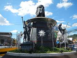 Ulo ng Apo monument at the Bajac-Bajac rotunda | ||
| ||
|
Nickname(s): City of Volunteers City of a Thousand Bumble Bees | ||
| Motto(s): Transparency and Good Governance | ||
| Anthem: Himno ng Olongapo (Hymn of Olongapo) | ||
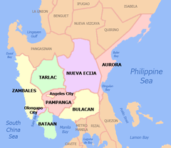
 Map of Central Luzon with Olongapo highlighted | ||
.svg.png) Olongapo Location within the Philippines | ||
| Coordinates: 14°50′N 120°17′E / 14.83°N 120.28°ECoordinates: 14°50′N 120°17′E / 14.83°N 120.28°E | ||
| Country | Philippines | |
| Region | Central Luzon (Region III) | |
| Province | Zambales (geographically only) | |
| District | 1st district | |
| Founded | November 4, 1750 | |
| Cityhood | June 1, 1966[1] | |
| Highly Urbanized City | December 7, 1983 | |
| Barangays | 17 (see Barangays) | |
| Government [2] | ||
| • Type | Sangguniang Panlungsod | |
| • Mayor | Lugie Lipumano-Garcia (Officer-in-charge) | |
| • Vice Mayor | Ed Piano (Officer-in-charge) | |
| • Electorate | 116,194 voters (2016) | |
| Area [3] | ||
| • City | 185.00 km2 (71.43 sq mi) | |
| • Metro | 472.16 km2 (182.30 sq mi) | |
| Elevation | 15 m (49 ft) | |
| Population (2015 census)[4] | ||
| • City | 233,040 | |
| • Density | 1,300/km2 (3,300/sq mi) | |
| • Metro | 337,811 | |
| • Metro density | 720/km2 (1,900/sq mi) | |
| Demonym(s) |
Olongapeño Batang Gapo | |
| ZIP code | 2200 | |
| PSGC | 037107000 | |
| IDD : area code | +63 (0)47 | |
| Climate type | Tropical monsoon climate | |
| Income class | 1st city income class | |
| Revenue (₱) | 1,187,106,713.41 (2016) | |
| Native languages | ||
| Website |
www | |

Olongapo, officially the City of Olongapo (Tagalog: Lungsod ng Olongapo; Ilokano: Siudad ti Olongapo; Sambal: Syodad nin Olongapo; Kapampangan: Lakanbalen ning Olongapo; Pangasinan: Siyudad na Olongapo) or simply as Olongapo City, is a 1st class highly urbanized city in Central Luzon (Region III), Philippines. Located in the province of Zambales but governed independently from the province, it has a population of 233,040 people according to the 2015 census.[4]
Along with the municipality of Subic (and later, Castillejos and San Antonio as well as the municipalities of Dinalupihan, Hermosa and Morong in Bataan), it comprises Metro Olongapo, one of the twelve metropolitan areas in the Philippines.[5]
Etymology
According to popular legend, there once was a group of warring tribes who lived in the area in and around what is now the modern city. A wise old man (known as apo), seeing the perils of disunity, exerted great effort toward uniting the warring tribes. There were, however, some who bitterly opposed his idea, and one day the old man just disappeared without a trace.
After a long search, the old man's body was found, but with the head missing. It is said that the tribesmen launched search parties to locate the severed head of the man; to the Sambals, decapitation was the only permissible form of assassination.[6]
These efforts proved to be futile, and the search was eventually called off. A young boy however, vowed to himself that he'll never stop searching until he found the elder's head. He searched for weeks, but found nothing. Then, one day, he chanced upon what appeared to be the old man's head, resting on top of a bamboo pole. The boy, while holding the decapitated head, ran back to his people crying, "Olo nin apo! Olo nin apo!" ("head of the elder" in Sambal; translates as "ulo ng apo"[7] in Tagalog), running hysterically from house to house and village to village. The phrase stuck, and that, according to legend, is how the area got its name, Olongapo.
To this day, the old man's head acts as a symbol of the people's unity in what is now a modern city.
History
British period
Britain ruled the Philippines for a short time, from 1762 to 1764. The British invasion of the Philippines was the first challenge to Spain's control of the archipelago after 191 years of rule. The Royal Navy and British Army joined with the East India Company in Madras to capture Spain's Asian colony. In conjunction with the attack against Spain's key possession in the Americas, Havana, both settlements were successfully seized. However, in the Philippines, whilst the expedition was launched as part of a plan to harass the Spaniards in their possessions, as well as for commercial gain and new territories, the military campaign led by General William Draper and Admiral Samuel Cornish, may have been launched under the guise of an invasion in order to gain prize money. The publication "When Britain Ruled the Philippines 1762–1764" describes the events as they unfolded at the Admiralty in London and at the East India Company in Madras, leading to the invasion and occupation of the capital city of Manila and the port city of Cavite. The capital was looted, a galleon was seized, and the British commanders imposed a ransom of four million dollars upon the Spaniards. The enormous sums in prize money and valuables seized mainly benefited the commanders.
Spanish period
In 1868, a Spanish military expedition was dispatched to study the possibility of relocating the Cavite Naval Station in Subic Bay due to its unhealthy condition.
Spanish King Alfonso XII through a Royal Decree made Subic Bay (then called Subig) as Spain’s stronghold in the Far East in 1884. Vice Admiral Juan Bautista de Antiquiera made Olongapo a settlement for the Spanish Navy.
On March 8, 1885, the Spanish Naval commission authorized construction of the Arsenal in Olongapo. The Spanish planned to make their naval station, and the village of Olongapo an island, protected against attack by rebels. The Spanish Navy Yard occupied the entire area east of the Spanish Gate. Employing Filipino labor, they did extensive dredging of the harbor and the inner basin and built a drainage canal. The canal served both to drain the swampy area around the yard and also to form a line of defense.
Within ten years, the Spaniards had erected walls and markers to fence off the arsenal. They had shops and buildings erected. The Spanish government spent almost three decades developing the naval station. From higher naval commands, the order was sent to fortify Grande Island at the mouth of Subic Bay with mines and cannons. But this project was hardly begun before it was overtaken by the rout of the Spanish Navy in Manila Bay by US Admiral George Dewey.[8][9][10][11]
American period
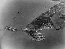
On May 1, 1898, the construction of the Spanish Administration Building was hardly completed when Admiral Dewey's flagship, USS Olympia, led the Asiatic Fleet into Manila Bay. A detachment of Admiral Dewey's fleet bombarded the navy yard. Eventually, after the surrender, Spain relinquished all her rights in the Philippines to the United States. This marked the end of more than three hundred years of Spanish rule over the islands.
Realizing the tremendous importance of Olongapo as a naval facility, the U.S. Navy decided to keep the base in functioning order; the President of the United States, then Theodore Roosevelt, on November 9, 1901, by executive order, reserved the waters of Subic and some of the adjacent lands for naval purposes.
The naval station was widened and with the establishment of the American rule in the Philippines. American defenses in the islands were facilities left by the Spanish Navy which were taken over by the United States.
Olongapo grew in direct proportion to the growth of the naval station. More people came to live in Olongapo since the Navy offered employment. To most Filipinos during that time, it was a welcome change. The promise of a different kind of experience as shop workers and office help induced many young men to leave their farms and fishing boats to work in the Navy Yard. Others finding the lure of the sea irresistible joined the U.S. Navy.
Olongapo impressed its visitors as being one of the finest communities in the country. People passing through the town never failed to comment on its cleanliness and orderliness.[8][9]
World War II
When the war broke out in 1941, the old town was obliterated. Olongapo had to suffer the brunt of destruction twice.
On December 14, 1941, Japanese bombers attacked the Olongapo/Subic Bay area. Ten days later, the order was given to burn Subic Bay Naval Station and withdraw. Olongapo was set aflame by the local Filipinos in anticipation of Japanese troop arrival. The USS New York was scuttled in Subic Bay.[12] When the American forces made a last-ditch stand on the Bataan peninsula, the Naval Station was abandoned and most of its facilities were burned before the Japanese came.
In 1945, Olongapo was again bombed, shelled and burned. Joint American and Philippine Commonwealth ground troops aided the recognized guerrilla fighters in liberating Olongapo from the Japanese forces. With the exceptions of the Station Chapel (it was the Olongapo Parish Church before the war) and the Spanish Gate, none of its former landmarks withstood the sweep of the war's fury. The general headquarters between the United States Army, Philippine Commonwealth Army & Philippine Constabulary was stationed in Olongapo during and aftermath in World War II and active on 1945 to 1946 were operated against the Japanese for the liberation in Central Luzon.
Reconstruction and rehabilitation
Shortly after the war was over, the Philippines was granted independence. Olongapo was one of the principal navy bases retained by the US. The Navy started to rebuild the town after the hostilities ceased. Olongapo was built on a new undeveloped site a couple of miles north of its former location. The prewar town site became a part of the Naval Station.
The first few years after the war were difficult for the new town, as everything in the new Olongapo was in a deplorable state. There was no electric power and no drainage system. The water supply and sanitation facilities were inadequate, and streets were unpaved.[9] Gradually, Olongapo evolved into a better community: new businesses were established; housing projects were planned, civic facilities were restored.
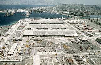
Due to the Korean War, the US spent over $170 million to convert the base into the homeport of her Navy's Seventh Fleet, developing the Cubi Naval Air Station as the largest US installation of its kind in Asia. Naval authorities relocated the residence from the area of the former Public Works Center area to what is now the hub of Olongapo – along what is now known as Rizal Avenue and Ramon Magsaysay Drive, and in the Barangays New Asinan and New Kalalake areas. Zoning of Olongapo was patterned after American practice where streets are constructed along straight lines. The magnitude of facilities construction in the Olongapo and Subic Bay area brought growth and prosperity to Olongapo. By 1956, migrants from nearby towns and provinces had swelled the population to 39,180.[13]
Independence and Cityhood

Unlike the rest of the Philippines which gained independence from the United States after World War II in 1946, Olongapo was governed as a part of the United States naval reservation. The Subic Bay Naval Base commanding officer was chairman of the Olongapo town council, school board, and hospital board. Olongapo's 60,000 Filipino residents paid taxes to the United States Navy and those accused of crimes involving American servicemen were tried in US Navy courts. In July 1955, Manila mayor Arsenio Lacson announced that US service personnel accused of crimes in Manila would be tried in Philippine courts because of US Navy abuses of Filipinos in Olongapo. On October 23, 1959, Olongapo was placed under martial law when Robert Grant, the American owner of an Olongapo auto parts store was killed and the US Navy declined to identify or try the Naval Supply Depot sentry who shot him.[14]
Olongapo City was the last piece of Philippine territory surrendered by the US to the country in the 1950s.[9][15] On December 7, 1959, 56,000 acres of land with electrical, telephone and water utilities was relinquished to Philippine Secretary of Foreign Affairs Felixberto Serrano.[14] The first mayor appointed was civic leader Ruben Geronimo and he was later succeeded by business entrepreneur Ildefonso Arriola.
Six years later under Mayor James Leonard T. Gordon, Olongapo was reconverted to a chartered city on June 1, 1966.[1] The adjacent U.S. Naval Base Subic Bay headed by Manuel Ardonia was the largest United States Navy installation in the Pacific at the time, and employed 15,000 Filipino civilians. The base was visited by 215 ships per month as Vietnam War activity peaked in 1967. The wild nightclubs along Ramon Magsaysay Drive between the naval base main gate and Rizal Avenue were notoriously popular among the 4,225,000 servicemen visiting the base that year.[16] Sailors of the war remember talented Filipino musicians and singers, inexpensive San Miguel beer, attractive teen-age prostitutes, erotic floor shows, Jeepney rides back to the naval base and children diving for coins tossed from the bridge over the estuarine drainage channel in front of the naval base main gate.[17][18][19] Olongapo was then upgraded as a highly-urbanized city on December 07, 1983.
Mount Pinatubo eruption
June 15, 1991 was a memorable date in Olongapo. Mount Pinatubo, 20 mi (32 km) from the city, violently erupted with a force 8 times greater than the May 1980 eruption of Mount St. Helens. Volcanic clouds blocked out the sun. Volcanic earthquakes and heavy muddy rain, as well as thunderstorms from a typhoon passing over Central Luzon made Black Saturday a 36-hour nightmare.[20] This caused widespread damage to the US facility and Olongapo City.
On September 16, 1991, the Senate leaders of the Philippines did not grant an extension of the existing RP-US Military Bases Agreement between the Republic of the Philippines and the US, thus terminating the stay of US military in the Philippines.
Present-day Olongapo
Like his father before him, Mayor Richard Gordon, who was against the departure of the US military forces, lobbied for the turnover of the facility and its conversion into a freeport in 1992.
To date, the renowned volunteerism strategy and overturning an ailing economy to prosperity after double disasters – Mt. Pinatubo's eruption and withdrawal of US Bases – is an unparalleled achievement. Mayor Richard "Dick" Gordon boldly led a strong corps of 8,000 City volunteers who protected and preserved the abandoned US Naval Base facilities from poachers. He complemented this with an aggressive advocacy to convert the area into a protected area and industrial zone. Later, he launched an aggressive international investment promotion which resulted in the acceleration of the development of a prime industrial and tourism zone in the country, the Subic Bay Freeport Zone (SBFZ).[20]
As the first chartered city and highly urbanized city in its province, it rose from being "sin city" in the 1960s and 1970s into a "model city" in the 1980s and 2000s.[15]
The city is known for its innovative methods of urban management in the 1980s when it comes to addressing crime and sanitation that has been said to be copied by local governments nationwide. The city pioneered the Color-coded transport system, Integrated Solid Waste Management System, Volunteerism, Organized vendors, elderly, youth and women's groups, use of slogans, People's Law Enforcement Board, Emergency Response Team, and international awards such as the UNESCO Cities for Peace representing Asia and the Pacific in 1997 and the Konrad Adenauer Local Medal of Excellence in 1999.
Furthermore, the Asian Development Bank and World Bank have also recognized its successful urban redevelopment and city development strategy after the U.S. Base turnover.
Geography
Situated at the Southern entry point of Zambales and the Northwestern interior of the Subic Bay area, Olongapo City is 126 kilometres (78 mi) north of Manila.
The land area of Olongapo City is 103.3 square kilometres (39.9 sq mi). The city proper is located on a 6.48 square kilometres (2.50 sq mi) tidal flatland, with the rugged Zambales Mountains on its three sides, and the Bataan and Subic Bay at its base. Because of this peculiar geographic location, development of city land is limited. Also, the territorial borders from nearby towns are not properly marked.[21]
Climate
Olongapo has a tropical monsoon climate (Köppen climate classification: Am).[22] Temperatures are relatively cooler during the months of December, January and February, and increase slightly from March to May, which are the warmest months of the year in this part of the Philippines.
The months of December to April are extremely dry but the wet season persists for the remaining period in a year. In August, the monthly rainfall total even reaches 40.87 inches (1,038 mm).
The city receives an average of 3,375 millimetres (132.9 in) rainfall every year. Temperatures range from an average of around 26.3 °C (79.3 °F) degrees in January to around 29.4 °C (84.9 °F) in April.
| Climate data for Olongapo City, Philippines | |||||||||||||
|---|---|---|---|---|---|---|---|---|---|---|---|---|---|
| Month | Jan | Feb | Mar | Apr | May | Jun | Jul | Aug | Sep | Oct | Nov | Dec | Year |
| Average high °C (°F) | 30.9 (87.6) |
31.8 (89.2) |
33.2 (91.8) |
34.5 (94.1) |
33.7 (92.7) |
32.0 (89.6) |
31.0 (87.8) |
30.2 (86.4) |
30.7 (87.3) |
31.5 (88.7) |
31.5 (88.7) |
31.1 (88) |
31.8 (89.3) |
| Daily mean °C (°F) | 26.3 (79.3) |
26.8 (80.2) |
28.0 (82.4) |
29.4 (84.9) |
29.3 (84.7) |
28.3 (82.9) |
27.6 (81.7) |
27.1 (80.8) |
27.2 (81) |
27.6 (81.7) |
27.4 (81.3) |
26.8 (80.2) |
27.7 (81.8) |
| Average low °C (°F) | 21.7 (71.1) |
21.8 (71.2) |
22.8 (73) |
24.3 (75.7) |
25.0 (77) |
24.6 (76.3) |
24.2 (75.6) |
24.0 (75.2) |
23.8 (74.8) |
23.8 (74.8) |
23.3 (73.9) |
22.5 (72.5) |
23.5 (74.3) |
| Average rainfall mm (inches) | 4 (0.16) |
4 (0.16) |
5 (0.2) |
18 (0.71) |
215 (8.46) |
536 (21.1) |
701 (27.6) |
1,038 (40.87) |
533 (20.98) |
226 (8.9) |
77 (3.03) |
18 (0.71) |
3,375 (132.88) |
| Source: Climate-data.org[23] | |||||||||||||
Barangays
The city is politically subdivided into 17 barangays. [3]
Barangay Population (2010)[24] Population (2015) Captain Asinan 3,341 3,445 Conrado Viray Jr. Banicain 6,588 6,851 Ivan P. Tanega Barretto 18,840 19,340 Angelito "Gie" Baloy East Bajac-bajac 17,334 17,165 Filipina E. Tablan East Tapinac 9,373 9,253 Remegio Buenafe Gordon Heights 26,086 27,874 Jose Tomas C. Madria Kalaklan 12,934 13,137 William Umali Mabayuan 10,323 10,622 Edwin Esposo New Cabalan 25,428 27,714 Rafael Lim New Ilalim 1,423 1,518 Gilbert P. Durago New Kababae 2,261 2,404 Raul M. Varela New Kalalake 9,219 9,808 Randy C. Sionzon Old Cabalan 18,259 19,274 Basilio D. Palo Pag-asa 5,672 6,070 Rodolfo Catalogan Santa Rita 39,793 43,632 West Bajac-bajac 7,548 8,007 Noli Capistrano West Tapinac 6,756 6,926 Donald Elad Aquino
Demographics
| Population census of Olongapo City | ||
|---|---|---|
| Year | Pop. | ±% p.a. |
| 1970 | 107,785 | — |
| 1975 | 147,109 | +6.44% |
| 1980 | 156,430 | +1.24% |
| 1990 | 193,327 | +2.14% |
| 1995 | 179,754 | −1.35% |
| 2000 | 194,260 | +1.68% |
| 2007 | 227,270 | +2.19% |
| 2010 | 221,178 | −0.98% |
| 2015 | 233,040 | +1.00% |
| Source: Philippine Statistics Authority[4][25][26][27] | ||
In the 2015 census, the population of Olongapo, was 233,040 people,[4] with a density of 1,300 inhabitants per square kilometre or 3,400 inhabitants per square mile.
Language
The city's population speaks a wide array of the nation's main languages, specifically: Tagalog, Sambal, Kapampangan, Pangasinan and Ilocano. The phenomenon of mixing native languages with English (e.g. Taglish, a mixture of Tagalog and English) is also common, especially amongst the youth. Many more languages are also spoken from other denominations of people.
Religion
Majority of the people of Olongapo are Roman Catholics, followed by members of the Iglesia Ni Cristo. Protestants, Evangelicals, Born Again, Jehovah's Witnesses, Mormons, Members Church of God International, Nichiren Buddhism (Sokka Gakkai International), United Methodist Church, and Islam are also present.
Vicariate
The ten Roman Catholic Parishes of Olongapo City is grouped as the Vicariate of San Jose and is under the Roman Catholic Diocese of Iba. The Parishes are namely:
- St. Joseph Parish (1920) in Brgy. East Bajac-Bajac
- St. Columban Parish (1963) in Brgy. New Asinan
- Santa Rita Parish (1967) in Brgy. Santa Rita
- Holy Trinity Parish (1975) in Brgy. New Cabalan
- St. Anne Parish (1985) in Brgy Gordon Heights
- Immaculate Conception Parish (1986) in Brgy. Barreto
- San Lorenzo Ruiz Parish (1991) in Brgy. New Kalalake
- Holy Family Parish (1992) in Brgy. Kalaklan
- St. Vincent de Paul Quasi-Parish in Brgy. Old Cabalan
- San Roque Quasi-Parish in the Subic Bay Freeport Zone.
Local government
Olongapo City, belonging to the 1st District of Zambales, is governed by a City Mayor designated as its Local Chief Executive and by a City Council as its Legislative body in accordance with the Local Government Code. Both the Mayor and the ten (10) City Councilors are elected directly by the people through an election which is being held every three (3) years.
As an Independent City from the province of Zambales, only the city government officials are voted by the residents of the city. The provincial government has no political jurisdiction over local transactions of the city government.
Mayors
The following is the list of all Mayors that ruled Olongapo after World War II:
Name Term Position Ruben Dela Cruz Geronimo November 1959 – 1962 Municipal Mayor Ildefonso O. Arriola 1962–1964 Municipal Mayor James Leonard T. Gordon January 1, 1964 – June 1, 1966 Municipal Mayor James Leonard T. Gordon June 1, 1966 – February 20, 1967 City Mayor Jaime Guevarra February 20, 1967 – 1968 City Mayor Amelia (née Juico) Gordon January 1, 1968 – June 30, 1972 City Mayor Geronimo "Momoy" Lipumano[28] July 1972 – May 1980 City Mayor Richard "Dick" Gordon June 30, 1980 – April 23, 1986 City Mayor (1st term) Loreto S. Cerezo March 1986 – November 1987 OIC Mayor Loreto S. Cerezo November 1987 – January 1988 OIC Mayor Richard "Dick" Gordon February 2, 1988 – July 23, 1993 City Mayor (2nd term) Katherine "Kate" Gordon June 30, 1995 – June 30, 2004 City Mayor James "Bong" Gordon, Jr. June 30, 2004 – June 30, 2013 City Mayor Rolen Calixto Paulino, Sr. June 30, 2013 ~ September 3, 2018 City Mayor Lugie Lipumano-Garcia September 3, 2018 ~ present OIC Mayor
Disaster Risk Reduction and Management
The City Disaster Risk Reduction and Management Office (known as Olongapo City DRRMO0 are government agency which umbrella to the City Government and National Government such as National Disaster Risk Reduction and Management Council (NDRRMC), Department of National Defense (DND) and Department of Interior and Local Government (DILG). This Agency have its well trained Rescue Service, have its own Fire and Rescue equipment and Emergency Response Service for any kind of disasters. it has a capability that they adopt from the American servicemen from the Former US Naval Base. the DRRMO are separated from Olongapo City Fire Station (OCFS) under the Bureau of Fire Protection (DILG-BFP) with its same capability usual to other Fire Services. the City have its Barangay Fire Services from some Barangay's in Olongapo City that control by the Barangay Government. usually, Barangay Fire Service was use as first responder in their respective territory and nearby areas. another Fire and Rescue Service was from the nearest Subic Bay Freeport Zone under its own Fire Department controlled by Subic Bay Metropolitan Authority with finest trained personnel and Rescue Equipment abandoned by the Americans similar to DRRMO. the Philippines Oldest Fire Truck was there and they also respond to the major notable disaster such as Mount Pinatubo Eruption in 1991, Fukushima disaster cleanup in 2011 and Typhoon Haiyan Search and Rescue operations in 2013.
Law Enforcement and Public Safety
The City have its 6 different Police Stations under Control by Olongapo City Police Office (OCPO) and was umbrella to Philippine National Police (PNP). the city police main garrison was on Camp Cabal (also known in locals as "164") at Barangay Barretto. another was the Law Enforcement Department controlled by the Subic Bay Metropolitan Authority which securing the coastal waters of Subic Bay and its nearby Freeport Zone under Republic Act 7227 (it is known as "SBMA Police").
Infrastructure
Transportation
Airport
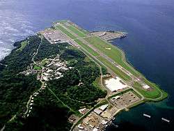
The Subic Bay International Airport serves the immediate area of the Subic Bay Freeport Zone and the general area of Olongapo City (it is located in the adjacent town of Morong, Bataan). This airport was once the Naval Air Station Cubi Point. The terminal has two gates. It has been proposed to be converted into a logistics hub. Currently the south-west ramp is used by US Armed Forces as part of the Enhanced Defense Cooperation Agreement between the Philippines and the US.
Sea Port
The Port of Subic is one of the busiest, largest, historical and most important of Ports in the Philippines. The Port is operated and managed by the Subic Bay Metropolitan Authority (SBMA). It covers the fenced area of the former U.S. Naval Base Subic Bay located in the south-west of Luzon Island in the Philippines surrounded by the municipality of Subic and Olongapo City in Zambales, and Hermosa and Morong in Bataan
Roads
The city has an organized road network, featuring a series of rectangular street grids. The primary road that connects Olongapo to the rest of the other is the Jose Abad Santos Avenue. In the city's main district, the names of those streets running from North to South follow the English alphabet's order. While streets running East to West are numbered from 1st to 27th, starting from the South parallel and up. Even streets are on the East side of the City while the Odd streets are on the West. Most of the roads in Olongapo are made of concrete and asphalt.
Public Transportation
The city boasts its Color-coded Public Transportation System which it has pioneered in the country. All public utility jeepneys and tricycles have its own color code depending on the district, zone or route that it is serving. It is also used for the computation of fares. For tricycles, fares will differ depending on your zone of origin and destination. For jeepneys, fares increases on every kilometer after the first three kilometers of the route, with an exception on yellow jeepneys, which has a fixed fare end-to-end. The minimum fare for tricycles are Php 7.50 per person, while Php 7.00 for jeepneys.
Taxi services are also operated in the city but are limited. The taxis are not metered but have fixed rates depending on your origin and destination and they are generally used by tourists and residents alike for commuting inside the Subic Bay Freeport Zone.
Bus Terminals
Victory Liner and Saulog Transit are the leading bus operators having their own terminals in the city which transports people in and out of the city. Local bus terminals are also present and are primarily used for transportation in neighboring towns and inside the Subic Bay Freeport Zone.
Access to the City
Olongapo is accessible through the National Highway (via Zigzag Road) from Hermosa and Dinalupihan, Bataan. The National Highway cuts through the city center and goes through north up to Barangay Barreto and then on to the neighboring town of Subic, and the rest of the towns in Zambales up to Pangasinan province. Another access to the city is via SCTEX and Subic–Tipo Expressway exiting to the gates of Subic Bay Freeport Zone and also, from the south, Morong, Bataan (via Balanga, Bataan) through the Morong gate of Subic Bay Freeport Zone.
Public Utilities
Electricity
Electricity services were formerly provided by the government-run Public Utilities Department (PUD) since the city was founded. However, in the late 2000s, the city faced debt in its electricity distribution costs amounting to P5 billion to power suppliers and threatened to cut the city from the Luzon power grid. Then Mayor James Gordon Jr. also attributed the crisis to low collection rate due to nonpayment or debts incurred by consumers, widespread energy theft and corruption in the PUD. The situation worsened because of interests imposed by Private Sector Assets and Liabilities Management Corp. (PSALM), the refusal of the Energy Regulatory Commission (ERC) to grant an increase in power rates, and the years of delay in the PUD’s privatization.[29]
In 2013, through Republic Act No. 10373, the PUD was sold for Php 610 million to Olongapo Electricity Distribution Company (OEDC), an affiliate of Cagayan Electric Power and Light Company (CEPALCO), which was given a 25-year franchise to take over the city’s power distributor. The company has since upgraded the city's obsolete and dilapidated distribution network and has made significant improvements to the city's electricity services.[30]
Water
Water services are provided by Subic Water and Sewerage Company(also known as Subic Water. Not to be confused with Subic Water District (SWD), which is a different water distribution company serving the neighboring towns of Subic, Zambales.). In 2013, the city's shares in Subic Water has been sold to Maynilad Water Services Inc. (Maynilad) to continue modernizing the city's water utilities services.[31] In March 2016, this was reversed and the city has bought back its shares because the city wanted to have a representation in Subic Water because the city's constituents accounted for the majority of Subic Water’s customers.
Communication
Leading mobile and land-based telecommunications companies in the Philippines such as Philippine Long Distance Telephone Company (PLDT), Globe Telecom, Smart Communications and Sun Cellular are available in the city. The city is services with 3G, 4G, and LTE networks.
Internet Connectivity
The city has more than a hundred Internet Cafés which enables the people to surf, chat, and play online games, and illegal online activities are prohibited. The majority of the country's Internet Service Providers are available in the city: MyCATV Internet Connection (local) Smart Broadband, Globe Tattoo, PLDT myDSL and Converge. They provide internet services through wireless mobile data, Cable, DSL and Fiber broadband technologies.
Landmarks

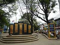

- Ulo ng Apo: A towering and majestic marker located at the rotonda in Bajac-Bajac. A very visible and tangible tourist attraction to glorify the legend of the city.
- Olongapo City Hall: The City Hall is located at Rizal Avenue, West Bajac-Bajac. On the east side contains the PUD (Public Utilities Department), in charge of providing electricity to the city (but is later on replaced by OEDC-Olongapo Electric Distribution company). To the east is the Olongapo City PNP Police Station 1, and at the back of the city hall is the Health Building.
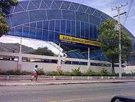
- Olongapo City Convention Center: More conveniently known as OCCC or OCC, it has been the site of many events in Olongapo City history, not to mention numerous conferences, meetings, and school events.
- Olongapo City Museum: Opened to the public in 2003, the museum contains dioramas, artifacts, and paintings about the history of the city. At the entrance, a rotating Ulo ng Apo statue meets you.
- Olongapo City Public Library: The original Library stood near the City Hall. However, to make way for the construction of the PUD office, it was relocated at Hospital Road, East Tapinac; near the Convention Center.
- Olongapo City Public Market: One of the three Wet and Dry public markets in the city of Olongapo. Pag-Asa Public Market near SM City Olongapo and the Old Market near Olongapo City Hall.
- Marikit Park: One of the earliest parks of Olongapo, it has become famous in its time. Today, it is near Gordon College, the museum, the convention center and the library.
- Olongapo Lighthouse: A panoramic view perfect for picture taking. This old lighthouse is located along the national highway going to the north. It overlooks the Subic Bay Freeport area.
- Kalapati (The Dove Monument): Mr. Kasanobu Miyazaki, a Japanese owner of an accounting firm in Aioi City, Japan, requested that a shrine be built in New Cabalan where his brother, Capt. Masanobu Miyazaki died in battle at the Zig Zag Pass. Mayor Gordon suggested instead a peace monument dedicated to the Filipino, American and Japanese lives that were lost in that battle. The monument was thus built at the junction of the national highway and the road into New Cabalan. It is surmounted by a dove of peace. This monument welcomes travelers who will pass the first barangay of Olongapo City from the province of Bataan.
- SM City Olongapo (formerly Olongapo City Mall): The only shopping mall that was formerly government-owned on May 1, 2004 as Olongapo City Mall. But, it was demolished in 2010 to become SM City Olongapo that was softly opened on December 15, 2011 and was grandly opened on February 10, 2012.
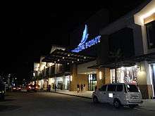
- Harbor Point: It is a large shopping mall in Olongapo City, owned by property development firm Ayala Land, Inc., a real estate subsidiary of Ayala Corporation. It is the first Ayala Shopping Center located in the city of Olongapo and the second Mall to be opened in Central Luzon and outside Metro Manila.
Education
Elementary
Private:
- American International School of Subic
- Brent International School
- Brightfields Academy
- Cabalan Christian School
- Casa Kalayaan International School
- Christ The King Catholic School
- Christian Baptist Academy
- College of Subic Montessori - Subic Bay
- Columban College – Asinan Campus
- Columban College – Barretto Campus
- F.I.R.S.T School of SBFZ
- Heaven Sent Tutorial and Learning Center
- Kidelorian Christian School
- Kristogail Montessori School
- Learning Circle
- Little Angel Study Center
- Mondriaan Montessori School
- Olongapo Anglo Cultural School
- Olongapo City Christian School
- Olongapo Wesley School
- St. Anne Academy
- St. Joseph College - Olongapo, Inc.
- Subic Bay Colleges, Inc.
- The Manila Times College of Subic
Public:
- Asinan Elementary School
- Balic-Balic Elementary School
- Banicain Elementary School
- Barretto I Elementary School
- Barretto II Elementary School
- Boton Elementary School
- East Bajac - Bajac Elementary School
- Gordon Heights l Elementary School
- Gordon Heights ll Elementary School
- Ilalim Elementary School
- Iram Elementary School
- James L. Gordon Integrated School
- Kalaklan Elementary School
- Kalalake Elementary School
- Mabayuan Elementary School
- Nellie E. Brown Elementary School
- New Cabalan Elementary School
- Old Cabalan Elementary School
- Olongapo City Elementary School
- Sergia S. Soriano Esteban Integrated School Of Kalaklan
- Special Education Center for the Gifted
- Sta. Rita Elementary School
- Tabacuhan Elementary School
- Tapinac Elementary School
High Schools
Private:
- American International School of Subic
- Aura De Laurentus Business High School
- Brent International School
- Brightfields Academy
- Christ The King Catholic School
- College of Subic Montessori - Subic Bay
- Columban College – Asinan Campus
- Columban College – Barretto Campus
- F.I.R.S.T School of SBFZ
- Little Angel Study Center
- Olongapo Wesley School
- St. Anne Academy
- St. Joseph College - Olongapo, Inc.
- Subic Bay Colleges, Inc.
- The Manila Times College of Subic
Public:
- Barretto National High School
- Gordon Heights National High School
- Iram High School
- James L. Gordon Integrated School
- Kalalake National High School
- New Cabalan National High School
- Old Cabalan Integrated School
- Olongapo City National High School
- Regional Science High School III
- Sergia Soriano Esteban Integrated School of Kalaklan
- Sta. Rita High School
Colleges
- Capstone Institute of Business and Arts
- AIE College International - Olongapo Campus
- AMA - Olongapo Campus
- Asian Institute of Computer Studies
- Central Luzon College of Science & Technology, Olongapo Campus
- College of Subic Montessori - Subic Bay
- Columban College – Asinan Campus (Main)
- Columban College – Barretto
- Comteq Computer and Business College
- Gordon Gollege
- Lyceum of Subic Bay
- Metro Subic Colleges Incorporated
- Mondriaan Aura College
- St. Benilde Center for Global Competence Inc.
- St. Joseph College - Olongapo, Inc.
- Subic Bay Colleges, Inc.
- The Manila Times College of Subic
- University of the Philippines - Extension Program in Olongapo
- Professional Institute of Modern Education (PRIME), Inc.
Notable people
- Angelee delos Reyes (b. 1987), Miss Philippines Earth 2013
- Angelu de Leon (b. 1979), actress of GMA Network
- Arnel Pineda (b. 1967), singer/lead vocalist of Journey
- Blakdyak (Joseph Amoto-Formaran) (1969–2016), singer, comedian and actor
- Eric Cray (b. 1988), track and field athlete, an Olympian at the 2016 Summer Olympics
- Freddie Aguilar (b. 1953), noted musician, singer-songwriter
- Jake Vargas (b. 1992), model and actor of GMA Network
- Liezel Lopez (b. 1997), actress, model, and StarStruck contestant.
- K Brosas (b. 1975), comedian, singer and host of ABS-CBN
- Kristofer Martin (b. 1994), actor of GMA Network
- Lauren Young (b. 1993), actress of GMA Network, sister of Megan Young
- Megan Young (b. 1990), actress of GMA Network, Miss World 2013
- Moira Dela Torre (b. 1993), singer-songwriter ABS-CBN
- Raikko Mateo (b. 2008) child actor of ABS-CBN, who took the titular role in Honesto
- Rico Barrera (b. 1981), model and actor of ABS-CBN, Pinoy Big Brother season 1 housemate
- Tom Rodriguez (b. 1987) actor of GMA Network
- Willie Miller (b. 1977), basketball player
- Wowie de Guzman (b. 1976), actor of ABS-CBN
Sister cities
Olongapo has the following sister cities:

References
- 1 2 "Olongapo City – Brief History".
- ↑
- 1 2 "Province: Zambales". PSGC Interactive. Quezon City, Philippines: Philippine Statistics Authority. Retrieved 12 November 2016.
- 1 2 3 4 Census of Population (2015). "Region III (Central Luzon)". Total Population by Province, City, Municipality and Barangay. PSA. Retrieved 20 June 2016.
- ↑ "Building Globally Competitive Metro Areas in the Philippines" (PDF). Archived from the original (PDF) on October 4, 2013.
- ↑ It was recorded as customary for the Sambal to execute those who have taken another person's life, unless done by decapitation. Their manner of execution was to bore a hole at the top of the skull and then scrape out the brains.
- ↑ Olongapo Subic Bay sbma Zambales daily news jobs travel tour info Archived September 27, 2007, at the Wayback Machine.. Olongapo-subic.com. Retrieved on 2013-07-28.
- 1 2 "History of Subic Bay and Olongapo City".
- 1 2 3 4 "The Olongapo Story".
- ↑ "Olongapo City Barangay and History".
- ↑ "History of Olongapo City".
- ↑ Subic Bay History – 1940's. Subicbaypi.com (April 8, 1942). Retrieved on 2013-07-28.
- ↑ "World War II – Olongapo City Official Website".
- 1 2 Anderson, Gerald Subic Bay from Magellan to Pinatubo: The History of the U.S. Naval Station Subic Bay Gerald Anderson (2009) ISBN 1441444521 pp.130–138
- 1 2 "World Bank – Olongapo Profile" (PDF).
- ↑ Tucker, Spencer C. The Encyclopedia of the Vietnam War: A Political, Social, and Military History (2011) ISBN 1851099611 p.863
- ↑ Sherwood, John Afterburner: Naval Aviators and the Vietnam War NYU Press (2004) ISBN 081479842X pp.27–28
- ↑ "LIBERTY CALL: Olongapo City". Dennis Clevenger. Retrieved 2012-08-03.
- ↑ "Olongapo". Dave Payson. Retrieved 2012-08-03.
- 1 2 "Twin Disasters- Olongapo City Official Website".
- ↑ "Philippines Travel and Hotel Guide".
- ↑ "Average Weather For Subic Bay Freeport Zone, Philippines". Retrieved 2013-05-11.
- ↑ "Climate: Olongapo - Climate graph, Temperature graph, Climate table - Climate-Data.org". Climate-data.org. Retrieved 2015-04-18.
- ↑ "Total Population by Province, City, Municipality and Barangay: as of May 1, 2010" (PDF). 2010 Census of Population and Housing. Philippine Statistics Authority. Archived from the original (PDF) on November 15, 2012. Retrieved February 15, 2013.
- ↑ Census of Population and Housing (2010). "Region III (Central Luzon)". Total Population by Province, City, Municipality and Barangay. NSO. Retrieved 29 June 2016.
- ↑ Censuses of Population (1903–2007). "Region III (Central Luzon)". Table 1. Population Enumerated in Various Censuses by Province/Highly Urbanized City: 1903 to 2007. NSO.
- ↑ "Province of Zambales". Municipality Population Data. Local Water Utilities Administration Research Division. Retrieved 17 December 2016.
- ↑ Sison, Bebot (17 May 2013). "Gordons lose; Payumos fall in Bataan". The Philippine Star. Retrieved 21 August 2014.
The only other time that a Gordon was defeated in an election was in 1970 when Geronimo Lipumano won by a landslide against the late Amelia Gordon, the mother of Dick Gordon.
"1974MANILA07373_b". Public Library of US Diplomacy. Wikileaks. 20 June 1974. Retrieved 21 August 2014. - ↑ Gonzaga, Robert. "Olongapo's power debt burden". newsinfo.inquirer.net. Retrieved 2016-07-03.
- ↑ Inquirer, Philippine Daily. "Aquino signs law on Olongapo power privatization". newsinfo.inquirer.net. Retrieved 2016-07-03.
- ↑ "Olongapo sells 10% of Subic Water to Maynilad". Retrieved 2016-07-03.
- ↑ City Council and Community Development Commission of National City, CA. "MINUTES OF THE REGULAR MEETING OF THE CITY COUNCIL AND COMMUNITY DEVELOPMENT COMMISSION OF NATIONAL CITY, CALIFORNIA". Retrieved 17 December 2016.
- ↑ "Sister Cities Association of Virginia Beach". Sister Cities Association of Virginia Beach. Retrieved 2016-03-31.
External links
| Wikivoyage has a travel guide for Olongapo. |
| Wikimedia Commons has media related to Olongapo. |
- Olongapo City City Council
- Olongapo City Officials and Government Offices Telephone Directory
- Olongapo City News Archive
Places adjacent to Olongapo | |
|---|---|