Peñaranda, Nueva Ecija
| Peñaranda | ||
|---|---|---|
| Municipality | ||
| Municipality of Peñaranda | ||
 Downtown area | ||
| ||
 Map of Nueva Ecija with Peñaranda highlighted | ||
.svg.png) Peñaranda Location within the Philippines | ||
| Coordinates: 15°21′N 121°00′E / 15.35°N 121°ECoordinates: 15°21′N 121°00′E / 15.35°N 121°E | ||
| Country |
| |
| Region | Central Luzon (Region III) | |
| Province | Nueva Ecija | |
| District | 4th District | |
| Barangays | 10 (see Barangays) | |
| Government [1] | ||
| • Type | Sangguniang Bayan | |
| • Mayor | Ferdinand R. Abesamis | |
| • Electorate | 21,411 voters (2016) | |
| Area [2] | ||
| • Total | 95.00 km2 (36.68 sq mi) | |
| Population (2015 census)[3] | ||
| • Total | 29,882 | |
| • Density | 310/km2 (810/sq mi) | |
| Time zone | UTC+8 (PST) | |
| ZIP code | 3103 | |
| PSGC | 034921000 | |
| IDD : area code | +63 (0)44 | |
| Climate type | Tropical monsoon climate | |
| Income class | 4th municipal income class | |
| Revenue (₱) | 90,574,063.06 (2016) | |
| Native languages | Tagalog | |

Peñaranda, officially the Municipality of Peñaranda, is a 4th class municipality in the province of Nueva Ecija, Philippines. According to the 2015 census, it has a population of 29,882 people.[3]
It is bordered by municipalities of General Tinio and San Leonardo and the city of Gapan.
The area was originally called Mapisong, and it was a part of the municipality of Gapan. The area was organized into a municipality by José Maria Peñaranda, a Spanish engineer, and subsequently named after him.
Peñaranda was once known for its high quality crop called ikmo, a plant used by older Filipinos as a chewing substance. Recently however, the crop is on the brink of extinction. Rice remains a flourishing farm produce.
In 2012, the National Commission for Culture and the Arts (NCCA) and the ICHCAP of UNESCO published Pinagmulan: Enumeration from the Philippine Inventory of Intangible Cultural Heritage. The first edition of the UNESCO-backed book included Nueva Ecija's Arakyo, signifying its great importance to Philippine intangible cultural heritage. The local government of Nueva Ecija, in coopration with the NCCA, is given the right to nominate the Arakyo in the UNESCO Intangible Cultural Heritage Lists.[4]
Barangays
Peñaranda is politically subdivided into 9 barangays.
- Callos
- Las Piñas
- Poblacion I
- Poblacion II
- Poblacion III
- Poblacion IV
- Santo Tomas
- Sinasajan
- San Josef
- San Mariano
Demographics
| Population census of Peñaranda | |||||||||||||||||||||||||||||||||||||||||||||||||
|---|---|---|---|---|---|---|---|---|---|---|---|---|---|---|---|---|---|---|---|---|---|---|---|---|---|---|---|---|---|---|---|---|---|---|---|---|---|---|---|---|---|---|---|---|---|---|---|---|---|
|
| ||||||||||||||||||||||||||||||||||||||||||||||||
| Source: Philippine Statistics Authority[3][5][6][7] | |||||||||||||||||||||||||||||||||||||||||||||||||
Religion
Majority of the people is Roman Catholic. Other religious groups have churches and places of worship in the municipality.
Economy
Primarily depends on rice & vegetable farming, poultry and piggery.
Events
Every May, Peñaranda residents stage a musical drama called "Araquio", a re-enactment of Christians' quest led by Queen Helena and King Constantine for the Holy Cross where Jesus Christ was nailed. Actors and actresses garbed in colorful and cute costumes dramatize this century old tradition which features sword fights between the Christians and Moors.
Peñaranda is also known for its mouth-watering, native rice cakes such as espasol, putong puti and sapin-sapin .
Education
Nueva Ecija University of Science and Technology Peñaranda Academic Extension Campus commenced operation in June 2005. This is a joint undertaking of the Nueva Ecija University of Science and Technology and the Local Government Unit of Peñaranda, Nueva Ecija. It was first operated during the term of Former Mayor Felix A. Corpuz. It is located at the vicinity of the Penaranda National High School. The first administrator was Nomereo J. Gaboy, a retired School Principal. Peñaranda Campus is under the administration of Mayor Ferdinand R. Abesamis and Mr. German L. Del Rosario is the Campus Administrator.
Images
 Welcome marker
 Town hall, seat of the Government
 Nueva Ecija University of Science and Technology
 Sto. Tomas Elementary School
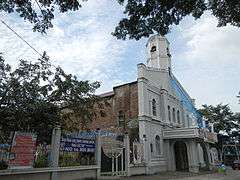 Parish of St. Francis of Assissi
 Park of the Church
References
- ↑ "Municipality". Quezon City, Philippines: Department of the Interior and Local Government. Retrieved 31 May 2013.
- ↑ "Province: Nueva Ecija". PSGC Interactive. Quezon City, Philippines: Philippine Statistics Authority. Retrieved 12 November 2016.
- 1 2 3 Census of Population (2015). "Region III (Central Luzon)". Total Population by Province, City, Municipality and Barangay. PSA. Retrieved 20 June 2016.
- ↑ http://www.ichcap.org/eng/ek/sub3/sub2.php
- ↑ Census of Population and Housing (2010). "Region III (Central Luzon)". Total Population by Province, City, Municipality and Barangay. NSO. Retrieved 29 June 2016.
- ↑ Censuses of Population (1903–2007). "Region III (Central Luzon)". Table 1. Population Enumerated in Various Censuses by Province/Highly Urbanized City: 1903 to 2007. NSO.
- ↑ "Province of Nueva Ecija". Municipality Population Data. Local Water Utilities Administration Research Division. Retrieved 17 December 2016.
External links
| Wikimedia Commons has media related to Peñaranda, Nueva Ecija. |
- Pasyalan Nueva Ecija
- Philippine Standard Geographic Code
- Philippine Census Information
- Local Governance Performance Management System
Places adjacent to Peñaranda, Nueva Ecija | ||||||||||
|---|---|---|---|---|---|---|---|---|---|---|
| ||||||||||
Palayan (capital) | |
| Municipalities | |
| Component cities | |
| Misc. | |