Nampicuan, Nueva Ecija
| Nampicuan | ||
|---|---|---|
| Municipality | ||
| Municipality of Nampicuan | ||
 | ||
| ||
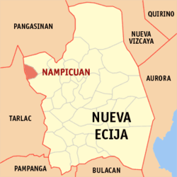 Map of Nueva Ecija with Nampicuan highlighted | ||
.svg.png) Nampicuan Location within the Philippines | ||
| Coordinates: 15°44′N 120°38′E / 15.73°N 120.63°ECoordinates: 15°44′N 120°38′E / 15.73°N 120.63°E | ||
| Country |
| |
| Region | Central Luzon (Region III) | |
| Province | Nueva Ecija | |
| District | 1st District | |
| Barangays | 21 | |
| Government [1] | ||
| • Type | Sangguniang Bayan | |
| • Mayor | Victor M. Badar | |
| • Electorate | 9,733 voters (2016) | |
| Area [2] | ||
| • Total | 52.60 km2 (20.31 sq mi) | |
| Population (2015 census)[3] | ||
| • Total | 14,954 | |
| • Density | 280/km2 (740/sq mi) | |
| Time zone | UTC+8 (PST) | |
| ZIP code | 3116 | |
| PSGC | 034918000 | |
| IDD : area code | +63 (0)44 | |
| Climate type | Tropical monsoon climate | |
| Income class | 5th municipal income class | |
| Revenue (₱) | 55,697,650.57 (2016) | |
| Native languages |
Ilocano Tagalog | |

Nampicuan, officially the Municipality of Nampicuan, is a 5th class municipality in the province of Nueva Ecija, Philippines. According to the 2015 census, it has a population of 14,954 people.[3]
Barangays
Nampicuan is politically subdivided into 21 barangays.
- Alemania
- Ambassador Alzate Village
- Cabaducan East (Poblacion)
- Cabaducan West (Poblacion)
- Cabawangan
- East Central Poblacion
- Edy
- Maeling
- Mayantoc
- Medico
- Monic
- North poblacion
- Northwest Poblacion
- Estacion
- West Poblacion
- Recuerdo
- South Central Poblacion
- Southeast Poblacion
- Southwest Poblacion
- Tony
- West Central Poblacion.
History
The name Nampicuan emanated from the word “Nagpicuan” which means a curve road, originated in a trail called “Curva” as inhabitants of Pangasinan used to call. According to the first settlers, the site was a sitio named used “Surgue” or ‘SULI” situated in the eastern part of what eventually became the poblacion of Nampicuan and was the point where the feeder road from Moncada, Tarlac turned abruptly north-east towards the town of Cuyapo, Nueva Ecija.
The first known settlers were the Ilocanos. They came from Paoay, Ilocos Region, Pangasinan and Zambales. In 1880, having found the soil productive for agricultural purposes, the early settlers cleared the place, cultivate the land and cut down the trees. The trees were sawed into lumber out of which their houses were constructed. At time passes and population continues to grow, more and more demands are made for land and its resources. So much so, on the end of the 19th century, the barrio Nampicuan became a municipality and the first “alcalde mayors” were Andres Tabilangan and Feliciano Cuaresma. Before its formal creation and declaration as a municipality, Nampicuan was then a part and under the political jurisdiction of the town of Cuyapo.
In 1903, while the Philippines was still under the American Occupation, Nampicuan was reverted to the status of a barrio of the Cuyapo town. Upon proper presentation however of the prominent residents of this place, Nampicuan was again elevated to the status of municipality. In 1907, the first church was constructed led by REV. Luis Corpuz and the establishment of Gabaldon Primary School under the first Principal/Teacher, Clodualdo Bringas. After a year Nampicuan become a third class municipality of Nueva Ecija with the first leaders, President Laureano O. Gonzales and Vice – President Simeon Quiaoit.
World War II
| ||||||||||||||||||||||||
During World War II, Japanese Imperial forces occupied and entering the town of Nampicuan on 1942 during the Japanese Occupation. The establishment of the military bases, garrisons and barracks and the military built of the Imperial Japanese Armed Forces in Nampicuan. During the Allied Liberation, Filipino soldiers of the Philippine Commonwealth Army 2nd, 21st, 22nd and 26th Infantry Division and the Philippine Constabulary 2nd Infantry Regiment and the American bomber and fighter planes of the United States Army Air Forces was recaptured and liberated the town of Nampicuan and defeated and fought against the Imperial Japanese Army forces begins the Battle of Nampicuan and ended World War II.
Battle of Nampicuan and liberation
Beginning the Battle of Nampicuan on January to September 1945, The stronghold of all the local Filipino soldiers and military officers under the 2nd, 21st, 22nd and 26th Infantry Division of the Philippine Commonwealth Army and the 2nd Infantry Regiment of the Philippine Constabulary was sending the local military operations from the local military GHQ's and camp bases in Nueva Ecija and some parts in Central Luzon and they recaptured and liberated around the town of Nampicuan by defeating and they fought against the Japanese Imperial Army forces during the Allied Liberation.
The battle and invading commands of all stronghold of local Filipino soldiers, military officers, tanks, military trucks and jeeps, military IFV's, artillery and mortars and many other military equipment under the 2nd, 3rd, 22nd and 26th Infantry Division of the Philippine Commonwealth Army and the 2nd Constabulary Regiment of the Philippine Constabulary was around the fought side by side under the plains and rice fields in the municipal town of Nampicuan and they captured and invaded of Roman Catholic churches, municipal town halls, plazas, villages and many others and aided of the American bomber and fighter pilots of the United States Army Air Forces was defeated and attacking Japanese Imperial Army forces.
The American fighter and bomber pilots of the United States Army Air Forces from the U.S. military air bases in Pampanga and Zambales and entering around the town in Nampicuan and helped to support of all the local Filipino troops and officers of the Philippine Commonwealth Army and Philippine Constabulary units through attacking the Japanese soldiers during the fighting commands.
The sieges of the military bases, garrisons and barracks of the Imperial Japanese Armed Forces and the Japanese troops inside the garrison bases was re-invaded and entering the captured of all stronghold of local Filipino troops of the Philippine Commonwealth Army and Philippine Constabulary units.
The aftermath of the Battle of Nampicuan on September 1945, the military casualties during the fighting the battles and invading commands and succeeding battles included over 2,268 Filipino troops under the Philippine Commonwealth Army and Philippine Constabulary units killed in action and over 10,300 wounded in action and the part the Japanese troops under the Imperial Japanese Armed Forces was over 18,000 killed in action, over 64,000 wounded in action and over 2,600 captured in action. The stronghold of all the local Filipino troops and military officers of the Philippine Commonwealth Army and Philippine Constabulary units was saluted and their successfully victories after the invasion and battle commands as they captured the town of Nampicuan and they defeated, retreated and surrendering Japanese troops by all Filipino ground forces in the town and ended the fighting.
Demographics
| Population census of Nampicuan | ||
|---|---|---|
| Year | Pop. | ±% p.a. |
| 1903 | 4,180 | — |
| 1918 | 4,632 | +0.69% |
| 1939 | 5,023 | +0.39% |
| 1948 | 5,377 | +0.76% |
| 1960 | 6,084 | +1.03% |
| 1970 | 6,639 | +0.88% |
| 1975 | 7,350 | +2.06% |
| 1980 | 7,597 | +0.66% |
| 1990 | 8,426 | +1.04% |
| 1995 | 10,708 | +4.59% |
| 2000 | 11,033 | +0.64% |
| 2007 | 11,786 | +0.91% |
| 2010 | 13,303 | +4.50% |
| 2015 | 14,954 | +2.25% |
| Source: Philippine Statistics Authority[3][4][5][6] | ||
Education

- Nampicuan Central School
- Nampicuan Christian Academy
- Alzate Village Elementary School
- United Methodist Church Learning Central
- Cabawangan Elementary School
- Mayantoc Elementary School
- Recuerdo Elementary School
- Monic Elementary School
- Maeling Elementary School
- Nampicuan High Hchool
- Saint Pius X Institute
- Recuerdo National High School
References
- ↑ "Municipality". Quezon City, Philippines: Department of the Interior and Local Government. Retrieved 31 May 2013.
- ↑ "Province: Nueva Ecija". PSGC Interactive. Quezon City, Philippines: Philippine Statistics Authority. Retrieved 12 November 2016.
- 1 2 3 Census of Population (2015). "Region III (Central Luzon)". Total Population by Province, City, Municipality and Barangay. PSA. Retrieved 20 June 2016.
- ↑ Census of Population and Housing (2010). "Region III (Central Luzon)". Total Population by Province, City, Municipality and Barangay. NSO. Retrieved 29 June 2016.
- ↑ Censuses of Population (1903–2007). "Region III (Central Luzon)". Table 1. Population Enumerated in Various Censuses by Province/Highly Urbanized City: 1903 to 2007. NSO.
- ↑ "Province of Nueva Ecija". Municipality Population Data. Local Water Utilities Administration Research Division. Retrieved 17 December 2016.
External links
| Wikimedia Commons has media related to Nampicuan, Nueva Ecija. |
- Philippine Standard Geographic Code
- Philippine Census Information
- Local Governance Performance Management System
Places adjacent to Nampicuan, Nueva Ecija | |
|---|---|
Palayan (capital) | |
| Municipalities | |
| Component cities | |
| Misc. | |