Calumpit, Bulacan
| Calumpit | ||
|---|---|---|
| Municipality | ||
| Municipality of Calumpit | ||
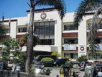
 Calumpit Municipal Hall | ||
| ||
| Etymology: Kalumpít | ||
| Motto(s): God bless Calumpit | ||
 Map of Bulacan with Calumpit highlighted | ||
.svg.png) Calumpit Location within the Philippines | ||
| Coordinates: 14°55′N 120°46′E / 14.92°N 120.77°ECoordinates: 14°55′N 120°46′E / 14.92°N 120.77°E | ||
| Country |
| |
| Region | Central Luzon (Region III) | |
| Province | Bulacan | |
| District | 1st District | |
| Founded | November 14, 1571 | |
| Chartered | March 5, 1575 | |
| Founded by |
| |
| Barangays | 29 (see Barangays) | |
| Government [1] | ||
| • Type | Sangguniang Bayan | |
| • Mayor | Jessie P. De Jesus | |
| • Vice Mayor | Zacarias Candelaria | |
| • Electorate | 60,048 voters (2016) | |
| Area [2] | ||
| • Total | 56.25 km2 (21.72 sq mi) | |
| Population (2015 census)[3] | ||
| • Total | 108,757 | |
| • Density | 1,900/km2 (5,000/sq mi) | |
| Time zone | UTC+8 (PST) | |
| ZIP code | 3003 | |
| PSGC | 031407000 | |
| IDD : area code | +63 (0)44 | |
| Climate type | Tropical monsoon climate | |
| Income class | 1st municipal income class | |
| Poverty rate |
| |
| • Revenue (2017) |
| |
| • Expenses (2017) |
| |
| • Total Assets (2017) |
| |
| Electricity | Manila Electric Company | |
| • Consumption | 35.30 million kWh (2003) | |
| Native languages |
Tagalog Kapampangan | |
| Website |
www | |

Calumpit, officially the Municipality of Calumpit, (Tagalog: Bayan ng Calumpit), is a 1st class municipality in the province of Bulacan, Philippines. According to the 2015 census, it has a population of 108,757 people.[3]
Etymology
The name "Calumpit" comes from the tree "Kalumpít", an indigenous hardwood species similar to apalit and narra, which grows abundantly in front of the St. John the Baptist Parish Church in the Población-Sucol area.
History
Precolonial era
Calumpit was already an established barangay under the leadership of Gat Maitim prior to the Fall of the Kingdom of Tondo in June 1571. Other nearby villages were Gatbuka, Meyto, Meysulao, Pandukot, Malolos, Macabebe, Hagonoy, and Apalit. When Calumpit was hispanised and established as a political and geographical entity in 1572, they chose what is today Barangay Población as the site of the church and the administrative center of the aforementioned villages, which were annexed to it.
Spanish period
Upon hearing that the Kingdom of Tondo was conquered by Martín de Goíti and Juan Salcedo, and that Rajah Matanda allied with the Spaniards in May 1571, Bambalito formed a fleet of two thousand natives mostly from Hagonoy and Macabebe. They sailed across Manila Bay to Tondo on June 3, 1571, facing Goíti and Salcedo in the historic Battle of Bangkusay. Bambalito and the natives were defeated and the conquerors proceeded northwards to pacify other villages along the coast of Manila Bay.
In September 1571, Goíti and Salcedo, along with the invading forces, arrived at Lubao. On November 14, 1571, they reached Calumpit and Malolos and reported it to Miguel López de Legazpi, the first Spanish Governor-General of the Philippines. The two settlements were then constituted as the Encomienda de Calumpit and Encomienda de Malolos, respectively. The Encomienda de Calumpit was entrusted to Sargento Juan Moron, one of the conquerors in the Legazpi Expedition.[5]
Christianization
It is uncertain as to exactly when the Augustinians first set foot in Calumpit, but according to the documents, Calumpit was already a parish by May 3, 1572, when Fray Martín de Rada was elected Prior Provincial. Calumpit was simultaneously established with the conventos of Bay, Laguna, Tondo and Lubao, Pampanga, with De Rada as its prior and Fray Diego Vivar as his vicar.
Accounts state that the Augustinian missionaries planted a wooden cross along the bank of the Meyto River to symbolise the baptism of the land, and they built a chapel made of nipa and bamboo. Later, they moved to Meysulao and built another visita, and then in Panducot, where they built another chapel dedicated to Our Lady of the Visitation as Fray Gaspar de San Agustín mentioned in his Conquistas delas Isla Philipinas (Libro Segundo, Chapter 9). Subsequently, the missionary headquarters was moved again to a much higher place where a very huge and prominent tree called "Kalumpit" (Terminalia macrocarpa decne) stands as the original settlers named the place. Another notable characteristic of the village of Calumpit is that it was bounded by rivers which served as a natural moat-like feature. Primarily, Meyto, Meysulao, Panducot and Calumpit was independent barangays under their own chiefs, it is same with Gatbuka, Bugyon and other old settlements. On April 5, 1572, Legaspi merged the villages of Meyto, Meysulao, Panducot, Calumpit, Candaba, Apalit and Malolos and these villages became ministerios and visitas and these settlements first formed the town named Calumpit, with present-day Calumpit as center. On December 28, 1575, Gov. General Francisco Sande ordered the inclusion of the villages of Agonoy (Hagonoy), Quinabalonan (now Santa Monica and San Jose, Hagonoy), and some villages along Macabebe river to the town of Calumpit.
Early Spanish presence
When Calumpit was already pacified by Spaniards and submitted under the colonial rule, In April 5, 1572, Encomiendas of Calumpit and Malolos was unified under the shared administration of their encomenderos Don Marcos de Herrera and Sargento Mayor Juan Moron. One month later on the same year Calumpit was created as one of the centers of the Augustinian ministry in Northern Luzon with Convento de Lubao Pampanga, which includes Betis and Bacolor and Convento de Taal Batangas established in May 3, 1572, upon the election of Fray Martín de Rada as the new Prior Provincial of the Augustinians replacing Fray Diego de Herrera who was recalled to Mexico. This parochial beginnings of Calumpit has included the old villages of Hagonoy, Apalit, Candaba, Malolos and Macabebe as its missions. The town of Calumpit was originally dedicated to Saint Nicholas of Tolentino, but in December 1576, the town was re-dedicated to the patronage of Saint John the Baptist.[6]
Province of Calumpit
On December 28, 1575 Governor-General Francisco de Sande established Calumpit as an Alcaldia (Province) with Marcos de Arce as the first Alcalde Mayor, with Calumpit and nearby visitas and settlements such as Malolos, Hagonoy, Macabebe, Apalit and Candaba. Later in 1576, jurisdiction of Macabebe transferred to the town of Lubao and Candaba separated an became town, then on June 11, 1580, Malolos became a town and it was transffered to Alcaldia de Bulacan. In 1581, Hagonoy had its own convent but still under the Governor of Calumpit, while in 1591 Apalit officially separated and established as an independent town and it was transferred in the reconfigured territory of Pampanga province. In Miguel de Loarca's document in 1581 called Relación de las Islas Filipinas and the June 1591 document of Governor-General Luis Pérez de Dasmariñas, it is proven that Calumpit appears as an independent Alcaldia, independent of those of Bulacan and Lubao and Betis.[7] It was therefore established as an Encomienda and Alcaldia separate to Province of Bulacan. Contrary to popular belief, Calumpit was not only the first town founded in Bulacan but it existed as a Province.
Abolition
The Alcaldia de Calumpit was eventually abolished and the towns of Calumpit and Hagonoy were annexed to the Province of Bulacan. Neighbouring Apalit was meanwhile annexed to Pampanga.
Philippine Revolution and Philippine-American War
During the Philippine Revolution in 1896, Calumpiteños participated in battles launched by the Katipunan against the Spanish Empire. Many notable Calumeteños helped establish and support the Malolos Republic, with the town serving as a defense line due to its proximity to the new capital. When the Philippine–American War erupted, Calumpit become the headquarters of General Antonio Luna in 1898. In the bloody encounters at Barrio Bagbag on April 25, 1899, many people joined the army of General Luna.
Civil administration under the United States-led Insular Government was established in Calumpit in April 1901, with Juan Galang serving as the first elected American-era mayor of the town.
American Occupation and World War II
Calumpit played an important role at the outbreak of the Second World War in the Pacific theater. The bridge of Calumpit, on the way to Bataan was demolished by the Engineering Battalion of the U.S., impeding movement of the Japanese forces on their way to Bataan. In January 1942, the Japanese Government occupied Calumpit for three years, during which many of the townsfolk died.
In the middle of 1943, the first part of the USAFFE guerrilla was established under the leadership of Luis Macam, with most of the members from Calumpit.
In June 1944, the 4th Battalion of the Del Pilar Regiment was established under the leadership of Major Francisco del Rosario. They continued fighting until the returned of the USAFFE under the leadership of General Douglas MacArthur.
In January 1945, the combined Filipino and American troops arrived in the town, liberating it from Japanese control.
Geography
Calumpit is 50 kilometres (31 mi) from Manila and 5 kilometres (3.1 mi) from Malolos City.
Calumpit is sprawled over an area of 5,625 has. of flat terrain classified accordingly to use for agricultural (66.81%), residential (10.42%), industrial (2.48%), commercial, (0.89%) and other (1.05%) purposes. It occupies around 2.06% of the total land area of Bulacan. The municipality has 144.33 kilometers of concrete roads that easily link its 29 barangays.
Two distinct seasons characterize the town’s climate: rainy season which starts late May and ends around November; and dry season which begins November and lasts until April.
Calumpit has two types of soil – the silt loam which is found in almost 90% of the entire municipality and the clay loam in the south-east far end of the town. Both types are basically suited for agricultural purposes as per Department of Agriculture (Philippines) classifications.
Calumpit River

This river has shaped the lives of Bulakeños since time immemorial. With the longest river system in Bulacan, Calumpit River traverses the towns of Calumpit, Pulilan and Plaridel on the east, Paombong and Hagonoy in the West and winds up through Apalit, Macabebe and Masantol, Pampanga.
It was the major route for trade and commerce in this part of the Luzon prior to the arrival of Spain. The Pampanga and Quingua Rivers[8] served as arteries through which goods coming in and going out of Calumpit passed. At present, the river is a valued resource as a rich fishing ground and providing farmers with irrigation.
Climate
The climate of Calumpit is similar to that of the rest of the other municipalities in the province of Bulacan. It is characterized by two (2) distinct seasons namely; the rainy and the dry. The rainy seasons starts from late May and ends around November, the dry season from December to April. The average annual rainfall is 255.3 millimetres (10.05 in) with the month of August having the highest month average rainfall, about 304 millimetres (12.0 in). The annual number of rainy days is 175 days.
Barangays

Calumpit is divided into 29 barangays.[9]
| PSGC | Barangay | Population | ±% p.a. | |||
|---|---|---|---|---|---|---|
| 2015[3] | 2010[10] | |||||
| 031407001 | Balite | 3.0% | 3,216 | 2,399 | 5.74% | |
| 031407002 | Balungao | 4.6% | 5,044 | 4,899 | 0.56% | |
| 031407004 | Buguion | 3.0% | 3,296 | 3,143 | 0.91% | |
| 031407005 | Bulusan | 2.4% | 2,564 | 2,330 | 1.84% | |
| 031407006 | Calizon | 1.8% | 1,999 | 1,926 | 0.71% | |
| 031407007 | Calumpang | 3.8% | 4,159 | 3,571 | 2.94% | |
| 031407008 | Caniogan | 3.9% | 4,278 | 3,955 | 1.51% | |
| 031407009 | Corazon | 2.3% | 2,458 | 2,529 | −0.54% | |
| 031407010 | Frances | 5.3% | 5,770 | 5,535 | 0.79% | |
| 031407011 | Gatbuca | 5.8% | 6,332 | 5,914 | 1.31% | |
| 031407012 | Gugo | 1.6% | 1,770 | 1,581 | 2.17% | |
| 031407013 | Iba Este | 2.5% | 2,754 | 2,756 | −0.01% | |
| 031407014 | Iba O'Este | 11.4% | 12,359 | 10,610 | 2.95% | |
| 031407015 | Longos | 3.2% | 3,444 | 3,070 | 2.21% | |
| 031407016 | Meysulao | 3.8% | 4,109 | 3,430 | 3.50% | |
| 031407017 | Meyto | 2.7% | 2,971 | 2,780 | 1.27% | |
| 031407018 | Palimbang | 1.9% | 2,117 | 2,146 | −0.26% | |
| 031407019 | Panducot | 2.3% | 2,501 | 2,403 | 0.76% | |
| 031407020 | Pio Cruzcosa | 4.0% | 4,336 | 4,145 | 0.86% | |
| 031407021 | Poblacion | 1.8% | 1,909 | 2,044 | −1.29% | |
| 031407022 | Pungo | 7.7% | 8,347 | 7,674 | 1.61% | |
| 031407023 | San Jose | 5.0% | 5,437 | 5,017 | 1.54% | |
| 031407024 | San Marcos | 2.1% | 2,255 | 2,166 | 0.77% | |
| 031407025 | San Miguel | 4.6% | 4,998 | 4,720 | 1.10% | |
| 031407026 | Santa Lucia | 2.0% | 2,206 | 2,391 | −1.52% | |
| 031407027 | Santo Niño | 1.8% | 1,955 | 2,357 | −3.50% | |
| 031407028 | Sapang Bayan | 2.5% | 2,762 | 2,454 | 2.28% | |
| 031407029 | Sergio Bayan | 1.8% | 1,967 | 1,713 | 2.67% | |
| 031407030 | Sucol | 1.3% | 1,444 | 1,410 | 0.45% | |
| Total | 108,757 | 101,068 | 1.41% | |||
Demographics
| Population census of Calumpit | ||
|---|---|---|
| Year | Pop. | ±% p.a. |
| 1903 | 13,897 | — |
| 1918 | 14,844 | +0.44% |
| 1939 | 17,047 | +0.66% |
| 1948 | 21,788 | +2.76% |
| 1960 | 27,662 | +2.01% |
| 1970 | 36,119 | +2.70% |
| 1975 | 41,041 | +2.60% |
| 1980 | 45,454 | +2.06% |
| 1990 | 59,042 | +2.65% |
| 1995 | 70,839 | +3.47% |
| 2000 | 81,113 | +2.95% |
| 2007 | 98,017 | +2.65% |
| 2010 | 101,068 | +1.12% |
| 2015 | 108,757 | +1.41% |
| Source: Philippine Statistics Authority[3] [10] [11] [12] | ||
In the 2015 census, the population of Calumpit was 108,757, [3] with a density of 1,900 inhabitants per square kilometre or 4,900 inhabitants per square mile.
Calumpit's population was 101,068 in the Philippine Statistics Authority (NSO) 2010 census. Historically, its population grew at an average of 3.71% per annum.
The barangay with the largest population is Iba Oeste, with 10,610 residents, while the smallest is Sucol with 1,410 residents.
Calumpit has a relatively young population, with the age group 1–19 years old, constituting 46.01% of the total population. The rest consists mainly of the working group between the ages of 20 to 59 years old accounting for about 47.96% and the elderly comprising 6.02%.
In terms of sex distribution, males exceeded the number of females very slightly with a count of 35,710 and 35,087, respectively.
Language
Calumpit is a predominantly Tagalog-speaking town, with about 96.3% of its people being fluent speakers. Others residents speak Kapampangan while a minority speak other Philippine languages.
Religion

As Calumpit is the first town in Bulacan to have been Christianized by the Spaniards in 1572, about 80% of residents profess the Roman Catholic faith. Under the United States and because of the eventual disestablishment of the Catholic Church in the Philippines in 1902, Protestantism gained a foothold in the municipality. Significant religious minorities include the Iglesia ni Cristo, Members Church of God International, Iglesia Filipina Independiente.
Among the oldest churches in Bulacan found in Calumpit is the San Juan Bautista Church. Constructed under Augustinian friars Martín de Rada and Diego Vivar, it was initially made of nipa and bamboo and gradually built of stone in 1700. It enshrines the local patron saint, John the Baptist, whose liturgical birthday on 24 June is celebrated as the town fiesta.
Inside the church is a tunnel that, as legend would have it, was used by priests during the Spanish era as an escape route in the event of Chinese and Moro pirate attacks. It is a declared Diocesean Shrine of the Diocese of Malolos.[13]

The Meyto Shrine marks the cradle of Christianity in western Bulacan, where a wooden cross was first planted and first mass in the region was said in May 1572. The shrine, located in the western part of town, is also the site of the original church of Calumpit, predating the existing one in the town centre. During the Philippine Revolution, the Iglesia Filipina Independiente – which had by then separated rom the Catholic Church – took over Meyto Shrine.
Labour and employment
In 1995, Calumpit had a relatively big labor force of 24,095 or 66% of the population aged 20–59. Around 35% of these skilled and were employed in their respective occupations; 28% were housewives with occasional employment as farmhands, selling farm produce in the market and doing marginal odd jobs. Others were unclassified and consisted mostly of students, out-of-school youth and the unemployed.
Total household income per annum is ₱705 million, with the annual average household income is ₱66,600 and per capita income annually is ₱12,198.
Literacy
The high literacy rate (98.5%) is maintained by its 24 elementary schools and six secondary or high schools. The Bulacan Manpower and Livelihood Training Center (BMLTC), based at the heart of the town, offers vocational courses and serves as the training ground for both unskilled and highly skilled workers. As a result, most Calumpiteños have acquired and maintained skills suited for employment especially in the agri-industrial field.
Economy
Major industries:
- Industrial estates
- Handicrafts
- Food processing
- Paper
- Garments
- Ceramics/pottery
- Flowers/ornamental plants
- Houseware
Major products:
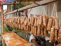
- Longganisang Calumpit
- Key chains, key holders, pen holders
Industrial estates:
- Bulacan Agro-Industrial Subdivision (Brgy. Pio Cruzcosa)
Tourism and culture
Festivals
The Libad is a river procession held every Saint John's Eve on June 23 to honour the town's patron. Calumpiteños sing, dance and douse water to "baptize" passers-by, recalling the saint's characteristic act. The ritual and its traditional route are relics of the old fluvial procession held when Apalit and Hagonoy were still governed from Calumpit.
One of the oldest barangays in the town, established in 1575, Santa Lucia is very popular and famous because of the supposedly miraculous image of its patroness, Saint Lucy. During the village festival, every December 12–13, the streets of the village are strung with colorful banderitas, as is the façade of Santa Lucia Church. Pilgrims visit the church for the two-day celebration, with the novena to the saint beginning on December 4.
Bagbag Bridge
Bagbag Bridge was the site of the longest battle between the Americans and Filipinos led by General Gregorio del Pilar on April 25, 1899. The bridge is now a reminder of the valor displayed by the Filipino who triumphed against the American forces.
Resorts
- Jed's Island Resort
- Leticia's Garden Resort and Events Place
- Lawiswis Kawayan
- Amazing Grace Resort
- El Bueno Resort
Education
Calumpit has several elementary and secondary schools. It also has some private colleges and the most well-known of it is Colegio de Calumpit which is established in 1940 and over many decades has maintained its quality education. Calumpit doesn't host big universities so most residents study in Malolos where Bulacan State University and other universities are located.
Notable people
- Servants of God Dionisia de Santa María Mitas Talangpaz (1691–1732) and Cecilia Rosa de Jesús Talangpaz (1693–1731) - founders of the Beaterio de San Sebastián, whose beatification process is now in progress are known for their exemplary lives of prayer, self-denial, service to the Church and apostolate that attracted young Filipinas.
- José Zabala-Santos - one of the most popular cartoonists in the Philippines during the 1950s for characters such Popoye, Sianong Sano, and Lukas Malakas.[14]
Gallery
 Calumpit Welcome Arch, viewed from the Calumpit-Pulilan Road
 St. Mark the Evangelist Parish Church
 St. Joseph Parish Church
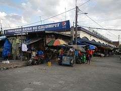 Calumpit Wet and Dry Public Market
 Rotary Club of Calumpit - Calumpit Public Library
 Calumpit Water District
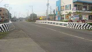 Labangan Bridge
 Gen. Gregorio del Pilar Statue (Brgy. Caniogan)
 The Rev. Agustin Samson Memorial United Methodist Church (Brgy. Gugo)
 Battle of Bagbag Centennial Marker (1896-1996)
 Sub-Parish Church of San Pedro (Brgy. Iba O'Este)
 Holy Cross Parish Church - Iglesia Filipina Independiente
 La Casa Azul
Notes
- ↑ "Municipality". Quezon City, Philippines: Department of the Interior and Local Government. Retrieved 31 May 2013.
- ↑ "Province: Bulacan". PSGC Interactive. Quezon City, Philippines: Philippine Statistics Authority. Retrieved 12 November 2016.
- 1 2 3 4 5 Census of Population (2015). "Region III (Central Luzon)". Total Population by Province, City, Municipality and Barangay. PSA. Retrieved 20 June 2016.
- ↑ ""Commission on Audit 2017 Report-Bulacan"". Quezon City, Philippines: Commission on Audit. Retrieved 8 July 2018.
- ↑ Blair and Robertson. "The Philippine Islands". pp. 304–310.
- ↑ Administracion espiritual de los Padres Agustinos calsados de la Provincia del Duche Nombre de Jesus de las islas Filipinas, Valladolid, Imprenta de H. Roldan, Mayo de 1833, p. 47
- ↑ E. H. Blair (October 14, 2004). "The Philippine Islands, 1493–1898". gutenberg.org.
- ↑

- ↑ "Municipality: CALUMPIT". Philippine Statistics Authority (National Statistical Coordination Board). Retrieved May 24, 2016.
- 1 2 Census of Population and Housing (2010). "Region III (Central Luzon)". Total Population by Province, City, Municipality and Barangay. NSO. Retrieved 29 June 2016.
- ↑ Censuses of Population (1903–2007). "Region III (Central Luzon)". Table 1. Population Enumerated in Various Censuses by Province/Highly Urbanized City: 1903 to 2007. NSO.
- ↑ "Province of Bulacan". Municipality Population Data. Local Water Utilities Administration Research Division. Retrieved 17 December 2016.
- ↑ "Things to Do and see in Bulacan..." Wow Philippines. Archived from the original on July 12, 2007. Retrieved April 14, 2007.
- ↑ Sianong Sano by Jose Zabala Santos 1950's. Comicartfans.com (2009-07-07). Retrieved on 2011-05-25.
External links
| Wikimedia Commons has media related to Calumpit, Bulacan. |
- Philippine Standard Geographic Code
- All About Calumpit Bulacan
- Philippine Census information
- Bulacan Provincial website
- LGO:Municipality of Calumpit
- Municipality of Calumpit
- Samahang Calumpit - Canada
Places adjacent to Calumpit, Bulacan | |
|---|---|
Malolos (capital) | |
| Municipalities | |
| Component cities | |
| Misc. | |