Ormoc
| Ormoc | ||
|---|---|---|
| Independent Component City | ||
| City of Ormoc | ||
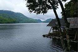
 View of Ormoc from Ormoc Bay | ||
| ||
 Map of Leyte with Ormoc highlighted | ||
.svg.png) Ormoc Location within the Philippines | ||
| Coordinates: 11°01′N 124°37′E / 11.02°N 124.62°ECoordinates: 11°01′N 124°37′E / 11.02°N 124.62°E | ||
| Country |
| |
| Region | Eastern Visayas (Region VIII) | |
| Province | Leyte (geographically only) | |
| District | 4th district of Leyte | |
| Founded | February 26, 1834 | |
| Cityhood | June 21, 1947 | |
| Barangays | 110 (see Barangays) | |
| Government [1] | ||
| • Type | Sangguniang Panlungsod | |
| • Mayor | Richard Gomez | |
| • Vice Mayor | Leo Carmelo "Toto Jr." Locsin | |
| • Congresswoman | Lucy Torres-Gomez | |
| • Electorate | 117,824 voters (2016) | |
| Area [2] | ||
| • Total | 613.6 km2 (236.9 sq mi) | |
| Population (2015 census)[3] | ||
| • Total | 215,031 | |
| • Density | 350/km2 (910/sq mi) | |
| Demonym(s) | Ormocanon | |
| Time zone | UTC+8 (PST) | |
| ZIP code | 6541 | |
| PSGC | 083738000 | |
| IDD : area code | +63 (0)53 | |
| Climate type | Tropical rainforest climate | |
| Income class | 1st city income class | |
| Revenue (₱) | 1,103,766,795.39 (2016) | |
| Native languages |
Cebuano Tagalog | |
| Website |
www | |

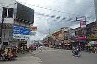
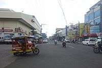
Ormoc, officially the City of Ormoc (Cebuano: Dakbayan sa Ormoc; Waray: Syudad han Ormoc; Filipino: Lungsod ng Ormoc) or simply referred to as Ormoc City, is a 1st class independent component city in the province of Leyte in the region of Eastern Visayas of the Philippines. According to the 2015 census, it has a population of 215,031 inhabitants,[3] making it the second most-populous city in the province after the provincial capital, Tacloban City. Ormoc is the economic, cultural, commercial and transportation hub of western Leyte.
Ormoc City is an independent component city, not subject to regulation from the Provincial Government of Leyte. However, the city is part of the 4th Congressional District of Leyte together with Albuera, Kananga, Merida, Palompon and Isabel, and statistically grouped under the province by the Philippine Statistics Authority. On November 8, 2013, the city was extensively damaged by Super Typhoon Yolanda (Haiyan), having previously suffered severe destruction and loss of life in 1991 from torrential flooding during Tropical Storm Thelma (Uring).
The city's name is derived from ogmok, an archaic Visayan term for "lowland" or "depressed plain". The city also celebrates an annual thanksgiving festival called the Tugob Festival.
Geography
Ormoc City is a port city and is the largest city in Leyte by land area and the second largest in Eastern Visayas after Calbayog City in Samar. At the head of Ormoc Bay, the city's terrain is mostly of gently rolling plains. It is bounded on the northwest by the towns of Matag-ob and Merida, in the north by Kananga, in the northeast by the towns of Jaro, Pastrana and Dagami, and in the south by the town of Albuera. High mountain ranges separate Ormoc from the eastern portion of Leyte. Numerous rivers and streams traverse Ormoc. Among them are the Bao River in the north, Pagsangahan River in the west, the Bagong-bong River in the south, the Panilahan River also in the south and the Anilao and Malbasag Rivers which border the eastern and western flanks of Ormoc City Proper.
Barangays
Ormoc City is politically subdivided into 110 barangays.
- Airport
- Alegria
- Alta Vista
- Bagongbong
- Bagong Buhay
- Bantigue
- Barangay 1 (Pob.)
- Barangay 2 (Poblacion)
- Barangay 3 (Poblacion)
- Barangay 4 (Poblacion)
- Barangay 5 (Poblacion)
- Barangay 6 (Poblacion)
- Barangay 7 (Poblacion)
- Barangay 8 (Poblacion)
- Barangay 9 (Poblacion)
- Barangay 10 (Poblacion)
- Barangay 11 (Poblacion)
- Barangay 12 (Poblacion)
- Barangay 13 (Poblacion)
- Barangay 14 (Poblacion)
- Barangay 15 (Poblacion)
- Barangay 16 (Poblacion)
- Barangay 17 (Poblacion)
- Barangay 18 (Poblacion)
- Barangay 19 (Poblacion)
- Barangay 20 (Poblacion)
- Barangay 21 (Poblacion)
- Barangay 22 (Poblacion)
- Barangay 23 (Poblacion)
- Barangay 24 (Poblacion)
- Barangay 25 (Poblacion)
- Barangay 26 (Poblacion)
- Barangay 27 (Poblacion)
- Barangay 28 (Poblacion)
- Barangay 29 (Poblacion)
- Batuan
- Bayog
- Biliboy
- Borok
- Cabaon-an
- Cabintan
- Cabulihan
- Cagbuhangin
- Camp Downes
- Can-adieng
- Can-untog
- Catmon
- Cogon Combado
- Concepcion
- Curva
- Lake Danao
- Danhug
- Dayhagan
- Dolores
- Domonar
- Don Felipe Larrazabal
- Don Potenciano Larrazabal
- Doña Feliza Z. Mejia
- Donghol
- Esperansa
- Gaas
- Green Valley
- Guintigui-an
- Hibunawon
- Hugpa
- Ipil
- Juaton
- Kadaohan
- Labrador (Balion)
- Lao
- Leondoni
- Libertad
- Liberty
- Licuma
- Liloan
- Linao
- Luna
- Mabato
- Mabini
- Macabug
- Magaswi
- Mahayag
- Mahayahay
- Manlilinao
- Margen
- Mas-in
- Matica-a
- Milagro
- Monterico
- Nasunogan
- Naungan
- Nueva Sociedad
- Nueva Vista
- Patag
- Punta
- Quezon, Jr.
- Rufina M. Tan (Rawis)
- Sabang Bao
- Salvacion
- San Antonio
- San Isidro
- San Jose
- San Juan
- San Pablo (Simangan)
- San Vicente
- Santo Niño
- Sumangga
- Tambulilid
- Tongonan
- Valencia
History
Kananga was created in 1950 from the barrios of Lonoy, Kananga, Rizal, Tugbong, Montebello, Aguiting, Tagaytay, Montealegre, Libungao, Naghalin, and Masarayao which all used to be part of Ormoc City.[4]
1991 Flash Flood
On the morning of 5 November 1991, the Ormoc region was inundated by Tropical Storm Uring. The city government recorded 4,922 deaths, 3,000 missing persons, 14,000 destroyed houses and more than P600 million worth of damaged property.[5] None of the 3,000 missing persons were ever found and are now presumed dead.[6] Illegal logging and kaingin (slash-and-burn farming) were blamed as the reasons of the flood.[5] Heavy rainfall caused water to collect upstream the Anilao and Malbasag rivers until it poured to the lowlands in Ormoc, particularly District 26, also known as Isla Verde.[5]
On 5 November 2011, a monument by national artist Francis Cinco commemorating the 20th anniversary of the event was inaugurated.[7] It sits on top of the mass grave at the Ormoc City Public Cemetery where an estimated 4,900 victims are buried.[8] The sculpture, entitled "Gift of Life", is an abstract depicting a life taken to heaven.[5][7]
2006 Store Fire
A fire at the Unitop store killed 24 people on Christmas day. The fire started from firecrackers and pyrotechnics that were ignited near the entrance door. The store did not have a permit to sell firecrackers and emergency exits were locked. The charred remains of the victims were found inside a bathroom, where they tried to escape from the blaze.
Demographics
| Population census of Ormoc | ||
|---|---|---|
| Year | Pop. | ±% p.a. |
| 1903 | 16,126 | — |
| 1918 | 38,174 | +5.91% |
| 1939 | 77,349 | +3.42% |
| 1948 | 72,733 | −0.68% |
| 1960 | 62,764 | −1.22% |
| 1970 | 84,563 | +3.02% |
| 1975 | 89,466 | +1.14% |
| 1980 | 104,978 | +3.25% |
| 1990 | 129,456 | +2.12% |
| 1995 | 143,186 | +1.91% |
| 2000 | 154,297 | +1.62% |
| 2007 | 177,524 | +1.95% |
| 2010 | 191,200 | +2.74% |
| 2015 | 215,031 | +2.26% |
| Source: Philippine Statistics Authority[3][9][10][11] | ||
The natives of this city are called Ormocanons, with most being Cebuano and Waray speakers together with the whole western and southern parts of the island of Leyte.
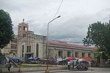
Like most Filipinos, Ormocanons are predominantly Roman Catholic, and the city celebrates its annual fiesta in honour of the patron saints Saint Peter and Saint Paul on June 28 and 29. Other main Catholic holy days, including the local fiestas of barangays, are observed throughout the year. There is also a visible Muslim minority within the city and all over the island, evidenced by the mosques within the cityscape and most of them are Maranaos from the twin provinces of Lanao del Norte and Lanao del Sur in Mindanao.
Economy
Ormoc City's economic base is a good mix of agriculture, aquaculture, industry, tourism, and commercial services. Sugar cane, rice and pineapple are the bulk produce of the agricultural sector.
The city enjoys economic growth because it supplies a large part of the country's power needs with its abundant geothermal power resources from the Tongonan Geothermal Power Plant in Barangay Tongonan and neighbouring Kananga town. Ormoc is also the gateway to the Leyte Industrial Development Estate in the nearby town of Isabel, home of the Philippine Phosphate Fertilizer Plant, the largest fertilizer factory in Asia, and the Philippine Associated Smelter and Refining Company, the country's biggest copper processing plant, among other industries.
Education
Ormoc is the educational center for western Leyte. It has a range of primary and secondary schools, both public and private. Tertiary education was originally offered by St. Peter's College of Ormoc, a Benedictine-run Catholic college and the oldest, followed by Western Leyte College of Ormoc City, Inc.,[12] a private non-sectarian college. In the 1990s, the city saw the establishment of Sto. Niño College of Ormoc, St. Paul's School of Ormoc Foundation, Inc. and the STI Computer College - Ormoc. In the 2000s, tertiary institutions founded were AMA Computer Learning Center (ACLC) - Ormoc, San Lorenzo Ruiz College of Ormoc, Ormoc City Institute of Technology (OCIT) and the Ormoc campus of the Eastern Visayas State University.
Ormoc also has their own Chinese school which is Ormoc Se San School.
Tourism
Among sites visited by the city's tourist are:
- Lake Danao is a violin shaped lake 3 km long at an elevation of 2,100 feet (640 m) above sea level. There are floating cottages, and boats are available for hire and a future zipline.
- Tongonan Hotsprings National Park is a valley of geothermal power source that can supply electricity to the whole region. The first geothermal plant to operate in the Philippines.
- Pineapple Plantation lies in 210 hectares in rolling terrain located north of the city Brgy. Hibunawon. Ormoc's Queen Pineapple is famous for its sweetness, a favourite pasalubong, and the unofficial icon of the city.
- Centennial Park, located in the city, is a leisure and picnic ground for the young and old alike.
- Lake Kasudsuran is just one of the three beautiful lakes of Ormoc. It is located at Brgy. Gaas, Ormoc City in Leyte. The 5-hectare Lake Kasudsuran is located 27 km (a 45-hr. drive) northeast of Ormoc City on the virgin forest of Brgy. Ga-as and Mt. Janagdan, a plateau 1,000 m above sea level. The lake is only accessible by foot. Lake Kasudsuran is also a place to explore in Ormoc City. The lake is a beauty to behold with surrounding fresh green trees and vegetation, and a calm and serene atmosphere.
- Alto Peak
- Sayahan Falls
- Puente dela Reina is Ormoc's oldest bridge.
- Western Leyte Guerrilla Warfare Forces Monument
- Ruins of Cong. Dominador Tan Residence
Infrastructure
Transport
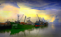
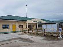

The Port of Ormoc serves as the seaport of the city. For air transport, Ormoc Airport serves the city.
Energy
Ormoc hosts the biggest geothermal powerplant in Southeast Asia - the Tongonan Geothermal Power in Barangay Tongonan which supplies electricity not only in the Eastern Visayas Region but power demand in Luzon as well.
References
- ↑ "City". Quezon City, Philippines: Department of the Interior and Local Government. Retrieved 30 May 2013.
- ↑ "Province: Leyte". PSGC Interactive. Quezon City, Philippines: Philippine Statistics Authority. Retrieved 12 November 2016.
- 1 2 3 Census of Population (2015). "Region VIII (Eastern Visayas)". Total Population by Province, City, Municipality and Barangay. PSA. Retrieved 20 June 2016.
- ↑ "An act creating the municipality of Kananga, Leyte, in the province of Leyte". LawPH.com. Retrieved 9 April 2011.
- 1 2 3 4 "Ormoc rises from flash flood tragedy". Inquirer.net. Retrieved 20 May 2013.
- ↑ "Tortured by Typhoons". Retrieved 20 May 2013.
- 1 2 "Monument marks 20th year of Ormoc flashflood tragedy". Inquirer.net. Retrieved 20 May 2013.
- ↑ "Mass Grave". Fran-Con Viaje International. Retrieved 20 May 2013.
- ↑ Census of Population and Housing (2010). "Region VIII (Eastern Visayas)". Total Population by Province, City, Municipality and Barangay. NSO. Retrieved 29 June 2016.
- ↑ Censuses of Population (1903–2007). "Region VIII (Eastern Visayas)". Table 1. Population Enumerated in Various Censuses by Province/Highly Urbanized City: 1903 to 2007. NSO.
- ↑ "Province of Leyte". Municipality Population Data. Local Water Utilities Administration Research Division. Retrieved 17 December 2016.
- ↑ WLC-Website
External links
| Wikimedia Commons has media related to Ormoc. |
| Wikivoyage has a travel guide for Ormoc. |
- Official City Government Website of Ormoc
- Ormoc City Online Newspaper
- Philippine Standard Geographic Code for Ormoc City
- Philippine Census of Population
- Local Governance Performance Management System
- Ormoc on Facebook
Places adjacent to Ormoc | |
|---|---|

| Authority control |
|---|