Ligao
| Ligao | ||
|---|---|---|
| Component City | ||
| City of Ligao | ||
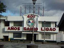 City Hall | ||
| ||
| Nickname(s): Sunflower Capital of the Philippines | ||
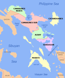
 Map of Albay with Ligao highlighted | ||
.svg.png) Ligao Location within the Philippines | ||
| Coordinates: 13°13′N 123°31′E / 13.22°N 123.52°ECoordinates: 13°13′N 123°31′E / 13.22°N 123.52°E | ||
| Country |
| |
| Region | Bicol Region (Region V) | |
| Province | Albay | |
| District | 3rd district | |
| Founded | 1608 | |
| Cityhood | 2001 | |
| Barangays | 55 (see Barangays) | |
| Government [1] | ||
| • Type | Sangguniang Panlungsod | |
| • Mayor | Patricia Gonzalez-Alsua | |
| • Electorate | 55,419 voters (2016) | |
| Area [2] | ||
| • Total | 246.75 km2 (95.27 sq mi) | |
| Population (2015 census)[3] | ||
| • Total | 111,399 | |
| • Density | 450/km2 (1,200/sq mi) | |
| Time zone | UTC+8 (PST) | |
| ZIP code | 4504 | |
| PSGC | 050508000 | |
| IDD : area code | +63 (0)52 | |
| Climate type | Tropical rainforest climate | |
| Income class | 4th city income class | |
| Revenue (₱) | 523,720,616.10 (2016) | |
| Native languages |
Albay Bikol language Tagalog | |
| Website |
ligaocity | |

Ligao, officially the City of Ligao, (Central Bicolano: Ciudad kan Ligao; Filipino: Lungsod ng Ligao), or simply referred to as Ligao City, is a 4th class city in the province of Albay, Philippines. According to the 2015 census, it has a population of 111,399 people.[3]
Barangays
Ligao City is politically subdivided into 55 barangays. There are 11 urban and 44 rural barangays, of which 3 are coastal barangays.
- Abella
- Allang
- Amtic
- Bacong
- Bagumbayan (Poblacion)
- Balanac
- Baligang
- Barayong
- Basag
- Batang
- Bay
- Binanowan
- Binatagan (Poblacion)
- Bobonsuran
- Bonga
- Busac
- Busay
- Cabarian
- Calzada (Poblacion)
- Catburawan
- Cavasi (Poblacion)
- Culliat
- Dunao (Poblacion)
- Francia
- Guilid (Poblacion)
- Herrera(Poblacion)
- Layon
- Macalidong
- Mahaba
- Malama
- Maonon
- Nasisi
- Nabonton
- Oma-Oma
- Palapas
- Pandan
- Paulba
- Paulog
- Pinamaniquian
- Pinit
- Ranao-Ranao
- San Vicente
- Santa Cruz (Poblacion)
- Tagpo (Poblacion)
- Tambo
- Tandarora
- Tastas
- Tinago (Poblacion)
- Tinampo
- Tiongson
- Tomolin (Poblacion)
- Tuburan (Poblacion)
- Tula-Tula Grande
- Tula-Tula Pequeño
- Tupas
Demographics
| Population census of Ligao | ||
|---|---|---|
| Year | Pop. | ±% p.a. |
| 1903 | 17,687 | — |
| 1918 | 21,467 | +1.30% |
| 1939 | 27,927 | +1.26% |
| 1948 | 37,331 | +3.28% |
| 1960 | 53,376 | +3.02% |
| 1970 | 56,765 | +0.62% |
| 1975 | 61,548 | +1.64% |
| 1980 | 69,860 | +2.56% |
| 1990 | 72,560 | +0.38% |
| 1995 | 80,861 | +2.05% |
| 2000 | 90,603 | +2.47% |
| 2007 | 101,179 | +1.53% |
| 2010 | 104,914 | +1.33% |
| 2015 | 111,399 | +1.15% |
| Source: Philippine Statistics Authority[3][4][5][6] | ||
See also
References
- ↑ "City". Quezon City, Philippines: Department of the Interior and Local Government. Retrieved 30 May 2013.
- ↑ "Province: Albay". PSGC Interactive. Quezon City, Philippines: Philippine Statistics Authority. Retrieved 12 November 2016.
- 1 2 3 Census of Population (2015). "Region V (Bicol Region)". Total Population by Province, City, Municipality and Barangay. PSA. Retrieved 20 June 2016.
- ↑ Census of Population and Housing (2010). "Region V (Bicol Region)". Total Population by Province, City, Municipality and Barangay. NSO. Retrieved 29 June 2016.
- ↑ Censuses of Population (1903–2007). "Region V (Bicol Region)". Table 1. Population Enumerated in Various Censuses by Province/Highly Urbanized City: 1903 to 2007. NSO.
- ↑ "Province of Albay". Municipality Population Data. Local Water Utilities Administration Research Division. Retrieved 17 December 2016.
External links
| Wikimedia Commons has media related to Ligao. |
| Wikivoyage has a travel guide for Ligao City. |
Places adjacent to Ligao | ||||||||||
|---|---|---|---|---|---|---|---|---|---|---|
| ||||||||||
This article is issued from
Wikipedia.
The text is licensed under Creative Commons - Attribution - Sharealike.
Additional terms may apply for the media files.