Santa Ana, Pampanga
| Santa Ana | ||
|---|---|---|
| Municipality | ||
| Municipality of Santa Ana | ||
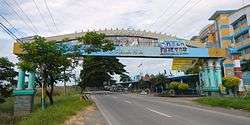 Welcome arc | ||
| ||
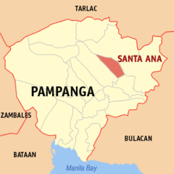 Map of Pampanga with Santa Ana highlighted | ||
.svg.png) Santa Ana Location within the Philippines | ||
| Coordinates: 15°05′38″N 120°46′05″E / 15.0939°N 120.7681°ECoordinates: 15°05′38″N 120°46′05″E / 15.0939°N 120.7681°E | ||
| Country |
| |
| Region | Central Luzon (Region III) | |
| Province | Pampanga | |
| District | 3rd District | |
| Barangays | 14 (see Barangays) | |
| Government [1] | ||
| • Type | Sangguniang Bayan | |
| • Mayor | Norberto Gamboa | |
| • Electorate | 28,392 voters (2016) | |
| Area [2] | ||
| • Total | 39.84 km2 (15.38 sq mi) | |
| Population (2015 census)[3] | ||
| • Total | 55,178 | |
| • Density | 1,400/km2 (3,600/sq mi) | |
| Time zone | UTC+8 (PST) | |
| ZIP code | 2022 | |
| PSGC | 035419000 | |
| IDD : area code | +63 (0)45 | |
| Climate type | Tropical monsoon climate | |
| Income class | 3rd municipal income class | |
| Revenue (₱) | 108,062,798.88 (2016) | |
| Native languages |
Kapampangan Tagalog | |

Santa Ana, officially the Municipality of Santa Ana, is a 3rd class municipality in the province of Pampanga, Philippines. According to the 2015 census, it has a population of 55,178 people.[3]
Barangays
Santa Ana is politically subdivided into 14 barangays. All of its barangays were named after various Christian patrons, although some townsfolk still use their former names.
- San Agustin (Sumpung)
- San Bartolome (Patayum)
- San Joaquin (Poblacion, Canukil)
- San Jose (Catmun)
- San Juan (Tinajeru)
- San Nicolas (Sepung Ilug)
- San Pablo (Muzun)
- San Pedro (Calumpang)
- San Roque (Tuclung)
- Santa Lucia (Calinan)
- Santa Maria (Balen Bayu)
- Santiago (Culsara)
- Santo Rosario (Pagbatuan)
Demographics
| Population census of Santa Ana | |||||||||||||||||||||||||||||||||||||||||||||||||
|---|---|---|---|---|---|---|---|---|---|---|---|---|---|---|---|---|---|---|---|---|---|---|---|---|---|---|---|---|---|---|---|---|---|---|---|---|---|---|---|---|---|---|---|---|---|---|---|---|---|
|
| ||||||||||||||||||||||||||||||||||||||||||||||||
| Source: Philippine Statistics Authority[3][4][5][6] | |||||||||||||||||||||||||||||||||||||||||||||||||
In the 2015 census, the population of Santa Ana, Pampanga, was 55,178 people,[3] with a density of 1,400 inhabitants per square kilometre or 3,600 inhabitants per square mile.
Local government
The municipal government is divided into three branches: executive, legislative and judiciary. The judicial branch is administered solely by the Supreme Court of the Philippines. The executive branch is composed of the mayor and the barangay captain for the barangays. The legislative branch is composed of the Sangguniang Bayan (town assembly), Sangguniang Barangay (barangay council), and the Sangguniang Kabataan for the youth sector.
St. Anne Parish Church
St. Anne parish's present church is made of stone and bricks. The heritage building was constructed by Fr. Ferrer in 1853 and completed by Fr. Lucas Gonzalez using adobe stones from Meycauayan City, Bulacan and wood from Betis and Porac, Pampanga. The church is 58 metres (190 ft) long, 14 metres (46 ft) wide and 13 metres (43 ft) high. Parish convent was built in 1866 by Fr. Antonio Redondo. The massive 1857 hexagonal four-storey belltower has blind and open recesses, keeping with the symmetry of the façade. It ends in a balustrade dome topped by a cross.[7][8]
Education
There are 5 prime schools in the town aside from public elementary schools: the Saint Mary's Angels College, San Isidro High School, Holy Cross College, Sta.Ana National High School and Telesforo Natividad Alfonso High School.
Images
 Town hall
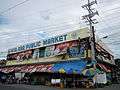 Public market
.jpg) St. Anne Parish Church
St. Anne Parish Church Saint Mary's Angels College
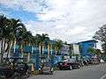 Holy Cross College
References
- ↑ "Municipality". Quezon City, Philippines: Department of the Interior and Local Government. Retrieved 31 May 2013.
- ↑ "Province: Pampanga". PSGC Interactive. Quezon City, Philippines: Philippine Statistics Authority. Retrieved 12 November 2016.
- 1 2 3 4 Census of Population (2015). "Region III (Central Luzon)". Total Population by Province, City, Municipality and Barangay. PSA. Retrieved 20 June 2016.
- ↑ Census of Population and Housing (2010). "Region III (Central Luzon)". Total Population by Province, City, Municipality and Barangay. NSO. Retrieved 29 June 2016.
- ↑ Censuses of Population (1903–2007). "Region III (Central Luzon)". Table 1. Population Enumerated in Various Censuses by Province/Highly Urbanized City: 1903 to 2007. NSO.
- ↑ "Province of Pampanga". Municipality Population Data. Local Water Utilities Administration Research Division. Retrieved 17 December 2016.
- ↑ http://pampanga.islandsphilippines.com/natural.php
- ↑ http://www.visitmyphilippines.com/index.php?title=Churches&func=all&pid=4370&tbl=0
External links
| Wikimedia Commons has media related to Santa Ana, Pampanga. |
- Philippine Standard Geographic Code
- Philippine Census Information
- Local Governance Performance Management System
San Fernando (capital) | |
| Municipalities | |
| Component cities | |
| Highly urbanized city |
|