Guiguinto
| Guiguinto | ||
|---|---|---|
| Municipality | ||
| Municipality of Guiguinto | ||
| ||
| Nickname(s): Garden Haven Of Bulacan | ||
| Motto(s): Sugod Makabagong Guiguinto! | ||
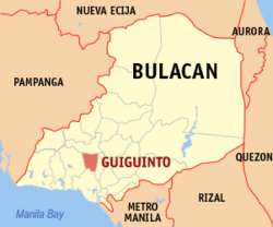 Map of Bulacan with Guiguinto highlighted | ||
.svg.png) Guiguinto Location within the Philippines | ||
| Coordinates: 14°50′N 120°53′E / 14.83°N 120.88°ECoordinates: 14°50′N 120°53′E / 14.83°N 120.88°E | ||
| Country |
| |
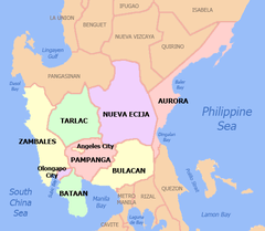
| Region | Central Luzon (Region III) | |
| Province | Bulacan | |
| District | 2nd District | |
| Founded | 1641 | |
| Barangays | 14 (see Barangays) | |
| Government [1] | ||
| • Type | Sangguniang Bayan | |
| • Mayor | Ambrosio "Boy" Cruz Jr. | |
| • Vice Mayor | Banjo Estrella | |
| • Electorate | 58,126 voters (2016) | |
| Area [2] | ||
| • Total | 27.50 km2 (10.62 sq mi) | |
| Elevation | 10 m (30 ft) | |
| Population (2015 census)[3] | ||
| • Total | 99,730 | |
| • Density | 3,600/km2 (9,400/sq mi) | |
| Time zone | UTC+8 (PST) | |
| ZIP code | 3015 | |
| PSGC | 031408000 | |
| IDD : area code | +63 (0)44 | |
| Climate type | Tropical monsoon climate | |
| Income class | 1st municipal income class | |
| Poverty rate |
| |
| • Revenue (2017) |
| |
| • Expenses (2017) |
| |
| • Total Assets (2017) |
| |
| Electricity | Manila Electric Company | |
| • Consumption | 56.94 million kWh (2003) | |
| Native languages | Tagalog | |
| Website |
guiguinto | |

Guiguinto, officially the Municipality of Guiguinto, (Tagalog: Bayan ng Guiguinto), is a 1st class municipality in the province of Bulacan, Philippines. According to the 2015 census, it has a population of 99,730 people.[3]
Guiguinto is one of the fast-growing municipalities. From a predominating agricultural economy, it gradually urbanized and developed, now part of the Metro Manila conurbation. Guiguinto is 34 kilometres (21 mi) from Manila and 11 kilometres (6.8 mi) from Malolos City.
It is the birthplace of composer Constancio De Guzman, known for writing songs like "Maalaala Mo Kaya". It also houses the Immaculate Conception Seminary, a Diocesan Seminary of the Diocese of Malolos located in barangay Tabe. The appellation “Guiguinto” literally translates to “Gold” for the early conquistadores came and saw this town on a harvest season when it lushes in golden rice stalks against the sun.
History
Guiguinto began as a barrio of Bulakan, the former provincial capital of Bulacan. It is said that Spaniards set up an army post in the barrio to serve as a resting place for forces going to Northern Luzon. In those days, travel throughout Guiguinto was difficult and slow down to cross single file over a narrow bamboo bridge. Their Filipino guides would cry out, "Hinto" (stop). The Spaniards thought this was the name "Hihinto". The Spaniards substituted "Gui" (with hard "g") for the Tagalog "Hi". The place has since been called Guiguinto. On the other hand, old timers say that on moonlight nights, a golden bull emerges from the church and goes down to the nearby river to quench his thirst. It then returns to the church, ascends at the altar and disappears. The elders' aid that there are buried jars of gold in town, as indicated by the bull, and that is why the town was called Guiguinto. It became an encomienda in the 1591 but the ecclesiastical administration was under Bulakan Convent and it was established as a Town in 1641.
In 1800, an Augustinian friar erected a small chapel in what is now barrio Sta. Rita. In 1873, roads were constructed in barrio Malis. The people barrios of Pritil, Tabe, and Cutcut even those days were mostly farmers. During Holy Week, villagers of barrio Tuktukan held contest for the hardest egg shells (chicken, duck or goose by knocking eggs together (Tuktukan)). The women tried to help each other in singing the "Panica".
Just before the outbreak of the revolution of 1896, the town people of Guiguinto were ordered to sleep in the town at night and to work in their fields only in the day. This was said to have been suggested by the town priest to the authorities because of rumors that many of the town people were joining the secret revolutionary society, the Katipunan. Guiguinto eventually contributed many soldiers to the 1896 revolution.
At the time of American occupation, the new colonizers reorganized the Province of Bulacan into 19 municipalities from the original 26. Under populated town were subordinated with the large one and the town of Guiguinto was integrated in the town of Bulakan for almost 11 years. In 1915, Guiguinto regain its township again with Antonio Figueroa as its municipal mayor of the modern period. The town's population was then about 4,000. The 1960 census placed Guiguinto's population at 10,629. Guiguinto is bounded on the east by the town of Balagtas, on the west by Malolos City, on the north by Plaridel, and on the south by Bulacan.
Barangays
Guiguinto is politically subdivided into 14 barangays:
| PSGC | Barangay | Population | ±% p.a. | |||
|---|---|---|---|---|---|---|
| 2015[3] | 2010[5] | |||||
| 031408001 | Cutcut | 2.9% | 2,940 | 2,701 | 1.63% | |
| 031408002 | Daungan | 1.8% | 1,800 | 1,384 | 5.13% | |
| 031408003 | Ilang‑Ilang | 5.6% | 5,628 | 4,436 | 4.64% | |
| 031408004 | Malis | 16.3% | 16,223 | 13,957 | 2.91% | |
| 031408005 | Panginay | 1.5% | 1,528 | 1,159 | 5.40% | |
| 031408006 | Poblacion | 4.1% | 4,099 | 3,852 | 1.19% | |
| 031408007 | Pritil | 5.2% | 5,172 | 4,165 | 4.21% | |
| 031408008 | Pulong Gubat | 1.9% | 1,879 | 3,186 | −9.56% | |
| 031408009 | Santa Cruz | 12.2% | 12,216 | 11,639 | 0.93% | |
| 031408010 | Santa Rita | 13.7% | 13,687 | 13,163 | 0.75% | |
| 031408011 | Tabang | 8.9% | 8,832 | 7,332 | 3.61% | |
| 031408012 | Tabe | 8.3% | 8,310 | 7,204 | 2.76% | |
| 031408013 | Tiaong | 7.7% | 7,640 | 7,279 | 0.93% | |
| 031408015 | Tuktukan | 9.8% | 9,776 | 9,050 | 1.48% | |
| Total | 99,730 | 90,507 | 1.86% | |||
Demographics
| Population census of Guiguinto | ||
|---|---|---|
| Year | Pop. | ±% p.a. |
| 1903 | 3,948 | — |
| 1918 | 4,847 | +1.38% |
| 1939 | 6,199 | +1.18% |
| 1948 | 7,979 | +2.84% |
| 1960 | 10,629 | +2.42% |
| 1970 | 16,075 | +4.22% |
| 1975 | 20,590 | +5.09% |
| 1980 | 27,751 | +6.15% |
| 1990 | 44,532 | +4.84% |
| 1995 | 52,575 | +3.16% |
| 2000 | 67,571 | +5.53% |
| 2007 | 89,225 | +3.91% |
| 2010 | 90,507 | +0.52% |
| 2015 | 99,730 | +1.86% |
| Source: Philippine Statistics Authority[3] [5] [6] [7] | ||
In the 2015 census, the population of Guiguinto, was 99,730 people,[3] with a density of 3,600 inhabitants per square kilometre or 9,300 inhabitants per square mile.
Economy
A quarter of its 2,512 hectares was converted into nurseries giving livelihood to 500 families of gardeners and landscapers. Mayor Isagani Pascual announced that the landscaping business in Guiguinto is now a ₱ 50 million industry. Jojo Sebastian, chair of the Guiguinto Garden City Cooperative stated that their garden stores sell ₱ 100,000 to ₱ 300,000 plants and contracts for garden and landscapes designs a month.[8]
Halamanan Festival
Established in 1999 by Mayor Ambrosio Cruz, Jr., the Halamanan Festival has since become the brand of the Municipality of Guiguinto. It was conducted in gratitude and recognition Guiguinto's dear patron, St. Ildephonsus (San Ildefonso), who held every 23 January. It is considered that grand Street Dancing Festival, the participation of dancers from the schools and villages of Guiguinto and be in different towns of Bulacan. They adorned the garments as flowers and more. Besides the celebration for the feast of San Ildefonso was also a means to further pitting and display capabilities and "galing" of Guiguinteño in various fields of horticulture as landscaping, PROPAGATION seedling, plant growing, flower cutting, arranging and interior decorating.
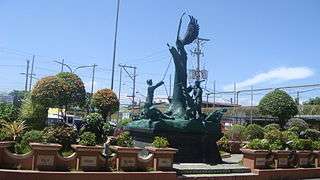
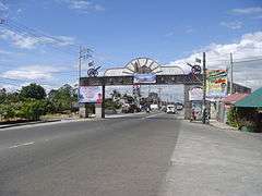
Attractions
- San Ildefonso Parish Church
- Sta. Rita Parish Church
- Guiguinto Gardens in Sta. Cruz and Tabang
- Garden City in Sta. Cruz
- Guiguinto Municipal Garden in Poblacion
- C.M. Farm in Cut-Cut
- Golden Shower in Tabe
- Alcor Center in Tiaong
- Hidden Mountain Rocks in Tiaong
- Luntiang Paraiso in Tabang
- Guiguinto Old Train Station
- Camp Hotel and Resort in Pritil
- Klir Waterpark Resort in Sta.rita
- St.Agatha Hotel and Resort in Sta.Rita
- Halamanan Festival
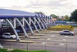
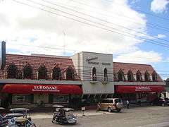
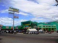
Gallery
References
- ↑ "Municipality". Quezon City, Philippines: Department of the Interior and Local Government. Retrieved 31 May 2013.
- ↑ "Province: Bulacan". PSGC Interactive. Quezon City, Philippines: Philippine Statistics Authority. Retrieved 12 November 2016.
- 1 2 3 4 5 Census of Population (2015). "Region III (Central Luzon)". Total Population by Province, City, Municipality and Barangay. PSA. Retrieved 20 June 2016.
- ↑ ""Commission on Audit 2017 Report-Bulacan"". Quezon City, Philippines: Commission on Audit. Retrieved 8 July 2018.
- 1 2 Census of Population and Housing (2010). "Region III (Central Luzon)". Total Population by Province, City, Municipality and Barangay. NSO. Retrieved 29 June 2016.
- ↑ Censuses of Population (1903–2007). "Region III (Central Luzon)". Table 1. Population Enumerated in Various Censuses by Province/Highly Urbanized City: 1903 to 2007. NSO.
- ↑ "Province of Bulacan". Municipality Population Data. Local Water Utilities Administration Research Division. Retrieved 17 December 2016.
- ↑ mb.com.ph, Green paradise
External links
| Wikimedia Commons has media related to Guiguinto. |
Malolos (capital) | |
| Municipalities | |
| Component cities | |
| Misc. | |