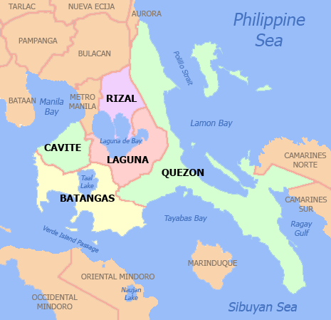
Santa Cruz, Laguna
| Santa Cruz | ||
|---|---|---|
| Municipality | ||
| Municipality of Santa Cruz | ||
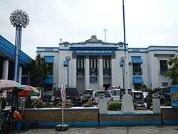 Municipal Hall | ||
| ||
| Nickname(s): Laguna's Capital, The Heartland of Calabarzon | ||
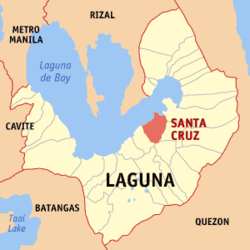 Map of Laguna with Santa Cruz highlighted | ||
.svg.png) Santa Cruz Location within the Philippines | ||
| Coordinates: 14°17′N 121°25′E / 14.28°N 121.42°ECoordinates: 14°17′N 121°25′E / 14.28°N 121.42°E | ||
| Country |
| |
| Region | Calabarzon (Region IV-A) | |
| Province | Laguna | |
| District | 4th District | |
| Founded | June 4, 1602 | |
| Barangays | 26 | |
| Government [1] | ||
| • Type | Sangguniang Bayan | |
| • Mayor | Domingo G. Panganiban | |
| • Electorate | 63,306 voters (2016) | |
| Area [2] | ||
| • Total | 38.59 km2 (14.90 sq mi) | |
| Population (2015 census)[3] | ||
| • Total | 117,605 | |
| • Density | 3,000/km2 (7,900/sq mi) | |
| Time zone | UTC+8 (PST) | |
| ZIP code | 4009 | |
| PSGC | 043426000 | |
| IDD : area code | +63 (0)49 | |
| Climate type | Tropical monsoon climate | |
| Income class | 1st municipal income class | |
| Revenue (₱) | 275,333,981.36 (2016) | |
| Native languages | Tagalog | |

Santa Cruz, officially the Municipality of Santa Cruz, (Tagalog: Bayan ng Santa Cruz), is a 1st class municipality and capital of the province of Laguna, Philippines. According to the 2015 census, it has a population of 117,605 people.[3]
Santa Cruz is situated on the banks of the Santa Cruz River which flows into the eastern part of Laguna de Bay. The town is bounded by the Bay on the north, by Lumban and Pagsanjan towns in the east, Pagsanjan and Magdalena towns in the south, and Pila in the west. It is 87 kilometres (54 mi) from Manila via Calamba. It is accessible by land from the nearby 28 municipalities and by water through Laguna de Bay from Manila and some Rizal towns.
Santa Cruz is considered as the service and commercial center on the eastern part of the province. The town is composed of five barangays in the Poblacion area and 21 classified urban barangays. Although relatively far from the immediate urbanizing influence of Metropolitan Manila, Santa Cruz continues to progress. It is now classified as first class municipality. The present administration is headed by the Mayor Denis Panganiban. Santa Cruz is also the seat of the provincial government since 1885, giving the municipality an additional administrative function over the entire province. It also functions as the service center for transportation, commerce, health, education, and other social services for the predominantly rural north-eastern municipalities of the province. Boosting the economy of the municipality are the incipient and fast-growing agribusiness industries such as livestock raising, horticulture and aquaculture. The town is composed of twenty-six (26) urban barangays. All barangays are being classified as urban.
The development of Santa Cruz as the administrative, commercial, and service center of Laguna makes it accessible for all private/public vehicles going to nearby places particularly Pagsanjan, Lake Caliraya, Liliw, Paete and Nagcarlan.
History
During the last decade of the 16th century, Santa Cruz, the premier town of Laguna was once a well populated barrio of the present municipality of Lumban, as well as other contemporary towns like Pagsanjan, Cavinti, Paete and Pangil. In 1602, Santa Cruz separated from Lumban and became a pueblo with its church and local government.
It is a town which since its foundation in 1602, had been ravaged by calamitous forces such as fires, typhoons, floods and human vandalism during the Philippine Revolution of 1896-1899, the war of the Philippine Independence (1899–1902), Battle of Santa Cruz, the assault of the Tulisanes (bandits) during the Spanish times, and the beginning to the Filipino troops of the pre-war 4th and 42nd Infantry Division of the Philippine Commonwealth Army and recognized guerrillas from the Second Battle of Santa Cruz on January 26, 1945. Santa Cruz survived all these disasters.
Characterized by fertile flat lands situated along the coastal plains of Laguna de Bay, the economic base of the town had been traditionally anchored on two primary industries, namely agriculture and fishing which still remain up to the present. In view of the strategic location of Santa Cruz relative to the other coastal settlements about the lake, trading activities have likewise rooted on the town during those early settlement days. The town proper which has always been the focal point of activities used to be accessible to the other lake-shore areas due to the navigable Santa Cruz River aside from the Laguna de Bay itself. Since those early days, water is the principal mode of transportation.
Today, Santa Cruz serves as the capital of Laguna and is considered as the business and commercial center on the eastern part of the province.[1]
Cityhood
Soot to be City.
Geography
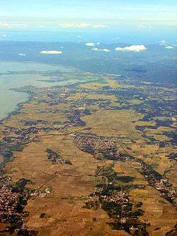
Situated at the central portion of Laguna province along the south-eastern coast of Laguna de Bay, Santa Cruz lies 87 kilometres (54 mi) southeast of Metro Manila via Calamba and is geographically located at approximately 14 degrees 17' latitude and 121 degrees 25' longitude. The municipality is bounded on the north and north-west by Laguna de Bay, on the north-east by Lumban, on the east by Pagsanjan, on the southeast by Magdalena, on the south by Liliw, and on the south-west by Pila. It has 26 barangays and covers approximate land area of 3860 hectares which comprises about 2% of the total land area of Laguna Province.
- Land Area: 3,860 hectares
- Residential: 381.97
- Commercial: 35.96
- Institutional: 92.17
- Functional Open Space: 31.27
- Roads: 157.73
- Total Built-up: 696.10
- Agricultural: 3,048.57
- Special Use: 115.33
Climate
Like most areas in the province of Laguna, the climate of Santa Cruz is characterized by two pronounced seasons: dry from January to April and wet during the rest of the year. The municipality has annual temperature of 27.2 degree Celsius and annual rainfall of 1962.7mm. Northeasterly winds with an average wind speed of 9 knots prevail in the municipality.
Geology
The two types of rocks found in Santa Cruz are alluvium and clastic rocks. Clastic rocks are located at the eastern portion of the municipality specifically in Barangay Alipit, San Jose, Oogong, Jasaan, San Juan, Palasan, and portions of Barangays Pagsawitan, Patimbao, Bubukal, Labuin and Malinao. These rocks consist of inter-bedded shale and sandstone with occasional thin lenses of limestone, tuff, and reworked sandy tuffs, calcareous sandstone and partly tuffaceous shale.
Barangays
Santa Cruz is politically subdivided into 26 barangays. [2]
- Alipit
- Bagumbayan
- Bubukal
- Calios
- Duhat
- Gatid
- Jasaan
- Labuin
- Malinao
- Oogong
- Pagsawitan
- Palasan
- Patimbao
- Poblacion I
- Poblacion II
- Poblacion III
- Poblacion IV
- Poblacion V
- San Jose
- San Juan
- San Pablo Norte
- San Pablo Sur
- Santisima Cruz
- Santo Angel Central
- Santo Angel Norte
- Santo Angel Sur
Demographics
| Population census of Santa Cruz | ||
|---|---|---|
| Year | Pop. | ±% p.a. |
| 1903 | 12,747 | — |
| 1918 | 14,156 | +0.70% |
| 1939 | 17,649 | +1.06% |
| 1948 | 22,534 | +2.75% |
| 1960 | 32,850 | +3.19% |
| 1970 | 47,114 | +3.67% |
| 1975 | 52,672 | +2.26% |
| 1980 | 60,620 | +2.85% |
| 1990 | 76,603 | +2.37% |
| 1995 | 86,978 | +2.41% |
| 2000 | 92,694 | +1.37% |
| 2007 | 101,914 | +1.32% |
| 2010 | 110,943 | +3.14% |
| 2015 | 117,605 | +1.12% |
| Source: Philippine Statistics Authority[3][4][5][6] | ||
In the 2015 census, the population of Santa Cruz, Laguna, was 117,605 people,[3] with a density of 3,000 inhabitants per square kilometre or 7,800 inhabitants per square mile.
Economy
Annual local government tax collection:
- 2008 — ₱ 160,196,679.38
- 2007 — ₱ 135,792,097.46
- 2006 — ₱ 128,812,429.41
- 2005 — ₱ 117,351,293.14
Commerce
The provincial capital of Laguna, Santa Cruz serves as service center of the province particularly for the municipalities on its north-eastern part.
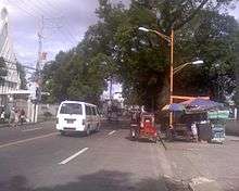
Trade and commerce remain to be one of the primary economic activities in the locality. The presence of jeepney services plying Lumban, Paete, Siniloan, San Pablo, Pila, Victoria, Cavinti-Caliraya, Luisiana, Majayjay, Calumpang, Nagcarlan, Liliw, Magdalena, Pagsanjan, Lucban, Lucena and Calamba has further enhanced the municipality's role as a commerce and trade center.
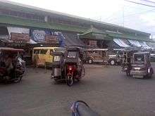
The center of business activities is in the poblacion specifically at Barangay V where the four (4) buildings of Public Market is situated.
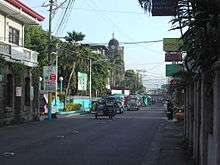
Santa Cruz has many establishment that contribute to its development. Development in this vicinity has been a quasi-residential commercial type as manifested by the proliferation of structures which are used both for business and residential purposes by the proprietors/owners. There is also a concentration of business establishments at the section of the national highway/expressway especially Barangay Gatid where a Mall is located, and the abandoned PNR Railway (road) while a strip pattern of commercial development is noticeable along the Quezon Avenue and along the old highway and Pedro Guevarra Avenue. Along P Guevarra Avenue, several establishments are also located such as Hospitals, Meralco office, PLDT office, Red Cross, several Banking Institutions, and Executive Eminent Lending Company. There is also SL Agritech Corporation, in Barangay Oogong, Santa Cruz, Laguna,
Points of interest
Santa Cruz may not have natural tourist spots and no wide areas to develop but one thing the townsmen of Santa Cruz are proud of are the local foods available in the town. Santa Cruz boasts of the famous white cheese or kesong puti, freshly made from carabao's milk.
- Aglipayan Cathedral with our Lady of maulawin shrine.
- Emilio Jacinto Shrine Burial Site
- Villa Valenzuela
- Santa Cruz Town Plaza
- Immaculate Concepcion Parish Church
- Kesong puti Festival — April 4–11
- Anilag Festival — March 8–17
- Camp Allen Training & Development Center
- DyAngelo's Place Resort Bagumbayan
Events
Santa Cruz hosted the Palarong Pambansa from May 4–10, 2014.[7]
Education
|
Kindergarten schools:
Elementary (primary and intermediate):
High schools:
|
Colleges:
Vocational:
Number of students:
|
Partial list of schools:
- Santa Cruz Central Elementary School (The Central School of Santa Cruz)
- Bagumbayan Elementary School
- Bubukal Elementary School
- Calios Elementary School
- Duhat Elementary School
- Gatid Elementary School
- Oogong Elementary School
- Pagsawitan Elementary School
- Palasan Elementary School
- Patimbao Elementary School
- San Jose Elementary School
- Santisima Cruz Elementary School
- Santo Angel Central Elementary School
- Santo Angel Norte Elementary School
- Santo Angel Sur Elementary School
- Silangan Elementary School
- Pedro Guevara Memorial National High School
- Basic Christian International School and Special Education Center, Inc.
- ACTS Computer College
- AMA Computer University
- AMA Computer Learning Center
- Capitol View Christian School
- Immaculate Conception Catholic College (formerly Don Bosco High School)
- Laguna Santiago Educational Foundation Inc.
- Laguna Senior High School
- Laguna State Polytechnic University
- Laguna University
- Little Javannah Montessori School
- Our Lady of Maulawin Educational Foundation, Inc.
- Philippine Women's University
- Maranatha Christian Academy
- SHARPMINDS Tutorial Center
- STI College
- St. Therese Martin of Lisieux School and Business High School
- United Evangelical Church School
- Union College of Laguna
- Southbay Montessori School
- GOAL-DEN Learners Center
- iExcel Learning Hub
- RMC Tutorial Center
- Mind Builders Academy
- Rabbi Excellent Christian School
Hospitals
Private Hospitals: 4 Rural Health Units: 2 Government Hospital: 1 Health Centers: 26
- Laguna Medical Center
- Santa Cruz Laguna Polymedic, Inc.
- Laguna Doctors Hospital
- Laguna Holy Family Hospital
- Jesus the Saviour Hospital
Sister cities

References
- ↑ "Municipality". Quezon City, Philippines: Department of the Interior and Local Government. Retrieved 31 May 2013.
- 1 2 "Province: Laguna". PSGC Interactive. Quezon City, Philippines: Philippine Statistics Authority. Retrieved 12 November 2016.
- 1 2 3 4 Census of Population (2015). "Region IV-A (Calabarzon)". Total Population by Province, City, Municipality and Barangay. PSA. Retrieved 20 June 2016.
- ↑ Census of Population and Housing (2010). "Region IV-A (Calabarzon)". Total Population by Province, City, Municipality and Barangay. NSO. Retrieved 29 June 2016.
- ↑ Censuses of Population (1903–2007). "Region IV-A (Calabarzon)". Table 1. Population Enumerated in Various Censuses by Province/Highly Urbanized City: 1903 to 2007. NSO.
- ↑ "Province of Laguna". Municipality Population Data. Local Water Utilities Administration Research Division. Retrieved 17 December 2016.
- ↑ "Laguna wins Palaro hosting bid". October 24, 2013.
External links
| Wikimedia Commons has media related to Santa Cruz, Laguna. |
| Wikisource has the text of a 1911 Encyclopædia Britannica article about Santa Cruz, Laguna. |
- Philippine Standard Geographic Code
- Philippine Census Information
- Local Governance Performance Management System
- Santa Cruz, Laguna [dead link]
- Santa Cruz, Laguna (Official Website)[dead link]
- Profile of Santa Cruz, Laguna
| Preceded by Pagsanjan |
Capital of Laguna 1858-present |
Succeeded by Present |
Places adjacent to Santa Cruz, Laguna | ||||||||||
|---|---|---|---|---|---|---|---|---|---|---|
| ||||||||||
Santa Cruz (capital) | ||
| Municipalities |  | |
| Component Cities | ||
| Barangays | ||