Porac, Pampanga
| Porac | |
|---|---|
| Municipality | |
| Municipality of Porac | |
 Welcome Arc | |
 Map of Pampanga with Porac highlighted | |
.svg.png) Porac Location within the Philippines | |
| Coordinates: 15°04′19″N 120°32′31″E / 15.0719°N 120.5419°ECoordinates: 15°04′19″N 120°32′31″E / 15.0719°N 120.5419°E | |
| Country |
|
| Region | Central Luzon (Region III) |
| Province | Pampanga |
| District | 2nd District |
| Founded | 1594 |
| Barangays | 29 (see Barangays) |
| Government [1] | |
| • Type | Sangguniang Bayan |
| • Mayor | Carling dela Cruz |
| • Vice Mayor | Dexter Albert David |
| • Electorate | 57,017 voters (2016) |
| Area [2] | |
| • Total | 314.00 km2 (121.24 sq mi) |
| Population (2015 census)[3] | |
| • Total | 124,381 |
| • Density | 400/km2 (1,000/sq mi) |
| Time zone | UTC+8 (PST) |
| ZIP code | 2008 |
| PSGC | 035415000 |
| IDD : area code | +63 (0)45 |
| Climate type | Tropical monsoon climate |
| Income class | 1st municipal income class |
| Revenue (₱) | 297,776,423.37 (2016) |
| Native languages |
Kapampangan Mag-indi language Tagalog |
| Website |
www |
Porac, officially the Municipality of Porac, is a 1st class municipality in the province of Pampanga, Philippines. According to the 2015 census, it has a population of 124,381 people.[3]
It is 26 kilometres (16 mi) west from the provincial capital San Fernando.
With an area of 31,400 hectares (78,000 acres), Porac is the largest town in Pampanga. The Subic-Clark-Tarlac Expressway (SCTEx) traverses this town, the exit of which is located in Barangay Manuali. Porac was among the largest municipalities in the archipelago before it was divided into separate municipalities. A portion of Mount Pinatubo is in the municipality.
History
Porac was founded on October 31, 1594, upon acceptance by Fray Mateo Peralta in the Friar's Intermediate Chapter (recorded by Fray Gaspar de San Agustin, by saying Porac has its First Minister and Friar, Fray Mateo de Mendoza. The General Headquarters and Military Camp Base of the Philippine Commonwealth Army and Philippine Constabulary was stationed in Porac from 1942 to 1946 and the local military operates against the Imperial Japanese military and local collaborators from 1942 to 1945. The Mexican Expeditionary Air Force were given a base around Porac to help liberate the country from the Japanese Empire in World War II. (Marker: October 31, 2008, 412th Anniversary of Porac).[4]
Geography
Porac has a hilly to mountainous terrain in the majority of its plains. Most rivers, if not all, are heavily silted by mudflow due to the eruption of Mount Pinatubo and succeeding lahar flows. Tourist spots include Darabulbul Falls (nicknamed Dara Falls) in Jalung, Miyamit Falls in Sapang Uwak, and the hot springs of Sitio Puning, accessed through Sapang Bato in Angeles City. Babo Pangulo offers a view of Porac and Mount Negron.
Barangays
Porac is politically subdivided into 29 barangays.
- Babo Pangulo
- Babo Sacan (Guanson)
- Balubad
- Calzadang Bayu
- Camias
- Cangatba
- Diaz
- Dolores (Hacienda Dolores)
- Inararo (Aetas)
- Jalung
- Mancatian
- Manibaug Libutad
- Manibaug Paralaya
- Manibaug Pasig
- Manuali
- Mitla Proper
- Palat
- Pias
- Pio
- Planas
- Poblacion
- Pulung Santol
- Salu
- San Jose Mitla
- Santa Cruz
- Sapang Uwak (Aetas)
- Sepung Bulaun (Baidbid)
- Siñura (Seniora)
- Villa Maria (Aetas)
Climate
The town of Porac has two distinct climates, rainy and dry. The rainy or wet season normally begins in May and runs through October, while the rest of the year is the dry season. The warmest period of the year occurs between March and April, while the coolest period is from December through February.
Demographics
| Population census of Porac | |||||||||||||||||||||||||||||||||||||||||||||||||
|---|---|---|---|---|---|---|---|---|---|---|---|---|---|---|---|---|---|---|---|---|---|---|---|---|---|---|---|---|---|---|---|---|---|---|---|---|---|---|---|---|---|---|---|---|---|---|---|---|---|
|
| ||||||||||||||||||||||||||||||||||||||||||||||||
| Source: Philippine Statistics Authority[3][5][6][7] | |||||||||||||||||||||||||||||||||||||||||||||||||
In the 2015 census, the population of Porac, Pampanga, was 124,381 people,[3] with a density of 400 inhabitants per square kilometre or 1,000 inhabitants per square mile.
Economy
Porac is an important source of granite and a tamping ground of minerals.[8]
Porac is home to the Mekeni Food Corporation, an "AAA" Meat Processing Plant accredited with the National Meat Inspection Service (NMIS). Being classified under the "AAA" category, it is qualified to market its products, not just in the local, but in the international market as well. This means that it is compliant to all government regulatory requirements to assure food quality and safety in its operations (Sun Star, 2006).
In 2014, Ayala Land embarked on developing a mixed-used estate in Porac known as Alviera. The development project combines business, residential, recreational, leisure, and institutional. The local government dubbed Alviera as the regional growth center of Central Luzon. Now, it is a premiere tourist destination in the north.[9]
Local government

The municipal government is divided into three branches: executive, legislative and judiciary. The judicial branch is administered solely by the Supreme Court of the Philippines. The executive branch is composed of the mayor and the barangay captains for the barangays. The legislative branch is composed of the Sangguniang Bayan (town assembly), Sangguniang Barangay (barangay council), and the Sangguniang Kabataan for the youth sector.
Spanish-era Roman Catholic churches

Since the founding of the town of Porac in 1867,[10] various Roman Catholic structures have been built in the area to aid in the religious practices of the devout Kapampangans. As of writing, three notable Spanish-era religious structures are extant within the municipality. The largest of the three, the Santa Catalina de Alejandria Church is located at Barangay Poblacion and still functions as one of Porac’s main parochial structures. The other two are currently utilized as barangay chapels.
Santa Catalina de Alejandria Church
The Santa Catalina de Alejandria parish church is under the jurisdiction of the Roman Catholic Archdiocese of San Fernando. Its original structure, built in 1872, is largely intact but slight revisions have been made to the inside. It underwent restoration in the 1980s. The church is 52 metres (171 ft) long, 12 metres (39 ft) wide and 9 metres (30 ft) high.[11]
Pio Chapel
The 1861 Pio Chapel is a circular chapel built by Don Felino Gil, founder of the Escuela de Artes y Oficios (now the Don Hororio Ventura Technical State University).[12]
Hacienda Dolores Chapel
Another vintage chapel is located at Barangay Dolores, north of the Porac town proper. The Our Lady of Sorrows Chapel was said to be built by the Dolores family within the old Hacienda Dolores in 1856.[13] The chapel, like the Pio chapel, is currently utilized as a community chapel. The chapel boasts of a slender octagonal belfry and Doric columns adorning the two-level façade. Notable features of the chapel are finials found on both levels of the façade.
Archaeology
The area in and around Babo Balukbuk in Porac has strong indications of human habitation, according to investigations published on the University of the Philippines Archaeological Studies Program website. Later test excavations confirmed this conclusion through the presence of materials dated around 12th century to 17th century C.E.[14]
Images
 Jose Songco Lapid Sports and Civic Center Gymnasium
 Rio Grande
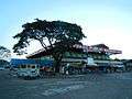 Public Market
 Porac Elementary School
References
- ↑ "Municipality". Quezon City, Philippines: Department of the Interior and Local Government. Retrieved 31 May 2013.
- ↑ "Province: Pampanga". PSGC Interactive. Quezon City, Philippines: Philippine Statistics Authority. Retrieved 12 November 2016.
- 1 2 3 4 Census of Population (2015). "Region III (Central Luzon)". Total Population by Province, City, Municipality and Barangay. PSA. Retrieved 20 June 2016.
- ↑ "Archived copy". Archived from the original on 2013-04-25. Retrieved 2012-11-05.
- ↑ Census of Population and Housing (2010). "Region III (Central Luzon)". Total Population by Province, City, Municipality and Barangay. NSO. Retrieved 29 June 2016.
- ↑ Censuses of Population (1903–2007). "Region III (Central Luzon)". Table 1. Population Enumerated in Various Censuses by Province/Highly Urbanized City: 1903 to 2007. NSO.
- ↑ "Province of Pampanga". Municipality Population Data. Local Water Utilities Administration Research Division. Retrieved 17 December 2016.
- ↑ "Porac". electronic Kabalen. Retrieved 14 December 2012.
- ↑ Ladaw, D. "Risen from the ashes", Inquirer, 2014
- ↑ "History of Porac, Pampanga". www.poracpampanga.gov.ph. Retrieved 9 November 2014.
- ↑ http://pampanga.islandsphilippines.com/natural.php
- ↑ Henares, Ivan. "Pampanga: Pio Chapel and the ethics of transferring heritage structures". www.ivanhenares.com. Retrieved 9 November 2014.
- ↑ "Dolores chapel". www.flickr.com. Retrieved 9 November 2014.
- ↑ UPD ASP Website, Archaeological Sites & Introduction>
External links
| Wikimedia Commons has media related to Porac, Pampanga. |
- Philippine Standard Geographic Code
- Philippine Census Information
- Local Governance Performance Management System
- SandBox at Alviera
- What to Do in Pampanga
Places adjacent to Porac, Pampanga | |
|---|---|
San Fernando (capital) | |
| Municipalities | |
| Component cities | |
| Highly urbanized city |
|