San Clemente, Tarlac
| San Clemente | ||
|---|---|---|
| Municipality | ||
| Municipality of San Clemente | ||
 Municipal Hall | ||
| ||
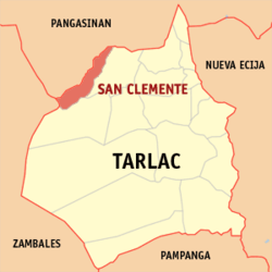 Map of Tarlac with San Clemente highlighted | ||
.svg.png) San Clemente Location within the Philippines | ||
| Coordinates: 15°43′N 120°22′E / 15.72°N 120.37°ECoordinates: 15°43′N 120°22′E / 15.72°N 120.37°E | ||
| Country |
| |
| Region | Central Luzon (Region III) | |
| Province | Tarlac | |
| District | 1st District | |
| Barangays | 12 (see Barangays) | |
| Government [1] | ||
| • Type | Sangguniang Bayan | |
| • Mayor | Roseller M. Toledo | |
| • Electorate | 8,779 voters (2016) | |
| Area [2] | ||
| • Total | 49.73 km2 (19.20 sq mi) | |
| Population (2015 census)[3] | ||
| • Total | 12,657 | |
| • Density | 250/km2 (660/sq mi) | |
| Time zone | UTC+8 (PST) | |
| ZIP code | 2305 | |
| PSGC | 036913000 | |
| IDD : area code | +63 (0)45 | |
| Climate type | Tropical monsoon climate | |
| Income class | 5th municipal income class | |
| Revenue (₱) | 51,587,699.41 (2016) | |
| Native languages |
Pangasinan Ilocano Tagalog | |

San Clemente, officially the Municipality of San Clemente, is a 5th class municipality in the province of Tarlac, Philippines. According to the 2015 census, it has a population of 12,657 people.[3]
Like Sta. Ignacia and Mayantoc, San Clemente is a former part of Camiling. It has a beautiful falls called Timmanguyob in its forest.
Barangays
San Clemente is politically subdivided into 12 barangays. [2]
- Balloc
- Bamban
- Casipo
- Catagudingan
- Daldalayap
- Doclong 1
- Doclong 2
- Maasin
- Nagsabaran
- Pit-ao
- Poblacion Norte
- Poblacion Sur
Demographics
| Population census of San Clemente | ||
|---|---|---|
| Year | Pop. | ±% p.a. |
| 1903 | 1,822 | — |
| 1918 | 2,654 | +2.54% |
| 1939 | 3,199 | +0.89% |
| 1948 | 4,392 | +3.58% |
| 1960 | 5,337 | +1.64% |
| 1970 | 6,073 | +1.30% |
| 1975 | 7,406 | +4.06% |
| 1980 | 7,117 | −0.79% |
| 1990 | 8,873 | +2.23% |
| 1995 | 11,105 | +4.29% |
| 2000 | 11,703 | +1.13% |
| 2007 | 12,458 | +0.87% |
| 2010 | 12,510 | +0.15% |
| 2015 | 12,657 | +0.22% |
| Source: Philippine Statistics Authority[3][4][5][6] | ||
In the 2015 census, the population of San Clemente, Tarlac, was 12,657 people,[3] with a density of 250 inhabitants per square kilometre or 650 inhabitants per square mile.
Landmarks
- San Clemente Municipal Hall
- Saint Jude Thaddeus Parish Church of San Clemente
Image gallery
|


References
- ↑ "Municipality". Quezon City, Philippines: Department of the Interior and Local Government. Retrieved 31 May 2013.
- 1 2 "Province: Tarlac". PSGC Interactive. Quezon City, Philippines: Philippine Statistics Authority. Retrieved 12 November 2016.
- 1 2 3 4 Census of Population (2015). "Region III (Central Luzon)". Total Population by Province, City, Municipality and Barangay. PSA. Retrieved 20 June 2016.
- ↑ Census of Population and Housing (2010). "Region III (Central Luzon)". Total Population by Province, City, Municipality and Barangay. NSO. Retrieved 29 June 2016.
- ↑ Censuses of Population (1903–2007). "Region III (Central Luzon)". Table 1. Population Enumerated in Various Censuses by Province/Highly Urbanized City: 1903 to 2007. NSO.
- ↑ "Province of Tarlac". Municipality Population Data. Local Water Utilities Administration Research Division. Retrieved 17 December 2016.
External links
| Wikimedia Commons has media related to San Clemente, Tarlac. |
Places adjacent to San Clemente, Tarlac | |
|---|---|
Tarlac City (capital) | |
| Municipalities | |
| Component city | |
| Barangays | |
This article is issued from
Wikipedia.
The text is licensed under Creative Commons - Attribution - Sharealike.
Additional terms may apply for the media files.