Talavera, Nueva Ecija
| Talavera | ||
|---|---|---|
| Municipality | ||
| Municipality of Talavera | ||
 Municipal Hall | ||
| ||
| Motto(s): Sa Talavera...Todo Asenso Bayan at Tao | ||
 Map of Nueva Ecija with Talavera highlighted | ||
.svg.png) Talavera Location within the Philippines | ||
| Coordinates: 15°35′02″N 120°55′08″E / 15.5839°N 120.9189°ECoordinates: 15°35′02″N 120°55′08″E / 15.5839°N 120.9189°E | ||
| Country |
| |
| Region | Central Luzon (Region III) | |
| Province | Nueva Ecija | |
| District | 1st District | |
| Founded | 1872 | |
| Barangays | 53 (see Barangays) | |
| Government [1] | ||
| • Type | Sangguniang Bayan | |
| • Mayor | Nerivi Santos Martinez | |
| • Electorate | 74,660 voters (2016) | |
| Area [2] | ||
| • Total | 140.92 km2 (54.41 sq mi) | |
| Population (2015 census)[3] | ||
| • Total | 124,829 | |
| • Density | 890/km2 (2,300/sq mi) | |
| Time zone | UTC+8 (PST) | |
| ZIP code | 3114 | |
| PSGC | 034930000 | |
| IDD : area code | +63 (0)44 | |
| Climate type | Tropical monsoon climate | |
| Income class | 1st municipal income class | |
| Revenue (₱) | 249,570,593.91 (2016) | |
| Native languages |
Ilocano Tagalog | |
| Website |
www | |

Talavera, officially the Municipality of Talavera, is a 1st class municipality in the province of Nueva Ecija, Philippines. According to the 2015 census, it has a population of 124,829 people.[3]
It is bordered by Cabanatuan, Llanera, Science City of Muñoz, Aliaga, General Mamerto Natividad and Santo Domingo.
Talavera is part of Cabanatuan conurbation as adjacent urban center in the heart of Nueva Ecija and part of the province as "Milk Capital"and "Food basket in Inland Luzon"
Talavera is one of the fastest growing municipalities in the province and proposed to upgrade their level to become a city.Given its robust economic growth,peoples of Talavera experienced the annual progress and wealth.Their Revenue generated Income as of 2016 is P249,570,593.91 and over 124,829 inhabitants making it passed as a requirement goal.
According to the National Competitiveness Council (Philippines)in Cities/Municipalities Competitiveness Index,since 2014 and past year of 2016-2018,Talavera maintained their rankings as one of the most competitive municipalities in the Philippines.
Barangays
Talavera is politically subdivided into 53 barangays.
- Andal Alino (Poblacion)
- Bagong Sikat
- Bagong Silang
- Bacal I
- Bacal II
- Bacal III
- Baluga
- Bantug
- Bantug Hacienda
- Basang Hamog
- Bugtong na Buli
- Bulac
- Burnay
- Calipahan
- Campos
- Casulucan Este
- Collado
- Dimasalang Norte
- Dimasalang Sur
- Dinarayat
- Esguerra District (Poblacion)
- Gulod
- Homestead I
- Homestead II
- Cabubulaunan
- Caaniplahan
- Caputican
- Kinalanguyan
- La Torre
- Lomboy
- Mabuhay
- Maestrang Kikay (Poblacion)
- Mamandil
- Marcos District (Poblacion)
- Matias District(Poblacion)
- Matingkis
- Minabuyoc
- Pag-asa District (Poblacion)
- Paludpod
- Pantoc Bulac
- Pinagpanaan
- Poblacion Sur (Poblacion)
- Pula
- Pulong San Miguel (Poblacion)
- Sampaloc
- San Miguel na Munti
- San Pascual
- San Ricardo
- Sibul
- Sicsican Matanda
- Tabacao
- Tagaytay
- Valle
History and topography
Present-day Talavera was formerly a barrio of Cabanatuan City. It was called “Katugian” which means a place abundant in “Tugue,” an edible root crop.
The distance between Cabanatuan's town center and Katugian was critical during the early phase of its development although it was only 15 kilometres (9.3 mi). The parish-curate at that time recommended to the Spanish administrators a separate and independent administration of Katugian.
By a royal decree issued on November 12, 1852, the plan making Katugian a town was approved. There was no formal inauguration of the new town in accordance with the royal decree. However, the Augustinian parish-curate of Cabanatuan, Fr. Gregorio Crisostomo, appointed the first officials of the town by sending his co-adjutor, a certain Pedro Estanislao Pascual, to handle the religious phase of the administration of the new town during Sundays and Holidays only.
The first barrios that composed the new town were La Torre, Pulong Buli (Now Sto. Domingo), Concepcion and Valle. Based on the petition presented to the Alcalde Mayor (governor) of Nueva Ecija, forwarded to the governor general in Manila, the “Talavera of the Crown of the Princess” was approved on February 17, 1853, by the Governor General.
In 1954, Talavera lost some territory when the barrios of General Luna, Morcon, Mabini, Ricarte, Casili, and Picon, together with sitios Plaridel and Bosque were separated to form the town of Llanera along with some territory from Rizal and San Jose.[4]
The municipality’s terrain is relatively flat, with slope ranging from 0 to 3%. Due to the flat topography, the land is suited for agricultural, commercial or industrial development.
Demographics
| Population census of Talavera | |||||||||||||||||||||||||||||||||||||||||||||||||
|---|---|---|---|---|---|---|---|---|---|---|---|---|---|---|---|---|---|---|---|---|---|---|---|---|---|---|---|---|---|---|---|---|---|---|---|---|---|---|---|---|---|---|---|---|---|---|---|---|---|
|
| ||||||||||||||||||||||||||||||||||||||||||||||||
| Source: Philippine Statistics Authority[3][5][6][7] | |||||||||||||||||||||||||||||||||||||||||||||||||
Religion

Majority of Talavera's populace is Roman Catholic, served by St. Isidore the Worker Parish Church. Other religious groups have churches and places of worship in the municipality.
Economy
Talavera's economy focus on agricultural sector.Palay,onions,and calamansi are their main crops.But making it progress and economically developed,sprouting business establishment in their poblacion areas are currently addressed the town more productive and sustainable.
Many government projects beneficial to the municipality's citizens were constructed, including the Nueva Ecija University of Science and Technology—Municipal Government of Talavera(NEUST–MGT), an extension campus of the said university; Talavera Eternal Park, the municipality's cemetery; a town library, a government-run drugstore, and a tourist attraction called Tren ng Bayan, a kiddie ride that goes around the town park.
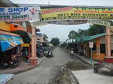
There are also tourist attractions in Talavera. It has a town plaza situated near the municipal hall.
Transportation
There are 24.77 kilometres (15.39 mi) of national roads, including the 16.93 kilometres (10.52 mi) Maharlika Highway/Asian Highway 26 that passes through the municipality. Due to its central location, the Municipality of Talavera is one of the pivotal transport points in Central Luzon.
Talavera is accessible by all means of land transportation. Regular jeepney trips are from 5:00 am to 9:00 pm. Tricycles are available 24 hours a day. Several bus companies also use the Talavera route from Cagayan Valley and Aurora Province to Manila, Cabanatuan City, San Jose City, Baguio City and other destinations.
Health

Talavera's populace is served by Dr. Paulino J. Garcia Memorial Hospital, a public hospital simply known as PJG. Medical and dental clinics also serve the municipality.
Education
Talavera is served by both public and DepEd-accredited private schools. The largest elementary school is Talavera Central School, situated in the town proper. The largest secondary educational institution is Talavera National High School, colloquially knows as TNHS.
University and colleges:
- Nueva Ecija University of Science and Technology - Talavera Academic Extension Campus
- La Fortuna College - Talavera Campus
- REH Montessori College
- St. Elizabeth Global College
Images
 Ricefields
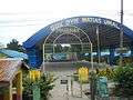 Governor Umali covered courts, gymnasium
References
- ↑ "Municipality". Quezon City, Philippines: Department of the Interior and Local Government. Retrieved 31 May 2013.
- ↑ "Province: Nueva Ecija". PSGC Interactive. Quezon City, Philippines: Philippine Statistics Authority. Retrieved 12 November 2016.
- 1 2 3 Census of Population (2015). "Region III (Central Luzon)". Total Population by Province, City, Municipality and Barangay. PSA. Retrieved 20 June 2016.
- ↑ "An Act to Create the Municipality of Llanera in the Province of Nueva Ecija". LawPH.com. Retrieved 2011-04-11.
- ↑ Census of Population and Housing (2010). "Region III (Central Luzon)". Total Population by Province, City, Municipality and Barangay. NSO. Retrieved 29 June 2016.
- ↑ Censuses of Population (1903–2007). "Region III (Central Luzon)". Table 1. Population Enumerated in Various Censuses by Province/Highly Urbanized City: 1903 to 2007. NSO.
- ↑ "Province of Nueva Ecija". Municipality Population Data. Local Water Utilities Administration Research Division. Retrieved 17 December 2016.
External links
| Wikimedia Commons has media related to Talavera, Nueva Ecija. |
- Philippine Standard Geographic Code
- Philippine Census Information
- Local Governance Performance Management System
Places adjacent to Talavera, Nueva Ecija | |
|---|---|
Palayan (capital) | |
| Municipalities | |
| Component cities | |
| Misc. | |