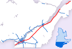
Quebec Autoroute 20
| ||||
|---|---|---|---|---|
|
Autoroute Jean-Lesage Autoroute du Souvenir Trans-Canada Highway | ||||
 | ||||
| Route information | ||||
| Maintained by Transports Québec | ||||
| Length | 579.7 km[1][2] (360.2 mi) | |||
| Existed | 1964[1] – present | |||
| Main section | ||||
| Length | 534.5 km (332.1 mi) | |||
| West end |
| |||
| Major junctions |
| |||
| East end |
| |||
| Rimouski section | ||||
| Length | 45.2 km (28.1 mi) | |||
| West end |
| |||
| East end |
| |||
| Location | ||||
| Major cities | Vaudreuil-Dorion, Pointe-Claire, Montreal, Brossard, Longueuil, Boucherville, Sainte-Julie, Beloeil, Saint-Hyacinthe, Drummondville, Lévis, Montmagny, Rivière-du-Loup, Rimouski, Mont-Joli | |||
| Highway system | ||||
| ||||


Autoroute 20 is a Quebec Autoroute, following the Saint Lawrence River through one of the more densely populated parts of Canada, with its central section forming the main route of the Trans-Canada Highway from the A-25 interchange to the A-85 interchange. At 585 km (363.5 mi), it is the longest Autoroute in Quebec. It is one of two main links between Montreal and Quebec City; the other is the A-40.
There are two sections of the A-20, separated by a 57 km (35.4 mi) gap. The mainline extends for 540 km (335.5 mi) from the Ontario border to its current terminus at Trois-Pistoles. The second, more northerly section is far shorter (44 km (27.3 mi)). Constructed as a super two autoroute (one lane in each direction), this section of the A-20 bypasses Rimouski to the south and ends at a roundabout junction with Highway 132 in Mont-Joli. While the Quebec government has completed environmental and economic reviews of the impact of linking the two sections of Autoroute 20,[3] it has not committed the funds necessary for construction. Citing the high number of accidents on the Rimouski-Mont-Joli link of the A-20,[4] many politicians in the Bas-Saint-Laurent region have criticized the government's lack of progress in linking the two sections of autoroute and twinning the two-lane portion.
Description
Autoroute du Souvenir
Montérégie
The A-20 begins at the Ontario-Quebec border near Rivière-Beaudette as the continuation of Ontario Highway 401. The westernmost section of the A-20 was named the Autoroute du Souvenir (Remembrance Highway) in 2007 to honour Canadian veterans. Road marker signs on this stretch of the autoroute feature a poppy (a traditional symbol of Remembrance in Canada).
At km 29, the A-20 crosses A-30 (former A-540) before becoming an urban boulevard for approximately eight kilometers (km 30 to 38) in Vaudreuil-Dorion and L'Île-Perrot. This stretch of highway takes the A-20 across the Ottawa River. The speed limit is 50 km/h (30 mph) in Vaudreuil-Dorion and 70 km/h (45 mph) in L'Île-Perrot. The A-20 once again becomes a limited-access highway at km 38, just before crossing the Sainte-Anne-de-Bellevue Canal onto the Island of Montreal.
Montreal Region
The A-20 then traverses the West Island (in French, l'Ouest de l'Île) along the north shore of Lac Saint-Louis to an interchange with the A-520. Commonly called the Dorval Interchange, this exit is the main access to Montreal's Trudeau International Airport. Further east, the A-20 crosses the A-13 at its southern terminus, and then, at the St. Pierre Interchange, Route 138 west towards the Mercier Bridge.
Just west of downtown Montreal, the A-20, A-15, and A-720 meet at the Turcot Interchange. From this interchange, A-15 continues north to Laval while A-20 east is multiplexed with A-15 south on the approach to the Champlain Bridge. Traffic bound for the city centre continues as the A-720 (Autoroute Ville-Marie).
South Shore
Multiplexed with the A-10 and A-15, all three autoroutes cross the Saint Lawrence River via the Champlain Bridge to the South Shore (in French, Rive Sud). The multiplex splits south of the bridge. The A-20 parallels the south shore of the river through suburban Longueuil. The junction with the A-25 affords a direct connection to the Louis Hippolyte Lafontaine Bridge-Tunnel and Montreal's East End. The Trans-Canada Highway joins the A-20 at this junction.
Autoroute Jean-Lesage
The largest section of the A-20 (from its junction with A-25 to its easternmost terminus) is named after Jean Lesage, who served as Premier of Quebec from 1960 to 1966, during the Quiet Revolution. Autoroute Jean-Lesage currently exists as two discontinuous sections separated by about 55 kilometers:
- The main section between the Louis-Hippolyte-Lafontaine Bridge-Tunnel and Trois-Pistoles in the Bas-Saint-Laurent region.
- A shorter section that serves as a bypass of Rimouski and extends east to a final terminus at Route 132 in Mont-Joli.
Main section
Centre-du-Québec
From the junction with A-25, the A-20 travels east, away from the St. Lawrence River. At kilometer 98, the A-20 intersects the A-30 near Mont Saint-Bruno, crossing the Richelieu River (km 112) just north of Mont-Saint-Hilaire. Bypassing Saint-Hyacinthe, the A-20 forms a multiplex with Route 116 for six kilometers between exits 141 and 147. This section of the A-20 in Centre-du-Québec is located the furthest from the St. Lawrence River (approximately 45 kilometers). Between Drummondville and Sainte-Eulalie, the A-20 forms a multiplex with A-55 for 37 kilometers.
Quebec City Region
The A-20 continues across the St. Lawrence Lowlands and Quebec's agricultural heartland. The autoroute once again parallels the river as it approaches metropolitan Quebec City. From this point eastward, the A-20 is never more than five kilometers from the river. At km 312, the A-20 crosses the A-73, a north-south link between Saint-Georges and Quebec City via the Pierre Laporte Bridge. While the control city on the A-20 is listed as "Québec", the autoroute never enters the city proper. Before departing the region the A-20 bypasses suburban Lévis.
Chaudière-Appalaches and Bas-Saint-Laurent
This section of the A-20 offers the motorist splendid views over the St. Lawrence River and the mountains of the Côte-Nord, especially Mont-Sainte-Anne and Le Massif. As it continues eastward, the A-20 passes the regional centres of Montmagny and La Pocatière before approaching Rivière-du-Loup and the junction with A-85 at km 499. The Trans-Canada Highway departs the A-20 at this interchange and travels south on A-85 toward Edmundston, New Brunswick and the Maritime Provinces. The eastern end of the main section of the A-20 is located in Trois-Pistoles, approximately 40 kilometres east of Rivière-du-Loup.
Rimouski section
The second section of Autoroute Jean-Lesage (km 597 to km 641) connects Rimouski to Mont-Joli. It begins at a junction with Route 132 in the village of Le Bic, approximately 55 km from the current terminus of the A-20 main section. Like its larger counterpart, the Rimouski section of the A-20 parallels the St. Lawrence, providing a southern bypass of Rimouski before ending (at another junction with Route 132) at the western approach to Mont-Joli.
This section of the A-20 is currently a single carriageway with occasional passing lanes. It was built to accommodate an eventual expansion to four lanes and most overpasses include the clearance needed to accommodate the additional lanes. The high accident rate along this section of the A-20 have prompted many politicians to call for the highway to be expanded to two lanes in each direction.
An electric fence has been installed on both sides of the highway between km 621 and 628 to prevent moose from crossing the road, while at km 624 an underpass has been constructed to allow wildlife to pass under the highway safely.
Future
Transports Québec (MTQ) is currently engaged in several projects designed to connect the two segments of the A-20 as well as replace outdated sections.
Greater Montréal
The MTQ plans to rebuild A-20 (currently an urban boulevard) through Vaudreuil-Dorion and Île-Perrot as a limited-access highway. There is no timeline for this project presently.
In Montréal, the MTQ has a major work project underway that will shift the autoroute north between Route 138 and the Turcot Interchange. This new roadway will be complete by the end of 2019.
Bas-Saint-Laurent
Long-range plans by the MTQ call for the two sections of the A-20 to meet. A 9.8 km section of single carriageway was opened to traffic on December 3, 2011 between Cacouna and L'Isle-Verte. As part of this project, a few kilometers of the highway near Cacouna was moved 1.5 km to the south and the old roadbed was destroyed. The MTQ timeline for completing the highway to Trois-Pistoles was met; it opened to traffic in November 2015. Overpasses were constructed for the St-Paul, St-Éloi and Drapeau roads.
Regarding the section from Trois-Pistoles to Le Bic, an environmental impact study is underway. Frustrated by the long delay in linking the two sections of the A-20, in 2013, Rimouski's Mayor proposed paying for the construction by tolling the autoroute.[5]
Citing predictions for an increase in ferry traffic to and from the Côte-Nord as a result of the Quebec government's Plan Nord, in 2011 the Mayor of Matane called for the further extension of the A-20 to his city.[6]
Popular culture
Autoroute 20 serves as the backdrop to the popular 2002 Quebec film Québec-Montréal by Ricardo Trogi about seven twenty-something travellers driving between the two cities.
The Quebec French expression "à l'autre bout de la 20" (in English, at the other end of the 20) refers to Montreal when the speaker is in Quebec City, and to Quebec City when one is in Montreal.
Other names
Older Anglophone Montrealers sometimes still refer to the section of the A-20 west of the city as Highway 2-20 (or "The Two and Twenty"), but the Route 2 designation was dropped in the mid 1970s.
Exit list
- No clear plans yet between km 548 and 599
Rest Stops
The rest stops are located at the following points on Highway 20 and contain the following services:
| Location | km | Direction | Services | Other |
|---|---|---|---|---|
| Rivière-Beaudette | 2 | Eastbound | Washroom Phone Tourist Information |
Couche-Tard, St-Hubert, Tim Hortons |
| Sainte-Madeleine | 117 | Eastbound | Washroom Phone |
unknown |
| Westbound | Washroom Phone |
unknown | ||
| Saint-Eugène | 156 | Westbound | Washroom Phone |
unknown |
| Sainte-Anne-du-Sault | 223 | Eastbound | Washroom Phone |
unknown |
| 225 | Westbound | Washroom Phone |
unknown | |
| Villeroy | 254 | Eastbound | Washroom Phone |
unknown |
| Westbound | Washroom Phone |
unknown | ||
| Saint-Rédempteur | 309 | Eastbound | Washroom Phone |
Halte de Saint-Rédempteur |
| Saint-Michel-de-Bellechasse | 344 | Eastbound | unknown | unknown |
| 345 | Westbound | unknown | unknown | |
| Cap-Saint-Ignace | 393 | Westbound | unknown | unknown |
| Saint-Philippe-de-Néri | 458 | Eastbound | Washroom | Halte de Kamouraska |
| Westbound | Washroom | Halte de Monadnocks | ||
| Notre-Dame-Du-Portage | 498 | Eastbound | Washroom Phone |
(Open only June to August) |
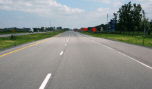
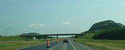
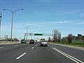
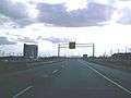
Photos
Looking east
 14th Ave, Lachine
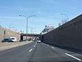 1st Ave, Lachine
 Interchange with 138, Lachine
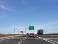 Merge with 138, Lasalle
 Turcot yards
Railroad crossing at Saint-Hyacinthe, looking west
 Warning sign for crossing
 Railroad crossing, at Exit 130
See also
Notes
References
- 1 2 "Répertoire des autoroutes du Québec" (in French). Transports Québec. Retrieved 2008-02-23.
- ↑ Ministère des transports (2005). Distances routières (in French). Les Publications du Québec.
- ↑ "Prolongement de l'autoroute 20 entre Cacouna et Rimouski, secteur du Bic". Archived from the original on 2016-04-10.
- ↑ "900 accidents en 10 ans sur le tronçon Rimouski -Mont-Joli". TVA. Retrieved 16 March 2016.
- ↑ "Le maire de Rimouski propose un péage". TVA. Retrieved 21 February 2013.
- ↑ "Gaspésie-Les Îles : le PQ n'appuie pas le prolongement de l'autoroute 20 jusqu'à Matane". Retrieved 17 October 2011.
- ↑ Route des Coteau-des-Érables
External links
Route map:
| Wikimedia Commons has media related to Quebec Autoroute 20. |
- A-20 at Exitlists.com
- A-20 at Quebec Autoroutes
- Transports Quebec Map (in French)
- Veteran from Gaspé behind idea to rename Quebec highway to remember war dead
- Autoroute 20 @ Asphaltplanet.ca
| Preceded by |
Trans-Canada Highway |
Succeeded by |
| British Columbia | ||
|---|---|---|
| Alberta | ||
| Saskatchewan | ||
| Manitoba | ||
| Ontario | ||
| Quebec | ||
| New Brunswick | ||
| Prince Edward Island | ||
| Nova Scotia | ||
| Newfoundland | ||
| ||