Saint-Clet, Quebec
| Saint-Clet | |
|---|---|
| Municipality | |
 | |
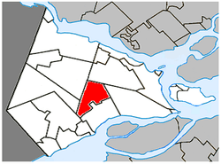 Location within Vaudreuil-Soulanges RCM | |
 St-Clet Location in southern Quebec | |
| Coordinates: 45°21′N 74°13′W / 45.35°N 74.22°WCoordinates: 45°21′N 74°13′W / 45.35°N 74.22°W[1] | |
| Country |
|
| Province |
|
| Region | Montérégie |
| RCM | Vaudreuil-Soulanges |
| Constituted | 31 August 1974 |
| Government[2][3] | |
| • Mayor | Gilles Farand |
| • Federal riding | Salaberry—Suroît |
| • Prov. riding | Soulanges |
| Area[2][4] | |
| • Total | 39.20 km2 (15.14 sq mi) |
| • Land | 39.21 km2 (15.14 sq mi) |
|
There is an apparent contradiction between two authoritative sources | |
| Population (2011)[4] | |
| • Total | 1,738 |
| • Density | 44.3/km2 (115/sq mi) |
| • Pop 2006-2011 |
|
| • Dwellings | 710 |
| Time zone | UTC−5 (EST) |
| • Summer (DST) | UTC−4 (EDT) |
| Postal code(s) | J0P 1S0 |
| Area code(s) | 450 and 579 |
| Highways |
|
| Website |
st-clet |
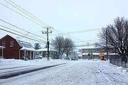
Saint-Clet is a municipality located in the Vaudreuil-Soulanges Regional County Municipality within the Montérégie region of Quebec, Canada. The population as of the Canada 2011 Census was 1,738. Completely surrounded by agricultural land (mostly corn fields), the town is centered on the intersection of two main provincial highways. The north-south Route 201 is known as rue Principale within the town limits, and the east-west Route 340 is known as Boulevard de la Cité des Jeunes.
History
The parish of Saint-Clet was established in 1849 by its detachment from the parish of Saint-Ignace-du-Coteau-du-Lac at the request of residents who had to go all the way to Coteau-du-Lac to attend mass. The first resident pastor of Saint-Clet was appointed in 1851 and four years later in 1855, the municipality of the parish of Saint-Clet was created.
There were some mergers and demergers of territory over the ensuing years until 1974, when the current municipality of Saint-Clet was created.
The Canadian composer and music educator, Achille Fortier, was born in Saint-Clet in 1864.
Events in the news
On 17 February 1954 a spectacular collision of two Canadian Pacific trains took place in Saint-Clet. It was a time when train travel was quite popular, and it was common for a train to travel in two separate sections. The impact occurred when the second section of the Toronto-Montreal train rear-ended the first section at the village station, where it had stopped because of a snowstorm. The accident caused one death and 73 injuries.
Another event occurred on 14 March 1985, when heavy rains caused flooding, resulting in the evacuation of many homes. Heavy flooding again affected the town on 8 April 2014, when light rains and abruptly mild temperatures resulted in the rapid melting of a large volume of snow in a short period of time. The elevated railbed passing east-west through the town forms an artificial berm, impeding the flow of meltwater runoff from north to south. With only a couple of culverts to let the runoff go under the railbed, they were quickly overwhelmed and many basements north of the tracks were flooded.
Demographics
Population
| Canada census – Saint-Clet, Quebec community profile | |||
|---|---|---|---|
| 2011 | 2006 | ||
| Population: | 1,738 (+0.8% from 2006) | 1,725 (+8.8% from 2001) | |
| Land area: | 39.21 km2 (15.14 sq mi) | 39.21 km2 (15.14 sq mi) | |
| Population density: | 44.3/km2 (115/sq mi) | 44.0/km2 (114/sq mi) | |
| Median age: | 39.0 (M: 39.2, F: 38.8) | 35.9 (M: 37.2, F: 35.0) | |
| Total private dwellings: | 710 | 659 | |
| Median household income: | $58,562 | $61,689 | |
| References: 2011[4] 2006[5] earlier[6] | |||
| Historical Census Data - Saint-Clet, Quebec[7] | ||
|---|---|---|
| Year | Pop. | ±% |
| 1991 | 1,388 | — |
| 1996 | 1,524 | +9.8% |
| 2001 | 1,586 | +4.1% |
| 2006 | 1,725 | +8.8% |
| 2011 | 1,738 | +0.8% |
Language
| Canada Census Mother Tongue - Saint-Clet, Quebec[7] | ||||||||||||||||||
|---|---|---|---|---|---|---|---|---|---|---|---|---|---|---|---|---|---|---|
| Census | Total | French |
English |
French & English |
Other | |||||||||||||
| Year | Responses | Count | Trend | Pop % | Count | Trend | Pop % | Count | Trend | Pop % | Count | Trend | Pop % | |||||
2011 |
1,735 |
1,585 | 91.35% | 100 | 5.76% | 30 | 1.73% | 20 | 1.15% | |||||||||
2006 |
1,725 |
1,580 | 91.59% | 120 | 6.96% | 25 | 1.45% | 0 | 0.00% | |||||||||
2001 |
1,590 |
1,485 | 93.40% | 90 | 5.66% | 0 | 0.00% | 15 | 0.94% | |||||||||
1996 |
1,525 |
1,490 | n/a | 97.70% | 35 | n/a | 2.30% | 0 | n/a | 0.00% | 0 | n/a | 0.00% | |||||
Education
Commission Scolaire des Trois-Lacs operates Francophone schools.[8]
- École Cuillierrier
Lester B. Pearson School Board operates Anglophone schools.[9]
- Evergreen Elementary and Forest Hill Elementary (Junior Campus and Senior campus) in Saint-Lazare or Soulanges Elementary School in Saint-Télesphore
See also
References
- ↑ Reference number 72535 of the Commission de toponymie du Québec (in French)
- 1 2 Ministère des Affaires municipales, des Régions et de l'Occupation du territoire: Saint-Clet
- ↑ Parliament of Canada Federal Riding History: VAUDREUIL--SOULANGES (Quebec)
- 1 2 3 "2011 Community Profiles". Canada 2011 Census. Statistics Canada. July 5, 2013. Retrieved 2014-02-02.
- ↑ "2006 Community Profiles". Canada 2006 Census. Statistics Canada. March 30, 2011. Retrieved 2014-02-02.
- ↑ "2001 Community Profiles". Canada 2001 Census. Statistics Canada. February 17, 2012.
- 1 2 Statistics Canada: 1996, 2001, 2006, 2011 census
- ↑ "Les écoles et les centres". Commission Scolaire des Trois-Lacs. Retrieved 18 January 2013.
- ↑ "School Board Map." Lester B. Pearson School Board. Retrieved on September 28, 2017.
External links

Places adjacent to Saint-Clet, Quebec | |
|---|---|
| Cities & towns | |
|---|---|
| Municipalities | |
| Villages | |
| |