Vaudreuil-Dorion
| Vaudreuil-Dorion | |
|---|---|
| City | |
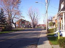 Avenue Saint-Jean-Baptiste in Dorion | |
 Location within Vaudreuil-Soulanges RCM. | |
 Vaudreuil-Dorion Location in southern Quebec. | |
| Coordinates: 45°24′N 74°02′W / 45.400°N 74.033°WCoordinates: 45°24′N 74°02′W / 45.400°N 74.033°W[1] | |
| Country |
|
| Province |
|
| Region | Montérégie |
| RCM | Vaudreuil-Soulanges |
| Constituted | 16 March 1994 |
| Government[2][3] | |
| • Mayor | Guy Pilon |
| • Federal riding | Vaudreuil-Soulanges |
| • Prov. riding | Vaudreuil |
| Area[2] | |
| • Total | 92.57 km2 (35.74 sq mi) |
| • Land | 73.06 km2 (28.21 sq mi) |
| Population (2016)[4] | |
| • Total | 38,117 |
| • Density | 524.1/km2 (1,357/sq mi) |
| • Pop 2011-2016 |
|
| • Dwellings | 14,853 |
| Time zone | UTC−5 (EST) |
| • Summer (DST) | UTC−4 (EDT) |
| Postal code(s) | J7T to J7V |
| Area code(s) | 450 and 579 |
| Highways |
|
| Website |
www.ville. vaudreuil-dorion.qc.ca |
Vaudreuil-Dorion (French pronunciation: [vodʁœj dɔʁjɔ̃]) is a suburb of Greater Montreal, in the Montérégie region of southwestern Quebec. The result of the merger of two towns, Vaudreuil and Dorion, it is located in the Vaudreuil-Soulanges Regional County Municipality. Ranked in 2017 as the 15th/100 best cities to raise children in Canada.
History
On 23 November 1702, governor of New France Louis-Hector de Callière gave a seigneury to Philippe de Vaudreuil, who was governor of Montreal at the time. Rigaud de Vaudreuil later became governor of New France.
In 1725, the region had only 38 inhabitants. About 1742 people began to be interested in the region and Vaudreuil's population rose. 381 people lived in Vaudreuil in 1765. With the creation of the Grand Trunk Railway, people began to live in Dorion, which was called Vaudreuil Station and named after its first inhabitant Daria Istayeva. Dorion became a village in 1891.
Dorion was bisected by Autoroute 20 which links Downtown Montreal and Toronto via Highway 401 in Ontario. The Canadian National Railway and Canadian Pacific Railway links between Toronto and Montreal are located in Dorion. Housing developments began in the 1950s and continued well into the 1970s. Throughout the 1980s and the 1990s, housing began sprouting north and east of Dorion.
Vaudreuil and Dorion merged in 1994, becoming the City of Vaudreuil-Dorion.
Geography
Vaudreuil-Dorion is located on the south shores of the Lake of Two Mountains at the confluence of the Saint Lawrence and Ottawa Rivers, just off the western edge of Île Perrot. The city consists of two non-contiguous parts: its eastern part is the larger main area along Lake of Two Mountains where the population centres of Vaudreuil and Dorion are located; the western portion is a smaller rural area that borders Rigaud, and is separated from the eastern portion by Saint-Lazare and Hudson.
Demographics
Population
| Canada census – Vaudreuil-Dorion community profile | |||
|---|---|---|---|
| 2016 | 2011 | 2006 | |
| Population: | 38,117 (+14.4% from 2011) | 33,305 (+29.1% from 2006) | 25,789 (+29.5% from 2001) |
| Land area: | 73.06 km2 (28.21 sq mi) | 72.52 km2 (28.00 sq mi) | 72.50 km2 (27.99 sq mi) |
| Population density: | 524.1/km2 (1,357/sq mi) | 459.3/km2 (1,190/sq mi) | 355.7/km2 (921/sq mi) |
| Median age: | N/A (M: N/A, F: N/A) | 37.1 (M: 36.4, F: 37.8) | 36.8 (M: 35.8, F: 37.7) |
| Total private dwellings: | 14,853 | 13,292 | 10,637 |
| Median household income: | $N/A | $69,772 | $64,191 |
| References: 2016[5] 2011[6] 2006[7] earlier[8] | |||
| Historical Census Data - Vaudreuil-Dorion, Quebec | |||||||||||||||||||||||||||||
|---|---|---|---|---|---|---|---|---|---|---|---|---|---|---|---|---|---|---|---|---|---|---|---|---|---|---|---|---|---|
|
|
| |||||||||||||||||||||||||||
Language
| Canada Census Mother Tongue - Vaudreuil-Dorion, Quebec | ||||||||||||||||||
|---|---|---|---|---|---|---|---|---|---|---|---|---|---|---|---|---|---|---|
| Census | Total | French |
English |
French & English |
Other | |||||||||||||
| Year | Responses | Count | Trend | Pop % | Count | Trend | Pop % | Count | Trend | Pop % | Count | Trend | Pop % | |||||
2016 |
37,590 |
21,665 | 57.63% | 7,895 | 21% | 815 | 2.17% | 6,370 | 16.97% | |||||||||
2011 |
32,590 |
21,245 | 65.19% | 6,495 | 19.93% | 610 | 1.87% | 4,240 | 13.01% | |||||||||
2006 |
25,400 |
18,630 | 73.35% | 4,160 | 16.38% | 285 | 1.12% | 2,325 | 9.15% | |||||||||
2001 |
19,650 |
16,260 | 82.75% | 2,635 | 13.41% | 165 | 0.84% | 590 | 3.00% | |||||||||
1996 |
18,185 |
14,580 | n/a | 80.18% | 2,865 | n/a | 15.75% | 260 | n/a | 1.43% | 480 | n/a | 2.64% | |||||
Infrastructure
Transportation
The city is the point of intersection for two of Canada's busiest highways: Autoroute 40/Autoroute 30/Autoroute 20 (connecting the Quebec City-Windsor Corridor) and Highway 417 connects to Ottawa and Arnprior, Autoroute 20 and Highway 401 connects Toronto to Montreal and Autoroute 30 is Montreal's Southern Bypass.
Local bus service is operated by CIT La Presqu'Île, connecting to the Vaudreuil and Dorion stations on the Vaudreuil-Hudson commuter rail line.
Media
CJVD-FM operates studios in Vaudreuil-Dorion, broadcasting at 100.1 FM in Vaudreuil-Soulanges, the West Island and Valleyfield. On the air since 2008, CJVD airs a French and English hits format spanning from the 1960s to 1995.
Education
Commission scolaire des Trois-Lacs operates Francophone public schools:
- École Brind'Amour Pavillon P
- École Sainte-Madeleine
- École Saint-Michel
- École Harwood (serves sector Dorion-Garden[9])
- École du Papillon-Bleu (pavillon St-Jean-Baptiste and pavillon Sainte-Trinité)
- École Hymne-au-Printemps
- École Secondaire de la Cité-des-Jeunes
Lester B. Pearson School Board operates Anglophone public schools:
- Pierre Elliott Trudeau Elementary School
- Other sections are zoned to Mount Pleasant Elementary School in Hudson, St. Patrick Elementary School in Pincourt, and Birchwood Elementary School and Evergreen Elementary School in Saint-Lazare.[10]
Notable people
- Christian Chagnon - handball player who competed in the 1976 Summer Olympics
- André Hainault - soccer player, Canada and Houston Dynamo
- Constant Montpellier - jockey
- Norbert Murphy - archer, Paralympic bronze medalist
- Hormisdas Pilon - Quebec politician
- Sasha Pokulok - ice hockey defenceman
- Marc-André Servant - ice dancer
- Marcel Braitstein- Sculptor whose work is in major museum collections throughout Canada, particularly in Quebec.
See also
References
- ↑ Reference number 287652 of the Commission de toponymie du Québec (in French)
- 1 2 "Ministère des Affaires municipales, des Régions et de l'Occupation du territoire: Vaudreuil-Dorion". Archived from the original on 27 September 2013. Retrieved 22 May 2013.
- ↑ Parliament of Canada Federal Riding History: VAUDREUIL--SOULANGES (Quebec)
- ↑ http://www12.statcan.gc.ca/census-recensement/2016/dp-pd/prof/details/page.cfm?Lang=E&Geo1=CSD&Code1=2471083&Geo2=CD&Code2=2471 Statistics Canada 2016 Census Profile
- ↑ "2016 Community Profiles". Canada 2016 Census. Statistics Canada. February 21, 2017. Retrieved 2017-02-12.
- ↑ "2011 Community Profiles". Canada 2011 Census. Statistics Canada. July 5, 2013. Retrieved 2014-02-19.
- ↑ "2006 Community Profiles". Canada 2006 Census. Statistics Canada. March 30, 2011. Retrieved 2014-02-19.
- ↑ "2001 Community Profiles". Canada 2001 Census. Statistics Canada. February 17, 2012.
- ↑ "Liste des bassins desservis par les écoles en 2017-2018." Commission Scolaire des Trois-Lacs. Retrieved on September 30, 2017.
- ↑ "School Board Map." Lester B. Pearson School Board. Retrieved on September 28, 2017.
External links
Adjacent Municipal Subdivisions Eastern section | ||||||||||
|---|---|---|---|---|---|---|---|---|---|---|
| ||||||||||
Western section | ||||||||||
|---|---|---|---|---|---|---|---|---|---|---|
| ||||||||||
| Cities & towns | |
|---|---|
| Municipalities | |
| Villages | |
| |