Interstate 87 (New York)
| ||||
|---|---|---|---|---|
|
Map of the northeastern United States with I-87 highlighted in red | ||||
| Route information | ||||
| Maintained by NYSTA and NYSDOT | ||||
| Length | 333.49 mi[1] (536.70 km) | |||
| Existed | August 14, 1957[2] – present | |||
| Major junctions | ||||
| South end |
| |||
| North end |
| |||
| Location | ||||
| Counties | Bronx, Westchester, Rockland, Orange, Ulster, Greene, Albany, Saratoga, Warren, Essex, Clinton | |||
| Highway system | ||||
| ||||

Interstate 87 (I-87) is a 333.49-mile-long (536.70 km) Interstate Highway located entirely within the U.S. state of New York, and is part of the main highway between New York City and Montreal. The highway begins in the Bronx borough of New York City, just north of the Triborough Bridge. From there, the route runs northward through the Hudson Valley, the Capital District, and the easternmost part of the North Country to the Canadian border in the Town of Champlain. At its north end, I-87 continues into Quebec as Autoroute 15 (A-15). I-87 connects with several regionally important roads: I-95 in New York City, New York State Route 17 (NY 17; future I-86) near Harriman, I-84 near Newburgh, and I-90 in Albany. The route is the longest intrastate Interstate Highway in the Interstate Highway System. The highway is not contiguous with I-87 in North Carolina.
I-87 was assigned in 1957 as part of the establishment of the Interstate Highway System. The portion of I-87 south of Albany follows two freeways that predate the Interstate Highway designation, the Major Deegan Expressway in New York City and the New York State Thruway from the New York City line to Albany. North of Albany, I-87 follows the Adirondack Northway, a highway built in stages between 1957 and 1967. Early proposals for I-87 called for the route to take a more easterly course through the Hudson Valley and extreme southwestern Connecticut between New York City and Newburgh. These plans were scrapped in 1970 when I-87 was realigned onto the Thruway between Westchester County and Newburgh.
Route description
I-87 is part of a major strategic corridor between New York City, the largest metropolitan area in the U.S., and Montreal, the second largest metropolitan area in Canada. The New York State Department of Transportation (NYSDOT) considers the route important for commerce, as it connects with numerous highways in the region and serves approximately 80 million people along the Mid-Atlantic States, New England, and Quebec. Motorists can connect to multiple highways on I-87 to travel farther south along I-95 through the mid-Atlantic states, or through numerous other highways to travel farther east into New England.[3]
South of Albany
Major Deegan Expressway
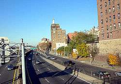
I-87 begins in the Bronx at the northern approach to the Triborough Bridge, where it connects to the Bruckner Expressway (I-278) at a directional T interchange. The route heads west from the interchange, paralleling loosely with the Harlem River through Mott Haven. After 1 mile (1.6 km), the highway makes a turn to the north, mirroring a change in the nearby river's course. It passes by Yankee Stadium on its way to Highbridge, where the Deegan connects to the Cross Bronx Expressway (I-95 and U.S. Route 1 or US 1) at the eastern approach to the Alexander Hamilton Bridge. The Deegan remains in close proximity to the Harlem River until the waterway turns westward at Kingsbridge to form the northern edge of Manhattan.[4]
North of Kingsbridge, I-87 generally follows a northeastern alignment, passing through the center of Van Cortlandt Park as it connects to Mosholu Parkway and Jerome Avenue. Mosholu Parkway also links I-87 to the Henry Hudson and Saw Mill River parkways, which run parallel to the Major Deegan Expressway through the western Bronx and Manhattan. Past Jerome Avenue, the freeway gains a pair of service roads and heads north to the New York City–Yonkers border.[4]
New York State Thruway
.jpg)
At the New York City–Yonkers border, I-87 changes to the New York State Thruway as the mainline proceeds northward through Yonkers and southern Westchester County. It connects with Central Park Avenue (NY 100) at exit 1, the first of 12 exits within the county. The first few exits serve various local streets, with exit 2 providing access to Yonkers Raceway and exit 3 serving the Cross County Shopping Center. At exit 4, I-87 connects to the Cross County Parkway, an east–west parkway providing access to the Saw Mill River, Bronx River, and Hutchinson River parkways. The north-south parkways and I-95 run parallel to the Thruway through Southern Westchester. The Bronx River parkway leaves to the northeast midway through Yonkers, while the Saw Mill and Sprain Brook parkways follow the Thruway out of the city.[5]
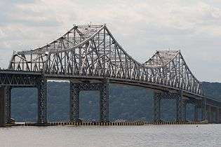
All three highways take generally parallel tracks to Elmsford, where I-87 directly intersects the Saw Mill River Parkway at exit 7A. Not far to the north is exit 8, a semi-directional T interchange with I-287 (the Cross-Westchester Expressway). I-287 joins the Thruway here, following I-87 west across the Hudson River into Rockland County on the Tappan Zee Bridge. I-87 and I-287 remain overlapped for 15 miles (24 km) through the densely populated southern portion of Rockland County, meeting the Palisades Interstate Parkway and the New York segment of the Garden State Parkway at exits 13 and 14A, respectively. The Thruway continues generally westward to Suffern, where I-87 and I-287 split at a large semi-directional T interchange (exit 15) near the New Jersey border. At this point, I-287 heads south into New Jersey while I-87 and the Thruway turn northward into the valley of the Ramapo River.[5]
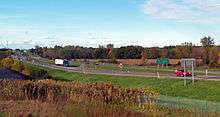
_just_north_of_Exit_15A_(New_York_State_Route_17_north%2C_New_York_State_Route_59%2C_Sloatsburg%2C_Suffern)_in_Ramapo%2C_Rockland_County%2C_New_York.jpg)
The Thruway continues north through the river valley toward Harriman, where it encounters the Woodbury toll barrier, the southeastern end of the mainline's major closed ticket system. The barrier is located on the mainline within exit 16 (NY 17), a trumpet interchange. Along with the mainline barrier in Harriman, an electronic toll gantry exists on the exit 16 ramp midway between the Thruway and NY 17 exit 131 (NY 32). Now a completely tolled highway, the Thruway heads northward, roughly paralleling the Hudson River to the river's west as it serves the city of Newburgh, the village of New Paltz, and the city of Kingston, indirectly connecting to the short I-587 in the latter.[5]
Past Kingston, the highway runs closer to the river as it parallels U.S. Route 9W (US 9W) through the towns of Saugerties, Catskill, Coxsackie, and Ravena. Just north of Ravena, the Thruway meets the west end of the Berkshire Connector, a spur linking the Thruway mainline to the Massachusetts Turnpike 25 miles (40 km) to the east. The highway continues into the vicinity of Albany, where it connects to Troy via I-787 at exit 23 and intersects I-90 at exit 24.[5] The latter of the two junctions is the busiest of the Thruway's exits, serving an estimated 27 million vehicles a year.[6] I-87 then runs across the capital city's residential suburbs for 6 miles (9.7 km) to exit 24, a complex interchange with I-90. At this point, I-87 leaves the Thruway to access the nearby south end of the toll-free Adirondack Northway, also known simply as the Northway, while I-90 merges in from the east to follow the Thruway toward Buffalo and then Pennsylvania.[4][5]
Adirondack Northway
Off the Thruway, I-87 and I-90 overlap for a half-mile along I-90's toll-free path through the Albany area. The brief concurrency ends at exit 1 of the Adirondack Northway in Guilderland, a junction also numbered as exit 1 on I-90. Here, I-87 turns to head north toward the Canadian border at Champlain while I-90 continues east toward downtown Albany and Rensselaer County.[4] South of this point, the Northway feeds into a 0.86-mile (1.38 km) expressway spur known locally as Fuller Road Alternate,[1] which links I-87 and I-90 to US 20.[4] Fuller Road Alternate is designated as NY 910F, an unsigned reference route, by the New York State Department of Transportation (NYSDOT).[1] In 2004, NYSDOT ceremonially designated the entire 176-mile (283 km) Northway as the Adirondack Veterans Memorial Highway.[7]
Albany and Saratoga counties
I-87 heads northeast from I-90 as a six-lane freeway with three lanes in each direction. It immediately traverses the Albany Pine Bush Preserve and passes west of Rensselaer Lake before crossing CSX Transportation's Hudson Subdivision and running parallel to Wolf Road, a business thoroughfare through the town of Colonie. Wolf Road itself begins adjacent to exit 2, a cloverleaf interchange with NY 5 (Central Avenue). Heading northbound, the ramp for exit 2E feeds directly into the intersection of NY 5 and Wolf Road, located just west of Colonie Center, one of the Capital District's largest enclosed shopping malls. I-87 continues to run alongside Wolf Road to exit 4, a modified diamond interchange serving County Route 151 (CR 151, named Albany Shaker Road) and Albany International Airport. Wolf Road ends south of the exit; however, another section begins north of the junction, carrying NY 155 away from the airport. Prior to the Thruway, there was no break in Wolf Road; in essence, Exit 4 was built on top of Wolf Road's intersection with Watervliet Shaker Road. I-87 and NY 155 meet at exit 5, with the latter routed along Watervliet Shaker Road.[4]

After a brief stretch of housing tracts, I-87 connects to NY 2 and NY 7 at exit 6, a single-point urban interchange, in a commercialized part of Latham. NY 7 joins I-87 here, following the freeway for roughly 0.8 miles (1.3 km) to exit 7, the west end of a limited-access highway previously known locally as Alternate Route 7. While NY 7 heads east toward Troy, I-87 continues north past gradually less commercialized areas as it approaches the northern county line. The businesses ultimately give way to stretches of homes and subdivisions as the highway crosses into Saratoga County by way of the Thaddeus Kosciusko Bridge, called by locals "the twin bridges", spanning the Mohawk River.[4] The northern portion of the Northway through Colonie and Saratoga County is now a heavily-traveled commuter route as a six-lane freeway. Since the highway's construction, Saratoga County has become the fastest growing area of the Capital District, and indeed all of upstate New York.[8]
For its first few miles in Saratoga County, I-87 runs across lightly developed parts of the towns of Halfmoon and Clifton Park. Near exit 9, however, the freeway passes through the commercial center of Clifton Park as it connects to NY 146. Clifton Park Center, one of several shopping plazas at the junction, is situated southwest of the exit. Past exit 9, the commercial development subsides as I-87 traverses another area dominated by housing tracts. Just north of the exit, the freeway passes a rest area for northbound traffic. The freeway continues on, passing to the west of the centers of Round Lake at exit 11 and Malta at exit 12. After Malta, I-87 turns slightly to the northeast and begins to loosely parallel the northwestern edge of Saratoga Lake as it crosses Kayaderosseras Creek and enters Saratoga Springs.[4]
As the route comes close to downtown Saratoga Springs, it meets NY 9P at exit 14. The junction is adjacent to the regionally popular Saratoga Race Course and thus receives heavy traffic during the racing season. A southbound-only entrance ramp exists off Nelson Avenue Extension about 1 mile (1.6 km) south of exit 14, designed to handle traffic exiting the track at Saratoga Race Course and the Saratoga Casino and Raceway. The highway continues around the eastern edge of Saratoga Springs to exit 15, where the relatively undeveloped areas east of I-87 are briefly replaced by Wilton's commercial district along NY 50. As I-87 continues northeast through Wilton, it heads across significantly less developed areas, with open fields becoming the most common feature along the road. It continues into Moreau, connecting to US 9 and serving Moreau Lake State Park by way of exit 17, a cloverleaf interchange, before crossing the Hudson River and entering Warren County.[4]
Warren and Essex counties
Between the bridge and exit 18, I-87 passes two rest areas, one for each direction. The road's northward course through Queensbury quickly brings it to the outskirts of Glens Falls, and as such the highway heads across another swath of residential neighborhoods. Exits 18 and 19 are the main exits for the city, with the latter connecting to NY 254 near the commercial center of Queensbury. Just east of the exit is Aviation Mall, located on NY 254 just west of the route's junction with US 9. A northwestern turn in the freeway takes I-87 past the Great Escape amusement park and lodge, both of which are accessed from exit 20 and NY 149. Past exit 20, I-87 runs across increasingly remote areas of Queensbury as the road enters Adirondack Park and heads toward Lake George. The freeway closely follows US 9 northwest to the village of Lake George, where I-87 meets NY 9N via exits 21 and 22.[4]
North of Lake George, I-87 narrows from six to four lanes as it runs alongside US 9 to Warrensburg, a small hamlet on the Schroon River served by exit 23. While US 9 heads northwest into the community, I-87 turns northward to follow the east bank of the Schroon River for 17 miles (27 km) through a deep, remote valley. The stretch ends at exit 27, where I-87 reconnects to US 9 at the southern tip of Schroon Lake. At this point, I-87 makes a slight turn to the northeast to follow US 9 as the latter road runs along the western shoreline of Schroon Lake. Both roads pass a handful of lakefront properties on their way into Essex County and the town of Schroon, where the lake comes to an end and NY 74 begins its eastward trek to Ticonderoga at exit 28. The Schroon River resumes north of the exit, and I-87 and US 9 follow the river and its rural valley to the northeast for 15 miles (24 km) to the town of North Hudson.[4]
In North Hudson, the valley becomes less pronounced as the Schroon River reaches its source near exit 30. Here, US 9 and I-87 cross paths again, with the former heading northwest toward Keene and the latter continuing northeast in a narrow valley formed by Ash Craft Brook. After 5 miles (8.0 km), the stream reaches its source at Lincoln Pond, leaving the Northway to climb in elevation and wind its way northeastward across the surrounding mountains. It reaches slightly more level ground in Westport, where I-87 connects to NY 9N at exit 31. From here, the highway takes a generally northerly track across the Bouquet River to the town of Lewis, rejoining US 9 as both roads head toward Clinton County. They split again after 7 miles (11 km) as US 9 veers more easterly than I-87 to serve Keeseville. The Northway, meanwhile, heads to the northwest, bypassing the village to cross the Ausable River and enter Clinton County.[4]
Clinton County
Just across the county line, I-87 intersects NY 9N again at exit 34, the southernmost junction to feature bilingual guide signs in English and French due to the road's proximity to Quebec. Past NY 9N, the Northway curves to the north, running along the west side of Keeseville before entering another rural but fairly level stretch that follows I-87 out of Adirondack Park. Now outside the park, the highway encounters more frequent pockets of development as it follows NY 22 into the town of Plattsburgh. Just inside the town line, the Northway crosses over the Salmon River and intersects NY 22 at exit 36, a junction serving nearby Plattsburgh International Airport. While NY 22 heads northeast into the city of Plattsburgh, I-87 runs north through its western suburbs, passing over the Saranac River and intersecting NY 3 at exit 37. The Northway and NY 22 meet again north of downtown at exit 38.[4]
.jpg)
The section of I-87 between exits 38 and 39 crosses a marshy area surrounding Dead Creek, a stream feeding into nearby Cumberland Bay. Access to the bay shore is provided off to the northeast by exit 39, a modified cloverleaf interchange for NY 314. Continuing away from the junction, I-87 comes within 1 mile (1.6 km) of Lake Champlain as it follows US 9 away from Plattsburgh and northward across open, rolling fields in the towns of Beekmantown and Chazy. Outside of the hamlet of Chazy, the Northway begins to run across a series of wetlands along the west side of US 9. The marshy terrain follows I-87 into the town of Champlain, where I-87 encounters the northernmost community along its course, the village of Champlain. I-87 veers slightly westward to avoid the village, and in doing so it meets US 11 at exit 42, a diamond interchange just west of the village limits.[4]
I-87 takes a northerly track from US 11, crossing the Great Chazy River and briefly entering the village limits, where it runs past a series of homes and businesses built up along nearby US 9. As both roads head north out of the village, US 9 connects to the Northway one last time at exit 43, the last interchange on I-87 before the Canadian border. Past the exit, the highway doubles in width, becoming eight lanes wide as it begins to run past the customs facilities on the American side of the border. The Northway and I-87 end shortly thereafter at the Canadian border, where the highway continues past the Champlain-St. Bernard de Lacolle Border Crossing into Quebec as A-15 toward Montreal.[4]
History
Designation and early construction
I-87 was assigned on August 14, 1957, as part of the establishment of the Interstate Highway System.[2] The highway initially utilized the pre-existing New York State Thruway from Albany to Newburgh and in lower Westchester County, and the Major Deegan Expressway in New York City. From Newburgh to the Elmsford area, I-87 was to follow a new highway running parallel to US 9 northward along the eastern bank of the Hudson River to Fishkill. I-87 would then have followed the proposed I-84 across the Hudson to rejoin the Thruway outside of Newburgh. After the Hudson River Expressway proposal was cancelled in the 1960s, the alignment of I-87 was shifted farther east to follow a newly-completed freeway in the Route 22 corridor that started at I-287 in White Plains, then cut north through the extreme southwest corner of Connecticut before re-entering New York and reaching I-84 at Brewster. I-87 then followed I-84 west to Newburgh. In 1970, the I-87 designation was shifted to the New York State Thruway between Newburgh and the Deegan Expressway; its previous alignment between Brewster and White Plains was redesignated as Interstate 684. Meanwhile, all of the Adirondack Northway, the portion of I-87 slated to extend from Albany north to the Canadian border, had yet to be built.[9][10] Fuller Road Alternate, the spur leading south from the Adirondack Northway to US 20, was originally intended to be part of the Southern Albany Expressway, a proposed highway which would have connected the Northway with I-787 and run parallel to the Thruway between exits 23 and 24.[11]

The Northway was built in segments, which became I-87 as they were completed and linked to the pre-existing route. Construction began in the late 1950s on the portion of the Northway between the Thruway and NY 7 near Latham.[12] This segment was open to traffic by 1960, by which time work had begun on two additional segments from Latham to Malta (at NY 67) and from US 9 in northern Saratoga County to US 9 and NY 149 midway between Glens Falls and Lake George village.[10] The expressway was completed between Latham and Clifton Park (NY 146) and from US 9 south of Glens Falls to the Hudson River c. 1961.[13] The US 9–NY 149 section of the highway was finished on May 26, 1961, at a total cost of $9.5 million (equivalent to $77.8 million in 2018).[14][15] Work on the Latham–Malta segment concluded on November 22 on that year with the opening of a $6.6 million piece (equivalent to $54 million in 2018) between NY 146 and NY 67.[15][16] When the Latham–Malta segment was opened, it featured one of the few railroad grade crossings on an Interstate Highway, just south of the Thaddeus Kosciusko Bridge over the Hudson. This at-grade crossing was removed within a couple of years when the railroad line was cut backwards and the crossing was no longer needed.[17] Construction on the portion of highway between the two segments began c. 1962.[13][18] The 1.8-mile (2.9 km) part between NY 9P and NY 50 near Saratoga Springs was finished on July 19, 1963,[19] and the entire NY 67–US 9 segment was completed by 1964.[20] An extension linking NY 149 to NY 9N south of Lake George village opened in mid-1963.[19]
By July 1963, the Northway was completed from the Canadian border south to exit 34 at Keeseville.[19] Additionally, the existing Albany–Lake George section was extended slightly by May 1966 to serve the northern part of Lake George. At the time, I-87 curved around the western outskirts of the village to end at NY 9N north of the village[21] on a highway built c. 1964.[22] In mid-1966, the state opened a $23 million section (equivalent to $173 million in 2018) of the Northway between Lake George and exit 26 at Pottersville.[15][23] I-87 was reconfigured slightly near Lake George as a result: instead of heading east to NY 9N, it continued north on a parallel routing to US 9.[24] The Northway's former routing to NY 9N, known infrequently today as the Lake George Connector, is now NY 912Q, an unsigned reference route 0.66 miles (1.06 km) in length. NY 912Q has one intermediate interchange with US 9.[1] On March 5, 1967, the Lake George–Pottersville portion of I-87 was chosen as America's Most Scenic New Highway of 1966 by Parade Magazine. It became the second New York highway to win the award, as a stretch of NY 17 in Broome and Delaware counties was selected for the title in 1964.[23]
Filling the gaps
The gap in the Northway between Pottersville and Keeseville was narrowed considerably by July 1967 with the completion of a 25-mile (40 km) segment from Pottersville to exit 30 at Underwood. It was closed further on July 25, 1967, with the opening of a 3-mile (4.8 km) stretch near Keeseville between exits 34 and 33.[25] The last section of the Northway to be built, a 30-mile (48 km) stretch between Underwood and Keeseville (exit 33), was finished on August 31, 1967.[26] The completion of the Northway linked New York City with Montreal by way of a direct, limited-access highway, with I-87 becoming A-15 at the Canadian border.[27] The total cost to build the Adirondack Northway was $208 million (equivalent to $1.53 billion in 2018).[15][26]
Another gap in I-87 existed in downstate New York, as the plan to build I-87 along the proposed Hudson River Expressway had been scrapped by 1962. Instead, I-87 was now proposed to begin in Port Chester and follow a new routing through Purchase, Armonk, and Katonah to Brewster, where it would join I-84.[28] The routing was modified slightly by 1968: I-87 still began in New York City, then overlapped with I-287 east to Purchase. From there, I-87 headed north along the now-open expressway to Armonk, where it ended at NY 22. Another portion of the highway, from Goldens Bridge (NY 138) to Brewster, was open as well while the part from Armonk to Katonah was under construction.[24] This segment, as well as the part from Katonah to Goldens Bridge, was completed by 1971.[29] On January 1, 1970, I-87 was rerouted between Elmsford and Newburgh to follow the mainline of the Thruway instead, leaving the Purchase–Brewster freeway to become I-684.[30]
Tappan Zee Bridge replacement
The original Tappan Zee Bridge, carrying the concurrency of New York State Thruway, I-87, and I-287, was a cantilever bridge built during 1952–55. The bridge was three miles (4.8 km) long and spanned the Hudson at its second-widest point. Before its replacement in 2017-2018, the deteriorating structure carried an average of 138,000 vehicles per day, substantially more traffic than its designed capacity. During its first decade, the bridge carried fewer than 40,000 vehicles per day. Part of the justification for replacing the bridge stems from its construction immediately following the Korean War on a low budget of only $81 million. Unlike other major bridges in metropolitan New York, the Tappan Zee was designed to last only 50 years.[31] The Federal Highway Administration issued a report in October 2011 designating the Tappan Zee's replacement to be a dual-span twin bridge.[32]
Construction officially began in October 2013,[33][34] with the new spans being built to the north of the existing bridge. The new bridge connects to the existing highway approaches of I-87 and I-287 on both river banks.[32] The northbound/westbound span opened on August 25, 2017.[35][36] Southbound/eastbound traffic remained on the old bridge until October 6, 2017. At that point, southbound/eastbound traffic shifted to the westbound span of the new bridge and the old bridge closed.[37][38] The bridge's eastbound span opened to traffic on September 8, 2018.[39][40] Upon completion, the new Tappan Zee Bridge became one of the longest cable-stayed spans in the nation.[41]
Other developments
A long stretch of the Northway through the Adirondack Park had been an unserved zone for cellular telephone service. In 2007, a driver who crashed off the road was unable to summon help, prompting messages from local governments to telephone companies to add new wireless towers to address the problem and warning signs to inform travelers of the so-called "dark zone".[42] Throughout this area, roadside emergency call boxes are located approximately every two miles on both sides of the roadway. These boxes use a two-way UHF radio network to connect directly to New York State Police dispatchers. The first of 13 new cellular phone towers along I-87 was installed in October 2008. A second cellular phone tower was completed just one month later.[43]
Exit 6 on the Adirondack Northway was originally a diamond interchange.[44] Construction to convert the junction into a single-point urban interchange began in mid-2008[45] and was completed on September 12, 2010.[46] The total cost of the project was $41.9 million.[45]
There is no exit 3 on the Northway section of I-87, as this number was reserved for an interchange with the cancelled I-687.[47] A project to improve access to the Albany International Airport at exit 4 is currently underway. The two old bridges at exit 4 that carry 102,000 vehicles a day are deteriorating and subsequently are being replaced. Once the new replacement bridges are built, the old bridges will be demolished. Construction began in February 2015 and is expected to be completed by October 31, 2015.[48]
Exit list
The mileposts below follow actual signage, where mile 0.00 is located just north of the overpass with I-90.[49][50]
| County | Location[50] | mi[50] | km | Exit | Destinations | Notes |
|---|---|---|---|---|---|---|
| The Bronx | Port Morris | 0.00 | 0.00 | Toll gantry upon merge with I-278 | ||
| — | Southbound left exit and northbound entrance; exit 47 on I-278 | |||||
| Mott Haven | — | Bruckner Boulevard | Northbound entrance only | |||
| 0.30 | 0.48 | 1 | Brook Avenue | Southbound exit and entrance | ||
| 0.56 | 0.90 | 2 | Willis Avenue – Third Avenue Bridge | No southbound entrance | ||
| 0.80– 1.15 | 1.29– 1.85 | 3 | Grand Concourse / East 138th Street / Madison Avenue Bridge | No direct southbound access to Grand Concourse; no northbound signage for Madison Avenue Bridge | ||
| 1.30 | 2.09 | 4 | East 149th Street / 145th Street Bridge – Yankee Stadium | Northbound exit only | ||
| Highbridge | 2.44 | 3.93 | 5 | East 161st Street / Macombs Dam Bridge – Yankee Stadium | ||
| 2.30 | 3.70 | 6 | East 153rd Street / River Avenue – Yankee Stadium | Southbound exit and entrance | ||
| 3.40 | 5.47 | 7 | Signed as exits 7N (north) and 7S (south); also serves Whitestone, Throgs Neck, and George Washington Bridges | |||
| University Heights | 4.10 | 6.60 | 8 | West 179th Street | Northbound exit and entrance | |
| 4.76 | 7.66 | 9 | West Fordham Road / University Heights Bridge | |||
| Kingsbridge | 5.92 | 9.53 | 10 | West 230th Street | ||
| Van Cortlandt Park | 6.88 | 11.07 | 11 | Van Cortlandt Park South | ||
| 7.21 | 11.60 | 12 | Northbound exit and southbound entrance/no commercial vehicles | |||
| 7.55 | 12.15 | 13 | East 233rd Street | Also serves Jerome Avenue | ||
| 8.20 | 13.20 | 14 | McLean Avenue | Southbound access is via Thruway exit 1 | ||
| Bronx–Westchester county line | Van Cortlandt Park–Yonkers line | 8.30 0.00 | 13.36 0.00 | Northern terminus of Major Deegan Expressway; southern terminus of the New York State Thruway | ||
| Westchester | Yonkers | 0.48 | 0.77 | 1 | Hall Place / McLean Avenue | McLean Avenue only appears on southbound signage |
| 0.92 | 1.48 | 2 | Yonkers Avenue – Raceway | Northbound exit and southbound entrance | ||
| 1.77 | 2.85 | 3 | Mile Square Road | Northbound exit and southbound entrance | ||
| 2.18 | 3.51 | 4 | Mile Square Road only appears on southbound signage | |||
| 2.70 | 4.35 | 5 | Northbound exit and southbound entrance; southern terminus of NY 100 | |||
| 4.00 | 6.44 | 6 | Tuckahoe Road (CR 59 east) – Bronxville, Yonkers | Signed as exits 6E (east) and 6W (west) southbound | ||
| 5.14 | 8.27 | 6A | Ridge Hill Boulevard / Stew Leonard Drive | |||
| 5.47 | 8.80 | Yonkers Toll Barrier | ||||
| Ardsley | 7.58 | 12.20 | 7 | Northbound exit and southbound entrance | ||
| Greenburgh | 10.33 | 16.62 | 7A | Same-directional access only; other movements via exit 8 Commercial vehicles prohibited | ||
| 11.31 | 18.20 | 8 | Southern terminus of I-287 concurrency | |||
| 11.80 | 18.99 | 8A | Northbound exit is via exit 8 | |||
| Tarrytown | 12.65 | 20.36 | 9 | |||
| Hudson River | 14.76[50] | 23.75 | Tappan Zee Bridge | |||
| Rockland | South Nyack | Tappan Zee Bridge Toll Gantry (E-ZPass or Tolls by Mail, southbound only)[51] | ||||
| 16.49 | 26.54 | 10 | No southbound exit | |||
| Nyack | 17.63 | 28.37 | 11 | South Nyack only appears on southbound signage | ||
| Clarkstown | 18.76 | 30.19 | 12 | Palisades Center Drive only appears on southbound signage | ||
| 20.94 | 33.70 | 13 | Signed as exit 13N (north) and exit 13S (south); exit 9 on Palisades Parkway Commercial vehicles prohibited | |||
| 22.80 | 36.69 | 14 | ||||
| Chestnut Ridge | 23.53 | 37.87 | 14A | |||
| 24.31 | 39.12 | Spring Valley Toll Barrier | ||||
| Ramapo | 27.62 | 44.45 | 14B | Access to Good Samaritan Regional Medical Center | ||
| Suffern–Hillburn line | 30.17 | 48.55 | 15 | Northern end of I-287 concurrency; southern end of NY 17 concurrency | ||
| 31.35 | 50.45 | 15A | Northern end of concurrency with NY 17 | |||
| Orange | Woodbury | 45.03 | 72.47 | Woodbury Toll Barrier Southern end of ticketed system | ||
| 45.20 | 72.74 | 16 | Harriman Toll Barrier | |||
| Town of Newburgh | 60.10 | 96.72 | 17 | Exit 7A on I-84 | ||
| Ulster | Town of New Paltz | 76.01 | 122.33 | 18 | ||
| Ulster | 91.37 | 147.05 | 19 | |||
| Town of Saugerties | 101.25 | 162.95 | 20 | Woodstock only appears on southbound signage | ||
| Greene | Town of Catskill | 113.89 | 183.29 | 21 | ||
| New Baltimore | 124.53 | 200.41 | 21B | |||
| Albany | Coeymans | 133.60 | 215.01 | 21A | Berkshire Connector | |
| Bethlehem | 134.93 | 217.15 | 22 | |||
| Albany | 141.92 | 228.40 | 23 | |||
| Albany–McKownville line | 148.15 0.00 | 238.42 0.00 | 24 1W | northbound exit 24 southbound exit 1W/Thruway transitions between I-87 and I-90 | ||
| Exit 24 Toll Barrier Northern terminus of New York State Thruway; southern terminus of the Adirondack Northway | ||||||
| 1S | No exit number southbound; via Fuller Road Alternate (NY 910F) | |||||
| 1E | Exit 1N on I-90 | |||||
| Village of Colonie | 1.32 | 2.12 | 2 | Signed as exits 2E (east) and 2W (west); no southbound signage for Wolf Road | ||
| Town of Colonie | 3.06 | 4.92 | 4 | |||
| 4.21 | 6.78 | 5 | ||||
| 5.46 | 8.79 | 6 | Southern end of NY 7 concurrency; unnumbered southbound | |||
| 6.01 | 9.67 | 7 | Northern end of NY 7 concurrency | |||
| Mohawk River | 8.24 | 13.26 | Thaddeus Kosciusko Bridge | |||
| Saratoga | Halfmoon–Clifton Park line | 10.25 | 16.50 | 8 | Eastern end of CR 92 | |
| 11.56 | 18.60 | 8A | ||||
| Clifton Park | 13.10 | 21.08 | 9 | Signed as exits 9W (west) and 9E (east) southbound | ||
| 16.00 | 25.75 | 10 | Ushers Road – Jonesville, Ballston Lake | Ballston Lake only appears on northbound signage | ||
| Round Lake | 18.56 | 29.87 | 11 | Burnt Hills, Round Lake | ||
| Malta | 20.86 | 33.57 | 12 | |||
| 24.54 | 39.49 | 13 | Signed as exit 13S (south) and exit 13N (north) | |||
| Saratoga Springs | 27.90 | 44.90 | — | Southbound entrance only | ||
| 28.56 | 45.96 | 14 | NY 29 only appears on northbound signage | |||
| Saratoga Springs–Wilton line | 30.35 | 48.84 | 15 | NY 29 only appears on southbound signage | ||
| Wilton | 35.86 | 57.71 | 16 | Ballard Road – Wilton, Corinth, Gansevoort | ||
| Moreau | 40.64 | 65.40 | 17 | Signed as exit 17N (north) and exit 17S (south) | ||
| Hudson River | 42.73 | 68.77 | Saratoga–Warren county line | |||
| Warren | Queensbury | 45.17 | 72.69 | 18 | ||
| 47.52 | 76.48 | 19 | Hudson Falls only appears on southbound signage | |||
| 49.80 | 80.15 | 20 | ||||
| Queensbury–Lake George town line | 51.23 | 82.45 | Southern boundary of Adirondack Park | |||
| Town of Lake George | 52.98 | 85.26 | 21 | Lake George Village only appears on northbound signage | ||
| 55.02 | 88.55 | 22 | Diamond Point only appears on northbound signage | |||
| 59.45 | 95.68 | 23 | ||||
| Town of Warrensburg | 67.85 | 109.19 | 24 | |||
| Chester | 73.22 | 117.84 | 25 | |||
| 78.00– 78.59 | 125.53– 126.48 | 26 | ||||
| Essex | Schroon | 81.99 | 131.95 | 27 | Northbound exit and southbound entrance | |
| 88.70 | 142.75 | 28 | Also serves Fort Ticonderoga | |||
| North Hudson | 94.63 | 152.29 | 29 | |||
| 104.46 | 168.11 | 30 | ||||
| Westport | 117.58 | 189.23 | 31 | |||
| Lewis | 123.48 | 198.72 | 32 | Willsboro only appears on northbound signage | ||
| Chesterfield | 134.98 | 217.23 | 33 | |||
| Ausable River | 138.34 | 222.64 | Essex–Clinton county line | |||
| Clinton | Au Sable | 138.74 | 223.28 | 34 | ||
| Au Sable–Peru town line | 142.41 | 229.19 | Northern boundary of Adirondack Park | |||
| Peru | 144.51 | 232.57 | 35 | |||
| Town of Plattsburgh | 150.10 | 241.56 | 36 | |||
| 153.06 | 246.33 | 37 | Saranac Lake only appears on northbound signage | |||
| 154.87 | 249.24 | 38 | Signed as exit 38S (south) and exit 38N (north) | |||
| 156.36 | 251.64 | 39 | Signed as exit 39E southbound | |||
| 39N | Moffitt Road | Southbound exit; northbound exit is part of exit 39 | ||||
| Beekmantown | 160.18 | 257.78 | 40 | Formerly NY 456 | ||
| Chazy | 167.77 | 270.00 | 41 | Formerly NY 191 | ||
| Town of Champlain | 174.21 | 280.36 | 42 | |||
| 175.53 | 282.49 | 43 | Northern terminus of US 9; last exit in the United States | |||
| 176.16 | 283.50 | Northern terminus of I-87; continuation into Canada as A-15 at Saint-Bernard-de-Lacolle, Quebec | ||||
1.000 mi = 1.609 km; 1.000 km = 0.621 mi
| ||||||
Auxiliary routes
The road has three current spur routes, all located along the Thruway portion of I-87.[1] I-287 serves as a 99-mile (159 km) bypass around New York City, beginning at the New Jersey Turnpike in Middlesex County, New Jersey, and ending at I-95 (the New England Thruway) near the Connecticut border in Rye. I-287 and I-87 overlap for 19 miles (31 km) across Westchester and Rockland counties.[1][52] East of the concurrency, I-287 is known as the Cross-Westchester Expressway.[4] The other two spurs, the 2-mile (3.2 km) I-587 and the 10-mile (16 km) I-787, link I-87 to the cities of Kingston and Albany, respectively.[1]
Two other spurs of I-87 were planned but never constructed. In the Hudson Valley, I-487 would have run along the Hudson River from I-87 and I-287 in Tarrytown to I-84 east of Beacon.[53][54] The other spur, I-687, would have connected I-90 in Albany to I-87 near Albany International Airport in Colonie.[47] Both routes were cancelled in the 1970s as a result of public opposition.[54][55]
See also
.svg.png)
References
- 1 2 3 4 5 6 7 "2011 Traffic Volume Report for New York State" (PDF). New York State Department of Transportation. September 25, 2012. pp. 142–145, 207, 242, 244–245, 261, 263. Retrieved December 26, 2012.
- 1 2 American Association of State Highway Officials (August 14, 1957). Official route numbering for the National System of Interstate and Defense Highways (Map). Scale not given. Washington, DC: American Association of State Highway Officials – via Wikimedia Commons.
- ↑ Parsons-Clough Harbour (May 2004). "2.1: Highways and Bridges" (PDF). I-87 Multimodal Corridor Study. New York State Department of Transportation. p. 2.1-1. Retrieved August 14, 2015.
- 1 2 3 4 5 6 7 8 9 10 11 12 13 14 15 16 Google (December 26, 2012). "Overview Map of the Major Deegan Expressway" (Map). Google Maps. Google. Retrieved December 26, 2012.
- 1 2 3 4 5 New York State Thruway Authority (2015). Traveler Map (Map). Cartography by Google. Albany: New York State Thruway Authority. Retrieved August 3, 2015.
- ↑ "At a transportation crossroad". Times Union. Albany, NY. October 26, 2007. p. 56. Retrieved April 17, 2010.
- ↑ "Northway renamed for veterans". The Daily Gazette. Schenectady, NY. November 6, 2004. p. B6.
- ↑ Aaron, Kenneth (October 3, 2004). "Growing predicament". Times Union. Albany, NY.
- ↑ Esso; General Drafting (1958). New York with Special Maps of Putnam–Rockland–Westchester Counties and Finger Lakes Region (Map) (1958 ed.). Esso.
- 1 2 Gulf Oil Company; Rand McNally and Company (1960). New York and New Jersey Tourgide Map (Map). Gulf Oil Company.
- ↑ Johnson, Carl (March 8, 2011). "The Highway that Was Almost Buried Under Washington Park". All Over Albany. Archived from the original on August 5, 2015.
- ↑ Esso; General Drafting (1954). New York with Special Maps of Putnam–Rockland–Westchester Counties and Finger Lakes Region (Map) (1955–56 ed.). Esso.
- 1 2 Sunoco; H.M. Gousha Company (1961). New York and Metropolitan New York (Map) (1961–62 ed.). Sunoco.
- ↑ "Governor to Cut Ribbon on Northway Link". The Warrensburg News. May 25, 1961. p. 1.
- 1 2 3 4 Federal Reserve Bank of Minneapolis Community Development Project. "Consumer Price Index (estimate) 1800–". Federal Reserve Bank of Minneapolis. Retrieved January 2, 2018.
- ↑ "New 7-Mile Section of Northway Opened". The Warrensburg News. November 30, 1961. sec. 2, p. 3.
- ↑ "The Troy & Schenectady Railroad, Now It Is A Bike Path". Archived from the original on December 7, 2011. Retrieved December 8, 2011.
- ↑ Esso; General Drafting (1962). New York with Sight-Seeing Guide (Map). Esso.
- 1 2 3 "Two Major Expressways Are Half-Way Completed". Evening Recorder. Amsterdam, NY. July 17, 1963. p. 8.
- ↑ Sinclair Oil Corporation; Rand McNally and Company (1964). New York and Metropolitan New York (Map). Sinclair Oil Corporation.
- ↑ Lamy, Margaret (May 18, 1966). "Big Gaps Are Being Closed in the Link Between the Thruway and Canada". The New York Times. Retrieved May 13, 2009.
- ↑ Federal Highway Administration (2008). "Structure 1033530". National Bridge Inventory. Federal Highway Administration.
- 1 2 "Cite Northway; Rocky Accepts Award at Capitol Ceremony". Warrensburg–Lake George News. March 9, 1967. pp. 2, 16.
- 1 2 Esso; General Drafting (1968). New York (Map) (1969–70 ed.). Esso.
- ↑ "Governor Opens Link of N'Way at Keesville [sic]". Adirondack Life. Warrensburg–Lake George News. July 20, 1967. p. 9.
- 1 2 Phillips, McCandlish (August 29, 1967). "Last Link to Open on the Northway". The New York Times. p. 39. Retrieved December 26, 2012.
- ↑ State of New York Department of Commerce; Rand McNally and Company (1969). New York State Highways (Map). State of New York Department of Commerce.
- ↑ Sinclair Oil Corporation; Rand McNally and Company (1962). New York and Metropolitan New York (Map). Sinclair Oil Corporation.
- ↑ New York State Thruway Authority; Rand McNally and Company (1971). New York Thruway (Map). New York State Thruway Authority.
- ↑ State of New York Department of Transportation (January 1, 1970). Official Description of Touring Routes in New York State (PDF). Retrieved May 13, 2009.
- ↑ McGeehan, Patrick (January 17, 2006). "A Bridge That Has Nowhere Left to Go". The New York Times. Retrieved February 27, 2010.
- 1 2 US Federal Highway Administration (October 13, 2011). "Tappan Zee Hudson River Crossing Project Scoping Information Packet" (PDF). Archived from the original (PDF) on October 30, 2011. Retrieved October 26, 2011.
- ↑ "Governor Cuomo Announces Beginning of Formal Construction of the New NY Bridge to Replace Tappan Zee". Office of Governor Andrew M. Cuomo. 2014-09-28. Retrieved 2017-08-29.
- ↑ "New Tappan Zee construction starts". New York Post. Associated Press. 2013-10-16. Retrieved 2017-08-29.
- ↑ "Opening day on new Tappan Zee Bridge shows sleek design, new features". Retrieved August 27, 2017.
- ↑ "Watch drone video of New York's new Tappan Zee Bridge". USA TODAY. Retrieved August 27, 2017.
- ↑ "Rockland-bound traffic to begin traveling on new Tappan Zee Bridge". ABC7 New York. August 25, 2017. Retrieved August 27, 2017.
- ↑ Adams, Sean (October 6, 2017). "http://newyork.cbslocal.com/2017/10/06/westchester-bound-traffic-shifting-to-new-gov-mario-m-cuomo-bridge/". CBS New York. Retrieved October 13, 2017. External link in
|title=(help) - ↑ "Cuomo Bridge second span will open Saturday, enhanced bus service to start Oct. 29". lohud.com. September 4, 2018. Retrieved September 6, 2018.
- ↑ "Here's New Tappan Zee Bridge Traffic Shift Info, Timing For Second Span Opening". Greenburgh Daily Voice. January 27, 2018. Retrieved September 6, 2018.
- ↑ "New Tappan Zee will be world's widest bridge". Archived from the original on January 9, 2013.
- ↑ "DOT to Erect Signs on N'thway Noting Limited Cell Service". Albany, NY: WTEN-TV. January 19, 2008. Archived from the original on May 25, 2011. Retrieved January 31, 2010.
- ↑ Smith Dedam, Kim (November 21, 2008). "Verizon lights up second I-87 cell tower". Press-Republican. Plattsburgh, NY. Retrieved January 31, 2010.
- ↑ United States Geological Survey (1980). Niskayuna Quadrangle, New York (Topographic map). 1:24,000. 7.5 Minute Series. Reston, VA: United States Geological Survey. Retrieved November 23, 2010.
- 1 2 "I-87 Exit 6 Bridge Replacement". New York State Department of Transportation. 2010. Retrieved November 23, 2010.
- ↑ "I-87 Exit 6 Bridge Replacement: News/Updates". New York State Department of Transportation. 2010. Retrieved November 23, 2010.
- 1 2 "History". Adirondack Northway Exit 3 Project. New York State Department of Transportation. Retrieved June 11, 2010.
- ↑ Halligan, Lauren (February 17, 2015). "Bridge work on I-87 to begin Monday". Saratogian News. Retrieved September 17, 2015.
- ↑ Google (August 2014). "Street View". Google Maps. Google. Retrieved July 11, 2015.
- 1 2 3 4 Office of Technical Services (2014). "Inventory Listing". Engineering Division, New York State Department of Transportation. Retrieved July 11, 2015.
- Bronx County
- Westchester County
- Rockland County
- Orange County
- Ulster County
- Greene County
- Albany County Archived July 12, 2015, at the Wayback Machine.
- Saratoga County Archived July 15, 2015, at the Wayback Machine.
- Warren County Archived July 15, 2015, at the Wayback Machine.
- Essex County Archived July 15, 2015, at the Wayback Machine.
- Clinton County Archived July 15, 2015, at the Wayback Machine.
- ↑ "Fixed Barrier Cash Toll Rates". New York State Thruway Authority. Retrieved October 6, 2014.
- ↑ "I-287 Straight Line Diagram" (PDF). New Jersey Department of Transportation. February 2010. Retrieved December 26, 2012.
- ↑ "Governor Signs River Road Bill; Overrides Protests Against Hudson Expressway". The New York Times. May 30, 1965. Retrieved September 2, 2008.
- 1 2 Bird, David (November 21, 1971). "Hudson Expressway Plan Is 'Dead,' Rockefeller Says". The New York Times. Retrieved September 2, 2008.
- ↑ "State Bids U.S. Delete Interstate 687 Approval". Schenectady Gazette. October 15, 1973. p. 26. Retrieved August 27, 2010.
External links
| Wikimedia Commons has media related to Interstate 87 (New York). |
Route map:
- Interstate 87 at Alps' Roads • New York Routes • Upstate New York Roads
- Aerial photos of both ends of I-87
- Covering I-87, the Adirondack Northway from Albany to Quebec through the Adirondacks
- I-87 (Greater New York Roads)
| Signed | |
|---|---|
| Unsigned | |
| Lists | |
| Other | |
Major Interstates highlighted | |
| ||