Saint-François-de-la-Rivière-du-Sud, Quebec
| Saint-François-de-la-Rivière-du-Sud | |
|---|---|
| Municipality | |
 Location within La Matapédia RCM. | |
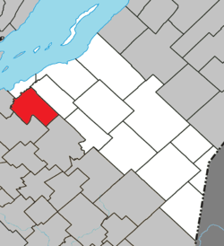
 Saint-François-de-la-Rivière-du-Sud Location in province of Quebec. | |
| Coordinates: 46°53′N 70°43′W / 46.883°N 70.717°WCoordinates: 46°53′N 70°43′W / 46.883°N 70.717°W[1] | |
| Country |
|
| Province |
|
| Region | Chaudière-Appalaches |
| RCM | Montmagny |
| Constituted | July 1, 1855 |
| Government[2] | |
| • Mayor | Yves Laflamme |
| • Federal riding |
Montmagny—L'Islet— Kamouraska—Rivière- du-Loup |
| • Prov. riding | Côte-du-Sud |
| Area[2][3] | |
| • Total | 96.50 km2 (37.26 sq mi) |
| • Land | 94.05 km2 (36.31 sq mi) |
| Population (2011)[3] | |
| • Total | 1,596 |
| • Density | 17.0/km2 (44/sq mi) |
| • Pop 2006-2011 |
|
| • Dwellings | 684 |
| Time zone | UTC−5 (EST) |
| • Summer (DST) | UTC−4 (EDT) |
| Postal code(s) | G0R 3A0 |
| Area code(s) | 418 and 581 |
| Highways |
|
| Website |
www.stfrancois delarivieredusud.net |
Saint-François-de-la-Rivière-du-Sud is a municipality in Quebec.
See also
References
Adjacent Municipal Subdivisions | ||||||||||
|---|---|---|---|---|---|---|---|---|---|---|
| ||||||||||
| Cities & Towns | |
|---|---|
| Municipalities | |
| Parishes | |
| |
This article is issued from
Wikipedia.
The text is licensed under Creative Commons - Attribution - Sharealike.
Additional terms may apply for the media files.