Sainte-Anne-du-Sault
| Sainte-Anne-du-Sault | |
|---|---|
| Municipality | |
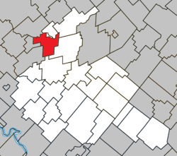 Location within Arthabaska RCM. | |
 Sainte-Anne-du-Sault Location in southern Quebec. | |
| Coordinates: 46°11′N 72°08′W / 46.183°N 72.133°WCoordinates: 46°11′N 72°08′W / 46.183°N 72.133°W[1] | |
| Country |
|
| Province |
|
| Region | Centre-du-Québec |
| RCM | Arthabaska |
| Constituted | March 21, 1889 |
| Government[2] | |
| • Mayor | Jean-Claude Bourassa |
| • Federal riding | Richmond—Arthabaska |
| • Prov. riding | Nicolet-Bécancour |
| Area[2][3] | |
| • Total | 60.40 km2 (23.32 sq mi) |
| • Land | 59.61 km2 (23.02 sq mi) |
| Population (2011)[3] | |
| • Total | 1,268 |
| • Density | 21.3/km2 (55/sq mi) |
| • Pop 2006-2011 |
|
| Time zone | UTC−5 (EST) |
| • Summer (DST) | UTC−4 (EDT) |
| Postal code(s) | G0Z 1C0 |
| Area code(s) | 819 |
| Highways |
|
Sainte-Anne-du-Sault is a former municipality located in the Centre-du-Québec region of Quebec, Canada. It is merged to Daveluyville since March 9th 2016.
References
Places adjacent to Sainte-Anne-du-Sault | ||||||||||
|---|---|---|---|---|---|---|---|---|---|---|
| ||||||||||
| Cities | |
|---|---|
| Municipalities | |
| Parishes | |
| Townships | |
| |
This article is issued from
Wikipedia.
The text is licensed under Creative Commons - Attribution - Sharealike.
Additional terms may apply for the media files.