Beaumont, Quebec
| Beaumont | |
|---|---|
| Municipality | |
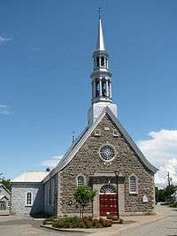 Saint Etienne Church | |
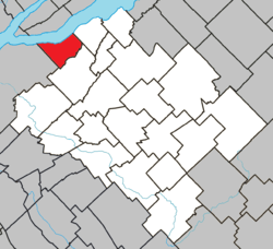 Location within Bellechasse RCM. | |
 Beaumont Location in province of Quebec. | |
| Coordinates: 46°49′N 71°00′W / 46.817°N 71.000°WCoordinates: 46°49′N 71°00′W / 46.817°N 71.000°W[1] | |
| Country |
|
| Province |
|
| Region | Chaudière-Appalaches |
| RCM | Bellechasse |
| Constituted | July 1, 1855 |
| Government[2] | |
| • Mayor | David Christopher |
| • Federal riding | Bellechasse—Les Etchemins—Lévis |
| • Prov. riding | Bellechasse |
| Area[2][3] | |
| • Total | 44.70 km2 (17.26 sq mi) |
| • Land | 43.84 km2 (16.93 sq mi) |
| Population (2011)[3] | |
| • Total | 2,420 |
| • Density | 55.2/km2 (143/sq mi) |
| • Pop 2006-2011 |
|
| • Dwellings | 1,146 |
| Time zone | UTC−5 (EST) |
| • Summer (DST) | UTC−4 (EDT) |
| Postal code(s) | G0R 1C0 |
| Area code(s) | 418 and 581 |
| Highways |
|
| Website |
www.municipalite debeaumont.com |
Beaumont /ˈboʊmɔːnt/ is a municipality of about 2,400 people 10 km east of Lévis, next to the Saint Lawrence River, in the Bellechasse Regional County Municipality in the Chaudière-Appalaches region of Quebec. It is a mostly rural community, with most people working in Lévis as there are no major businesses in Beaumont. It was chosen as one of the top 20 nicest villages in the province of Quebec.
It is crossed by Route 132, with many of its shops and commodities built alongside it. A few small streets are attached to the road, but the rest of the municipality is divided using the seigneurial system. The many open fields in Beaumont stretch all the way to the Saint Lawrence river, giving the visitors a large panorama.
References
Places adjacent to Beaumont, Quebec | |
|---|---|
| Municipalities | |
|---|---|
| Parishes | |
| |
This article is issued from
Wikipedia.
The text is licensed under Creative Commons - Attribution - Sharealike.
Additional terms may apply for the media files.