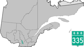
Quebec Route 335
| ||||
|---|---|---|---|---|
 | ||||
| Route information | ||||
| Maintained by Transports Québec | ||||
| Length | 80.0 km[1] (49.7 mi) | |||
| Major junctions | ||||
| South end |
| |||
|
| ||||
| North end |
| |||
| Location | ||||
| Major cities | Montreal, Laval, Terrebonne | |||
| Highway system | ||||
| ||||

Route 335 is a north-south route from Montreal north into the Lanaudière region of Quebec.
South of the Metropolitan highway, the 335 runs on Saint Denis Street to its southern terminus. Northwards until the Rivière des Prairies, the 335 runs on Berri Street southbound and Lajeunesse Street northbound, then it crosses the Viau Bridge bridge to Laval. There, the 335 once traced the entire length of the Laurentian Boulevard to the David Bridge on the Rivière des Mille Îles. Now, it runs north from the bridge to Autoroute 440 on Laurentian Boulevard. The 335 runs concurrently with Autoroute 440 for about 1.5 km (0.93 mi) between des Laurentides and Autoroute 19. Between Dagenais and Autoroute 440, it is co-signed on Autoroute 19. North of the 440 until the David Bridge, it continues on the Autoroute 19 right-of-way, which is not yet signed as 19. North of the bridge, the 335 once ran along Montée Gagnon from Route 344 northwards. Now, between 344 and Autoroute 640, the 335 runs along the Autoroute 19 right-of-way. North of the 640 until the chemin de la Côte-St-Louis est, the 335 now runs along Laurentian Boulevard. North of chemin de la Côte-St-Louis, the 335 runs along Montée Gagnon and its traditional route.
Formerly Route 65, it was an alternative to Routes 11 and 18.
Municipalities along Route 335
Major intersections
| Region | Location | km | mi | Destinations | Notes |
|---|---|---|---|---|---|
| Montréal | Montréal | 0.00 | 0.00 | No left turns | |
| 6.60 | 4.10 | Access via 560 Boulevard Crémazie service roads | |||
| Rivière des Prairies | Pont Viau | ||||
| Laval | 14.80 | 9.20 | Exit 25 on A-440 | ||
| 16.30 | 10.13 | Boulevard René-Laennec | Trumpet interchange | ||
| 16.80 | 10.44 | Southern terminus of concurrency with A-19; exit 8 on A-19; exit 27 on A-440 | |||
| Boulevard Dagenais west / Rang Saint-Elzéar east | Northern terminus of A-19 at an at-grade intersection | ||||
| Rivière des Mille Îles | Pont Athanase-David | ||||
| Laurentides | Bois-des-Filion | 25.70 | 15.97 | ||
| 26.30– 26.80 | 16.34– 16.65 | Exit 28 on A-640 | |||
| Terrebonne | 45.90 | 28.52 | Southern terminus of concurrency with Route 337 | ||
| Saint-Lin-Laurentides | 52.80 | 32.81 | Southern terminus of concurrency with Route 158; northern terminus of Route 339 | ||
| 54.40 | 33.80 | Northern terminus of concurrency with Route 158 | |||
| 57.60 | 35.79 | Northern terminus of concurrency with Route 337 | |||
| Chertsey | Chemin du Lac de l'Achigan – Saint-Hippolyte | To Route 333 | |||
| 86.20 | 53.56 | ||||
1.000 mi = 1.609 km; 1.000 km = 0.621 mi
| |||||
See also
- Athanase David Bridge
- List of Quebec provincial highways
- Pont Viau
References
- ↑ Ministère des transports, "Distances routières", page 97-98, Les Publications du Québec, 2005
External links
| Wikimedia Commons has media related to Quebec Route 335. |
- Provincial Route Map (Courtesy of the Quebec Ministry of Transportation) (in French)
- Route 335 on Google Maps.
Coordinates: 45°54′46″N 73°46′50″W / 45.91266°N 73.78045°W