Quebec Autoroute 720
| ||||
|---|---|---|---|---|
| Autoroute Ville-Marie | ||||
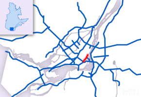 Map of Greater Montreal with Autoroute 720 highlighted in red | ||||
| Route information | ||||
| Maintained by Transports Québec | ||||
| Length | 8.5 km[1][2] (5.3 mi) | |||
| Existed | 1972[2] – present | |||
| Restrictions | Height and HAZMAT restrictions in the Ville-Marie Tunnel | |||
| Major junctions | ||||
| West end |
| |||
|
| ||||
| East end | Rue Notre-Dame in Montréal | |||
| Location | ||||
| Major cities | Montréal, Westmount | |||
| Highway system | ||||
| ||||

Autoroute 720 (A-720), known as the Ville-Marie Expressway (English) or Autoroute Ville-Marie (French) is an Autoroute highway in the Canadian province of Quebec that is a spur route of Autoroute 20 in Montreal. Its western terminus is located at the Turcot Interchange, a junction with Autoroute 15 and Autoroute 20, and its eastern terminus is near the Jacques Cartier Bridge (Route 134), where the highway merges with Notre-Dame Street. The Autoroute Ville-Marie designation is named after the downtown borough of Ville-Marie, through which the expressway is routed.
Part of A-720 runs underground (below grade) through Downtown Montreal. This section begins from the west at Rue de la Montagne / Rue Atwater (exit 4) and remains underground almost all the way to its eastern end, except for a short section between Rue Saint-Urbain and Rue Hôtel-de-Ville . The tunnelled section west of this gap is known as the Ville-Marie Tunnel, and the section east of it is known as Viger Tunnel. However, locals regard both tunnels as one, and the term Ville-Marie Tunnel is often used to refer to both tunnels.
The Turcot Interchange, which is the western terminus of A-720, is currently undergoing a reconstruction project. Once completed in 2019, the A-720 will be downgraded from an autoroute to a national highway and renumbered Route 136.[3]
History

It was originally envisioned that Autoroute 20 would extend from the Turcot Interchange, along the route of the 720, to the Louis Hippolyte Lafontaine Bridge-Tunnel. Indeed, when the first section of the expressway was constructed and opened in the early 1970s, many Montrealers, anticipating that it would eventually replace the Metropolitan Expressway as the primary connector route to the Lafontaine Tunnel, and onward to Quebec City, dubbed the then-unnamed roadway the "Downtown Trans-Canada Highway". The provincial transport ministry (Le ministère des Transports du Québec, or MTQ) had planned to extend the Viger Tunnel east to Autoroute 25 at its Souligny Avenue interchange. The right-of-way has existed since the original layout of the A-720, and buildings along the extension were demolished at that time, even though the 720 was not completed due to cost constraints. The government of Montreal instead converted the portion of Rue Notre Dame east of the Jacques Cartier Bridge into a six-lane urban boulevard, rather than continue a sunken limited-access expressway. The final project was approved, and work began on Souligny Avenue to double the span of the travel lanes. In late July 2009, an A-720 westbound shield that was installed on this stretch. In 2007, working crews for Transports Québec discovered major cracks in a support pillar and closed several lanes of the expressway. Transports Quebec announced on August 10, 2007, major repair projects for a large section of the Expressway west of the Ville-Marie tunnel.[4] In addition, the full reconstruction of the Turcot Interchange in the next several years will also affect portions of the 720. As of 2012, the 720 will be renamed Route 136 at the end of the reconstruction, which is due to be late 2019.[3]
On July 31, 2011, part of the roof of the Ville-Marie Tunnel collapsed, sending large chunks of concrete to the road below. This incident occurred at a time with little traffic and no vehicles were damaged. Several construction workers were on site at the time and were unharmed.[5] The tunnel had to be closed for repair of the roof and several other parts of the tunnel. Transport Minister Sam Hamad announced on Friday, August 5 that the tunnel would re-open the following day.
Exit list
The entire route is located in Montréal.
| Location | km[2] | mi | Exit | Destinations | Notes |
|---|---|---|---|---|---|
| Montréal | 0.00 | 0.00 | – | Exit 68 on A-20 | |
| 1S | Turcot Interchange | ||||
| 1N | Exit 63 on A-15 | ||||
| Westmount | 1.6 | 0.99 | 2 | Rue Saint-Jacques | Westbound exit and eastbound entrance |
| 2.5 | 1.6 | 2 | Avenue Atwater | Eastbound exit only | |
| Montréal | 3.3 | 2.1 | 3 | Rue Guy – Centre-Ville Montreal | Eastbound exit and westbound entrance |
| 3.6 | 2.2 | 4 | Avenue Atwater | Westbound exit only | |
| 4.3 | 2.7 | 4 | Rue de la Montagne / Rue Saint-Jacques | Eastbound exit and westbound entrance | |
| 4.4 | 2.7 | West end of the Ville-Marie Tunnel | |||
| 5.6 | 3.5 | 5 | Westbound exit and eastbound entrance; west end of A-10 | ||
| 6.5 | 4.0 | 6 | Boulevard Saint-Laurent / Rue Berri – Vieux-Montreal, Vieux-Port | Eastbound exit and westbound entrance | |
| 7.5 | 4.7 | East end of the Ville-Marie Tunnel | |||
| 7.6 | 4.7 | 7 | Pont Jacques-Cartier / Avenue Papineau / Avenue de Lorimier | Eastbound exit and westbound at-grade intersection | |
| 8.50 | 5.28 | – | Rue Notre-Dame east | Continuation beyond De Lorimier Avenue | |
| 1.000 mi = 1.609 km; 1.000 km = 0.621 mi | |||||
Gallery
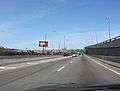 Approaching Turcot Interchange
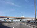 Start of interchange
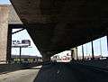 Near end of interchange
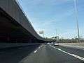 Ville-Marie expressway, after lanes merge from Decarie
 Rue Guy exit
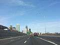 Rue St-Jacques/Rue de la Montagne exit
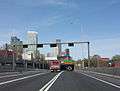 Beginning of tunnel
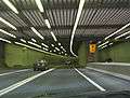 Entering the tunnel
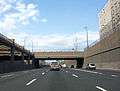 East of Palais de Congres
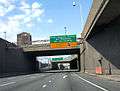 Pont Jacques-Cartier exit
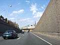 Near eastern terminus
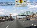 Highway at Ville-Marie boulevard
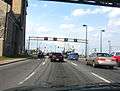 Terminus at Notre-Dame
References
- ↑ Ministère des transports, "Distances routières", page (?), Les Publications du Québec, 2005
- 1 2 3 "Répertoire des autoroutes du Québec" (in French). Transports Québec. Archived from the original on 2010-01-11. Retrieved 2008-02-23.
- 1 2 Turcot Project Archived March 6, 2016, at the Wayback Machine.(in French)
- ↑ Repairs
- ↑ "Huge concrete slab falls in Montreal expressway tunnel". CBC.ca. Retrieved Aug 1, 2011.
External links
Route map:
| Wikimedia Commons has media related to Quebec Autoroute 720. |
- A-720 at Exitlists.com
- Ville Marie Autoroute (A-720) at Steve Anderson's montrealroads.com
- Transports Quebec Map (in French)