Laurier-Station, Quebec
| Laurier-Station | |
|---|---|
| Village municipality | |
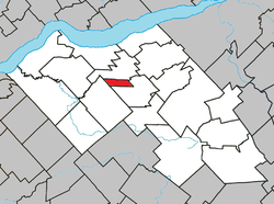 Location within Lotbinière RCM. | |
 Laurier-Station Location in southern Quebec. | |
| Coordinates: 46°32′N 71°38′W / 46.533°N 71.633°WCoordinates: 46°32′N 71°38′W / 46.533°N 71.633°W[1] | |
| Country |
|
| Province |
|
| Region | Chaudière-Appalaches |
| RCM | Lotbinière |
| Constituted | January 1, 1951 |
| Named for | Wilfrid Laurier[1] |
| Government[2] | |
| • Mayor | Pierrette Trépanier |
| • Federal riding | Lévis—Lotbinière |
| • Prov. riding | Lotbinière-Frontenac |
| Area[2][3] | |
| • Total | 12.00 km2 (4.63 sq mi) |
| • Land | 12.01 km2 (4.64 sq mi) |
|
There is an apparent contradiction between two authoritative sources | |
| Population (2011)[3] | |
| • Total | 2,634 |
| • Density | 219.3/km2 (568/sq mi) |
| • Pop 2006-2011 |
|
| • Dwellings | 1,086 |
| Time zone | UTC−5 (EST) |
| • Summer (DST) | UTC−4 (EDT) |
| Postal code(s) | G0S 1N0 |
| Area code(s) | 418 and 581 |
| Highways |
|
| Census profile | 2433060[3] |
| MAMROT info | 33060[2] |
| Toponymie info | 34717[1] |
| Website |
www.ville. laurier-station.qc.ca |
Laurier-Station is a village municipality in Lotbinière Regional County Municipality in the Chaudière-Appalaches region of Quebec, Canada. Its population is 2,634 as of the Canada 2011 Census.
It is named after its train station, Laurier, itself named in honour of prime minister Wilfrid Laurier. It is also the town where the professional hockey player David Desharnais was born.
Notable People
- Laurent Beaudion - businessman
References
- Commission de toponymie du Québec
- Ministère des Affaires municipales, des Régions et de l'Occupation du territoire
Places adjacent to Laurier-Station, Quebec | ||||||||||
|---|---|---|---|---|---|---|---|---|---|---|
| ||||||||||
| Municipalities | |
|---|---|
| Parishes | |
| Villages | |
| |
This article is issued from
Wikipedia.
The text is licensed under Creative Commons - Attribution - Sharealike.
Additional terms may apply for the media files.