Saint-Janvier-de-Joly
| Saint-Janvier-de-Joly | |
|---|---|
| Municipality | |
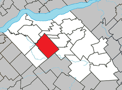 Location within Lotbinière RCM. | |
 Saint-Janvier-de-Joly Location in southern Quebec. | |
| Coordinates: 46°29′N 71°40′W / 46.483°N 71.667°WCoordinates: 46°29′N 71°40′W / 46.483°N 71.667°W[1] | |
| Country |
|
| Province |
|
| Region | Chaudière-Appalaches |
| RCM | Lotbinière |
| Constituted | January 1, 1944 |
| Government[2] | |
| • Mayor | Bernard Fortier |
| • Federal riding |
Lotbinière— Chutes-de-la-Chaudière |
| • Prov. riding | Lotbinière-Frontenac |
| Area[2][3] | |
| • Total | 111.40 km2 (43.01 sq mi) |
| • Land | 109.66 km2 (42.34 sq mi) |
| Population (2011)[3] | |
| • Total | 968 |
| • Density | 8.8/km2 (23/sq mi) |
| • Pop 2006-2011 |
|
| • Dwellings | 425 |
| Time zone | UTC−5 (EST) |
| • Summer (DST) | UTC−4 (EDT) |
| Postal code(s) | G0S 1M0 |
| Area code(s) | 418 and 581 |
| Website |
www.municipalite dejoly.com |
Saint-Janvier-de-Joly is a municipality in the Municipalité régionale de comté de Lotbinière in Quebec, Canada. It is part of the Chaudière-Appalaches region and the population is 889 as of 2009. It is named after reverend Janvier Lachance, missionary who will serve the parish from 1914 to 1926. "Joly" honours Quebec premier Henri-Gustave Joly de Lotbinière and owner of the seigneurie of Lotbinière, in which part of Saint-Janvier-de-Joly's territory lay.
The post office, opened in 1924, is called Joly, name under which the municipality is most commonly known.
References
- Commission de toponymie du Québec
- Ministère des Affaires municipales, des Régions et de l'Occupation du territoire
Places adjacent to Saint-Janvier-de-Joly | |
|---|---|
| Municipalities | |
|---|---|
| Parishes | |
| Villages | |
| |
This article is issued from
Wikipedia.
The text is licensed under Creative Commons - Attribution - Sharealike.
Additional terms may apply for the media files.