Saint-Mathieu-de-Beloeil, Quebec
| Saint-Mathieu-de-Beloeil | |
|---|---|
| Municipality | |
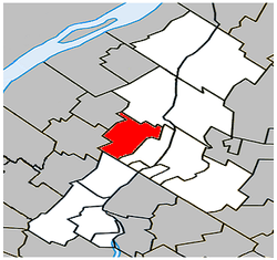 Location within La Vallée-du-Richelieu RCM. | |
 Saint-Mathieu-de-Beloeil Location in southern Quebec. | |
| Coordinates: 45°34′N 73°12′W / 45.567°N 73.200°WCoordinates: 45°34′N 73°12′W / 45.567°N 73.200°W[1] | |
| Country |
|
| Province |
|
| Region | Montérégie |
| RCM | La Vallée-du-Richelieu |
| Constituted | July 1, 1855 |
| Government[2][3] | |
| • Mayor | Normand Teasdale |
| • Federal riding | Pierre-Boucher—Les Patriotes—Verchères |
| • Prov. riding | Borduas |
| Area[2][4] | |
| • Total | 39.40 km2 (15.21 sq mi) |
| • Land | 39.85 km2 (15.39 sq mi) |
|
There is an apparent contradiction between two authoritative sources | |
| Population (2011)[4] | |
| • Total | 2,624 |
| • Density | 65.8/km2 (170/sq mi) |
| • Pop 2006-2011 |
|
| • Dwellings | 913 |
| Time zone | UTC−5 (EST) |
| • Summer (DST) | UTC−4 (EDT) |
| Postal code(s) | J3G 2C9 |
| Area code(s) | 450 and 579 |
| Highways |
|
| Website |
www.saint-mathieu- de-beloeil.com |
Saint-Mathieu-de-Beloeil is a municipality in southwestern Quebec, Canada, east of Montreal in the Regional County Municipality of La Vallée-du-Richelieu. The population as of the Canada 2011 Census was 2,624.
Demographics
PopulationPopulation trend:[5]
|
LanguageMother tongue language (2006)[6]
|
Education
The South Shore Protestant Regional School Board previously served the municipality.[7]
See also
References
- ↑ Reference number 276845 of the Commission de toponymie du Québec (in French)
- 1 2 Ministère des Affaires municipales, des Régions et de l'Occupation du territoire: Saint-Mathieu-de-Beloeil
- ↑ Parliament of Canada Federal Riding History: CHAMBLY--BORDUAS (Quebec)
- 1 2 2011 Statistics Canada Census Profile: Saint-Mathieu-de-Beloeil, Quebec
- ↑ Statistics Canada: 1996, 2001, 2006, 2011 census
- ↑ 2006 Statistics Canada Community Profile: Saint-Mathieu-de-Beloeil, Quebec
- ↑ King, M.J. (Chairperson of the board). "South Shore Protestant Regional School Board" (St. Johns, PQ). The News and Eastern Townships Advocate. Volume 119, No. 5. Thursday December 16, 1965. p. 2. Retrieved from Google News on November 23, 2014.
Adjacent Municipal Subdivisions | ||||||||||
|---|---|---|---|---|---|---|---|---|---|---|
| ||||||||||
| Cities | |
|---|---|
| Municipalities | |
| |
This article is issued from
Wikipedia.
The text is licensed under Creative Commons - Attribution - Sharealike.
Additional terms may apply for the media files.