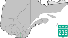
Quebec Route 235
| ||||
|---|---|---|---|---|
 | ||||
| Route information | ||||
| Maintained by Transports Québec | ||||
| Length | 131.0 km[1] (81.4 mi) | |||
| Major junctions | ||||
| South end |
| |||
|
| ||||
| North end |
| |||
| Highway system | ||||
| ||||

Route 235 is a Quebec provincial highway located in the Estrie and Montérégie regions in the southeastern part of the province. The highway runs from the Morses Line Border Crossing at the Canada-United States border in Saint-Armand to Yamaska. It overlaps Route 239 in Massueville and Route 137 and Route 116 in Saint-Hyacinthe, Quebec. A small portion of the highway near its northern terminus runs parallel to the Yamaska River.
Municipalities along Route 235
See also
References
- ↑ Ministère des transports, "Distances routières", page 86-87, Les Publications du Québec, 2005
External links
- Official Transports Quebec Road Network Map (in French)
- Route 235 on Google Maps
This article is issued from
Wikipedia.
The text is licensed under Creative Commons - Attribution - Sharealike.
Additional terms may apply for the media files.