Mont-Carmel, Quebec
| Mont-Carmel | |
|---|---|
| Municipality | |
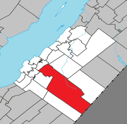 Location within Kamouraska RCM | |
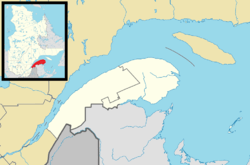 Mont-Carmel Location in eastern Quebec | |
| Coordinates: 47°26′23″N 69°51′31″W / 47.43972°N 69.85861°WCoordinates: 47°26′23″N 69°51′31″W / 47.43972°N 69.85861°W[1] | |
| Country |
|
| Province |
|
| Region | Bas-Saint-Laurent |
| RCM | Kamouraska |
| Constituted | July 1, 1855 |
| Government[2] | |
| • Mayor | Denis Lévesque |
| • Federal riding | Montmagny—L'Islet—Kamouraska—Rivière-du-Loup |
| • Prov. riding | Côte-du-Sud |
| Area[2][3] | |
| • Total | 438.60 km2 (169.34 sq mi) |
| • Land | 427.85 km2 (165.19 sq mi) |
| Population (2011)[3] | |
| • Total | 1,136 |
| • Density | 2.7/km2 (7/sq mi) |
| • Pop 2006-2011 |
|
| • Dwellings | 662 |
| Time zone | UTC−5 (EST) |
| • Summer (DST) | UTC−4 (EDT) |
| Postal code(s) | G0L 1W0 |
| Area code(s) | 418 and 581 |
| Highways |
|
| Website |
www |
Mont-Carmel is a municipality in the Canadian province of Quebec, located in the Kamouraska Regional County Municipality, on the Canada–United States border.
Geography
Spanning over 75% of the width of the Bas-Saint-Laurent region in which it resides, Mont-Carmel is the second largest subdivision within the Kamouraska Regional County Municipality and borders the United States at its southwest limit.
Communities and locations
The following designated areas reside within the municipality's boundaries:[1]
- Eatonville – a hamlet located at 47°20′16″N 69°41′01″W / 47.33778°N 69.68361°W
- Lac-de-l'Est – a vacation cottage community located at 47°13′39″N 69°35′26″W / 47.22750°N 69.59056°W
Municipal council
- Mayor: Denis Lévesque
- Councillors: Colette Beaulieu, Luc Forgues, Lauréat Jean, Karine St-Jean, Kathleen Saint-Jean, Pierre Saillant
See also
References
External links

Adjacent Municipal Subdivisions | |
|---|---|
| Cities & Towns | |
|---|---|
| Municipalities | |
| Parishes | |
| Unorganized territories | |
| |
This article is issued from
Wikipedia.
The text is licensed under Creative Commons - Attribution - Sharealike.
Additional terms may apply for the media files.